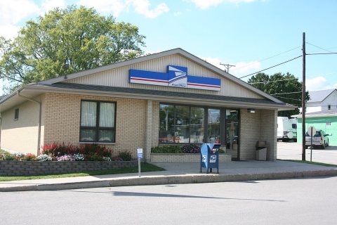
Davis was founded in the 1850s when the railroad was extended to that point. The village was named for one of its founders, S. J. Davis. A post office has been in operation at Davis since 1858.
Passages that mention Davis, cut from the printed page as they were published.
History of Stephenson County, Illinois1910 · page 386Read the page →
Read the text
and re-decoration. New Methodist hymnals were purchased recently by the congregation to take the place of the old ones, which were deemed out of date and inappropriate. The pastor in charge is the Rev. J. A. H. McLean, an Englishman, who came to the Davis charge from Canada in January, 1910. Evangelical Association. The Evangelical church of Davis is the oldest church of the village. It was organized in 1857, with the following members : Thomas Bond and family, Jacob Bond and family, Jacob Weaver, Michael Meinzer, William Kramer, T. Jenuine, and their families, and M. Abbersted.
Text read by machine from the scan; it may contain errors.
History of Stephenson County, Illinois1910 · page 382Read the page →
Read the text
their holding to Conrad Epley. A number of smaller mills were built farther south along Rock Run and its tributaries, but no trace is to be found of many of them. There was one, for instance, on the Carnefix farm, south of Davis, in section 28, the ruins of which are still to be seen. In 1839 a large number of arrivals were registered. Among them were Conrad Epley, who purchased the Epleyanna mills, and from whom the village of Epleyanna takes its name, Edward Pratt, who afterward moved to Freeport, M.
Text read by machine from the scan; it may contain errors.
Scans and text from the Internet Archive. Books published in 1930 or earlier, which are in the public domain.
Timeline
Davis, 1858 to 1932
Woven from the archive, old maps, post office records, the National Register and the people born here.
Founding dates: Wikidata, Wikipedia, the U.S. post office records of Blevins & Helbock (CC0) and the Census. Homes by year built: Census ACS 2020–24. National Register of Historic Places: National Park Service (list of May 22, 2026). Old photos, postcards and papers: Wikimedia Commons, the Library of Congress and other public archives, credited on each item’s page. Maps: U.S. Geological Survey historical topographic maps (via Esri) and Sanborn fire-insurance maps (Library of Congress). History text and census tables: Wikipedia (CC BY-SA 4.0). Places that used to be: USGS Geographic Names Information System (2021). How TownRatings grades history →
From Wikimedia Commons (4), Wikipedia, Wikidata and Wikipedia for famous people, U.S. Geological Survey historical maps, U.S. Census counts (via Wikipedia), the US Post Offices dataset (Blevins & Helbock), the USGS Geographic Names Information System and old county and town histories (Internet Archive). Archive images are copied here with their credits and licenses, shown on each photo’s page. Refreshed monthly.


 2007
 2007
 2007
 2007

