Danville’s post office opened in 1827, and 44% of its homes were built before 1940
More historic than 97% of U.S. towns · #20 of 768 in Illinois. What drives it
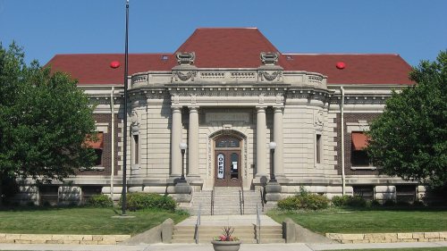
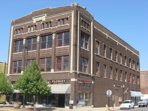
10 places in town are on the National Register, among them a historic district with 47 buildings. Below: 21 old photos and papers, maps from 1884 on, and the census since 1840.
Founding year: the first Danville post office (Blevins & Helbock, CC0).The full story ↓
History grade
What drives Danville’s History grade
On its age, its old homes and the National Register, Danville is more historic than 97% of U.S. towns, #20 of 768 in Illinois. All 3 inputs are above most U.S. towns; its share of homes from before 1940 ranks highest and its age lowest.
A+
HistoryA character grade: shown, never part of Danville’s overall grade.
Few Illinois towns list much on the Register (a typical Illinois town has 0.5 per 10,000 residents, the U.S. 2.4), so Danville’s 19.2 sits above most of its state (87% of Illinois towns have fewer) while its 55 historic buildings outnumber those of 86% of U.S. towns.
How sure. Graded on any two of the three inputs instead, the letter would range from A to A+. The pre-1940 share is a Census survey estimate (±3.0 points). The founding year is the first post office, not a stated founding date.
Founding year: the first post office (other dates in Quick answers). Homes: Census ACS 2020–24. National Register: National Park Service, May 2026 list; each listing counted once (boundary changes and added documentation belong to their listing), and a historic district counts its contributing buildings. How TownRatings grades history →
What stands out about Danville’s past
Read from the archive, the National Register and the record. The page puts what stands out first.
Nothing in the archives for these yearsWeddings on Main Street, storms, parades, school pictures, the old store. If it’s in your family album, it belongs here.
Fire insurance maps drew every building, what it was made of and what it was used for, so insurers could price the risk of fire. Pick a year, then a sheet.
The area that became Danville was once home to the Miami, Kickapoo, and Potawatomi tribes of Native Americans. Danville was founded in 1827 on 60 acres (240,000 m2) of land donated by Guy W. Smith and 20 acres (81,000 m2) donated by Dan W. Beckwith. The sale of lots was set for April 10, 1827, and advertised in newspapers in Indianapolis, Indiana and the state capital of Vandalia. The first post office was established in May of the same year in the house of Amos Williams, organizer of Vermilion and Edgar Counties and a prominent Danville citizen. Williams and Beckwith drew up the first plat map; the city was named after Dan Beckwith at Williams' suggestion, although Beckwith suggested the names "Williamsburg" and "Williamstown". Beckwith was born in Pennsylvania in 1795 and moved to Indiana as a young man; in 1819 he accompanied the first white explorers to the area where Danville later…
Passages that mention Danville, cut from the printed page as they were published.
History of Vermilion County, together with historic notes on the Northwest, gleaned from early authors, old maps and manuscripts, private and official correspondence, and other authentic, though, for the most part, out-of-the-way sources1879 · page 353Read the page →
Read the text
"Without taking up space to note the many preliminary meetings, conferences, etc., covering a period of four or five years, in which many citizens of Danville spent a good deal of time and money in aid of the "Indianapolis, Crawfordsville & Danville,1' and the "Danville, Urbana, Bloomington & Pekin" railroads, we may say that the first was extended as far west as Crawfordsville late in the year 1869, while the latter was completed from Pekin to Danville in January, 1870. Trains ran from Danville to Pekin for a period of
Text read by machine from the scan; it may contain errors.
History of Vermilion County, together with historic notes on the Northwest, gleaned from early authors, old maps and manuscripts, private and official correspondence, and other authentic, though, for the most part, out-of-the-way sources1879 · page 344Read the page →
Read the text
To make this still more specific (it will be seen that the people were learning something all this time), another meeting was held, which voted on the proposition submitted in this form : " For or against giving 852,000 to the Chicago, Danville & Vincennes Railroad, provided the road is located and shall run into the city of Danville on a line between the North Fork of the Vermilion River and Stony Creek, and intersect the Toledo, Wabash & Western Railroad north of the Vermilion River and within the city limits."' Upon this
Text read by machine from the scan; it may contain errors.
Scans and text from the Internet Archive. Books published in 1930 or earlier, which are in the public domain.
Timeline
Danville, 1827 to 1970
Woven from the archive, old maps, post office records, the National Register and the people born here.
The Danville post office opened in 1827, the earliest record of the town by name (U.S. post office records).
How does Danville rank for history?
Danville is more historic than 97% of U.S. towns, #20 of 768 in Illinois. The History grade combines the town’s founding era, the share of homes built before 1940 and its National Register listings. It’s a character grade, so it isn’t part of the overall grade. How it works.
What is on the National Register in Danville?
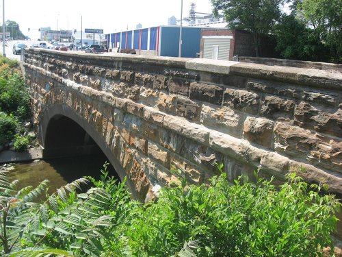
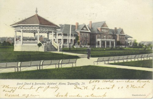
10 listings: 8 buildings, among them the Fithian House (listed 1975, the first), 1 historic district, the Danville Branch, National Home for Disabled Volunteer Soldiers Historic District, with 47 contributing buildings, and 1 structure. 55 historic buildings in all.
How old are the homes in Danville?
44% of Danville’s homes were built before 1940 (Census estimate, ±3.0 points), against a typical 11% for an Illinois town; the median home was built in 1951.
Founding dates: Wikidata, Wikipedia, the U.S. post office records of Blevins & Helbock (CC0) and the Census. Homes by year built: Census ACS 2020–24. National Register of Historic Places: National Park Service (list of May 22, 2026). Old photos, postcards and papers: Wikimedia Commons, the Library of Congress and other public archives, credited on each item’s page. Maps: U.S. Geological Survey historical topographic maps (via Esri) and Sanborn fire-insurance maps (Library of Congress). History text and census tables: Wikipedia (CC BY-SA 4.0). Places that used to be: USGS Geographic Names Information System (2021).
From Wikimedia Commons (13), the Library of Congress (8), Wikidata (3), the National Register of Historic Places (10), Wikipedia, Wikidata and Wikipedia for famous people, U.S. Geological Survey historical maps, U.S. Census counts (via Wikipedia), the US Post Offices dataset (Blevins & Helbock), the USGS Geographic Names Information System, Sanborn fire insurance maps (Library of Congress) and old county and town histories (Internet Archive). Archive images are copied here with their credits and licenses, shown on each photo’s page. Refreshed monthly.


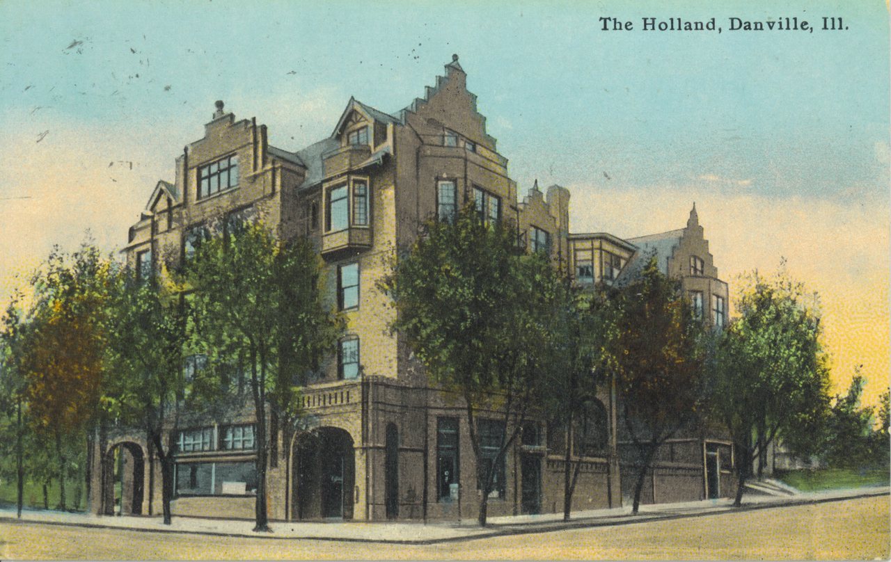

 1865
 1865
 1869
 1879
 1889
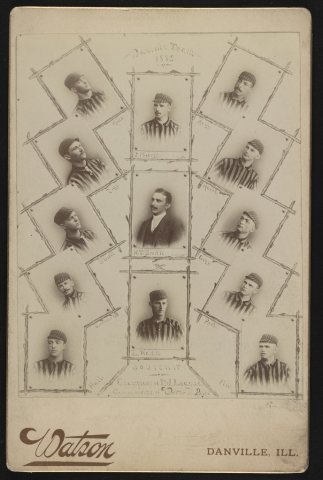 1889
 1906
 c. 1907
 c. 1907
 1907
 c. 1908
 c. 1910
 1910
 c. 1911
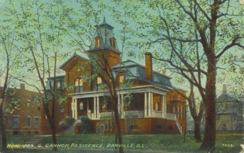 1913
 1917
 1917
 c. 1920
 c. 1920
 1920
 c. 1923