The Town of Chenoa was laid out on May 13, 1856, by Matthew T. Scott. At this time, the Chicago and Alton Railroad had been running trains for almost two years but the survey for the east-west Toledo, Peoria and Oquawka (soon to be the Toledo, Peoria and Western) had not reached McLean County. Scott anticipated the place where the railroads would cross and platted the town which he called Chenoa. Scott (February 24, 1828 - May 21, 1891) was the son of a Kentucky banker, and, by the time he reached Illinois, was an experienced land developer who led a group of well-financed investors. The European settlement history of Chenoa began in 1854 when Matthew T. Scott began buying thousands of acres of land in this area.
Passages that mention Chenoa Township, cut from the printed page as they were published.
History of McLean County, Illinois1924 · page 121Read the page →
Read the text
The T. P. & W. Railroad crosses the township. Chenoa and Lexington are the nearest trading towns in McLean County for the Yates Township people. Owing to the lack of timber, Yates was not settled early, the first entries of lands being in 1855-6. It was part of Chenoa Township from its organization in 1858 until 1862. This was first called Union Township owing to the sentiments of its people, but there were others of the same name in the state, and the name was changed to Yates in honor of the Civil War governor of Illinois. Yates Township had a great
Text read by machine from the scan; it may contain errors.
History of McLean County, Illinois1924 · page 91Read the page →
Read the text
Chenoa Township. — The name of this township was meant for Che- •nowa, which Matthew T. Scott, its earliest settler, gave it. He came from Kentucky, and Chenowa was the Indian name of Kentucky and he bestowed it upon his new settlement. The postoffice department made a mistake in first noting the name, leaving out the "w", and refused ever afterward to correct it, hence Chenoa was the word that stuck. The prairie lands of Chenoa Township long remained unsettled after other portions were taken up. The Chicago & Alton railroad having been built
Text read by machine from the scan; it may contain errors.
Scans and text from the Internet Archive. Books published in 1930 or earlier, which are in the public domain.
Timeline
Chenoa Township, 1854 to 1962
Woven from the archive, old maps, post office records, the National Register and the people born here.
Nothing in the archives for these yearsWeddings on Main Street, storms, parades, school pictures, the old store. If it’s in your family album, it belongs here.
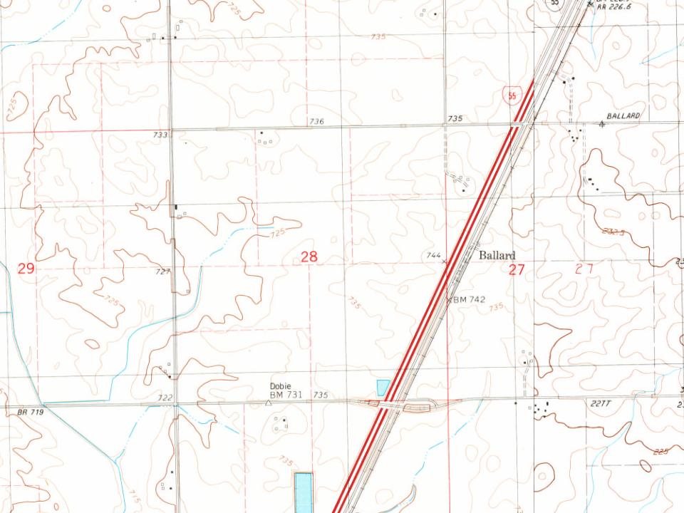
Every edition of the U.S. Geological Survey’s map of Chenoa Township. Tap a year, or press play to watch the town change.
1926Normal sheet · 1:62,500
U.S. Geological Survey historical topographic maps (public domain), via Esri’s collection of the scans. The red ring marks the center of Chenoa Township.
Then & now
Stand where they stood
No then-and-now pairs yet. Take a photo from the same spot as an old one and they appear here side by side.
Retake this viewBird's eye view of Chenoa, McLean County, Illinois 1869, 1869
Find the spot, match the angle, and add your photo. It becomes the first then-and-now pair on Chenoa Township’s page.
Founding dates: Wikidata, Wikipedia, the U.S. post office records of Blevins & Helbock (CC0) and the Census. Homes by year built: Census ACS 2020–24. National Register of Historic Places: National Park Service (list of May 22, 2026). Old photos, postcards and papers: Wikimedia Commons, the Library of Congress and other public archives, credited on each item’s page. Maps: U.S. Geological Survey historical topographic maps (via Esri) and Sanborn fire-insurance maps (Library of Congress). History text and census tables: Wikipedia (CC BY-SA 4.0). Places that used to be: USGS Geographic Names Information System (2021). How TownRatings grades history →
From Wikimedia Commons (13), the Library of Congress (5), Wikipedia, U.S. Geological Survey historical maps, U.S. Census counts (via Wikipedia), the US Post Offices dataset (Blevins & Helbock), the USGS Geographic Names Information System and old county and town histories (Internet Archive). Archive images are copied here with their credits and licenses, shown on each photo’s page. Refreshed monthly.


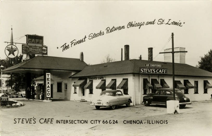


 1900
 Date?
 Date?
 Date?
 Date?
 2023
 2023
 2023
 2007
 2007
 2007
 2007
 2007
 2007
 2007
 2007