174 years in pictures
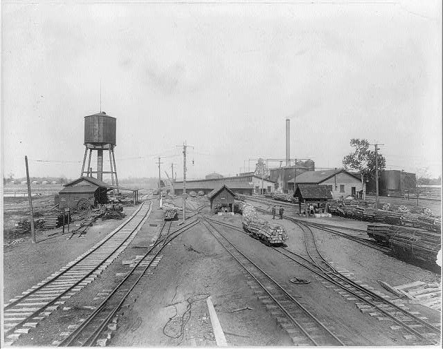
Census counts: 2,213 in 1880, 25,083 in 2020. The archive holds 24 old photos and papers going back to 1880 and 5 maps from 1922 on.
- 1852Carbondale Township is settled
Each edition grades its towns against each other only.

34% of residents live below the poverty line in Carbondale Township, against 8.4% in Illinois’ towns and 9.6% across U.S. towns. Only 3 of the 769 Illinois towns we compare have a lower median age than Carbondale Township. The biggest park or preserve is Crab Orchard National Wildlife Refuge, at 340 acres. We don’t grade Carbondale Township yet; the figures below are still real.
Where Carbondale Township beats most towns.
29,544 counted in 2010 and 24,686 in 2020; an estimated 24,571 in 2025.
U.S. Census 2010 & 2020 counts · Census Bureau estimate, July 1, 2025
Census counts: 2,213 in 1880, 25,083 in 2020. The archive holds 24 old photos and papers going back to 1880 and 5 maps from 1922 on.
Who provides power, water and the rest in Carbondale Township, and how to reach them.
EPA SDWIS (Oct 9, 2026) · HIFLD + EIA-861 2025 · Census 2020 ZCTAs · NCES 2024–25 · registration: vote.gov, updated Sep 12, 2025.
Ordered by what stands out in Carbondale Township.
14% of Carbondale Township residents are under 18, where Illinois’ towns sit at 22% and U.S. towns at 22%. 11% of Carbondale Township residents are 65 or older. Carbondale Township has lost 2% of its people since 2020, down to 24,571 in the Census Bureau’s 2025 estimate.
| Carbondale Township | Illinois towns | U.S. towns | |
|---|---|---|---|
| Under 18 | 14% | 22% | 22% |
| Bachelor’s degree or more, 25+ | 48% | 29% | 29% |
| Aged 65 or older | 11% | 19% | 18% |
49% women, 51% men
That’s an even split within the survey’s margin of ±1.3 points. Across Illinois, 50.6% of residents are women. Median age: women 26.5, men 24.7.
| Carbondale Township | IL | U.S. | |
|---|---|---|---|
| Under 10 | 8% | 11.5% | 11.6% |
| 10 to 17 | 6.3% | 10.4% | 10.3% |
| 18 to 24 | 35.3% | 9.1% | 9.1% |
| 25 to 34 | 14.9% | 13.6% | 13.7% |
| 35 to 44 | 9.2% | 13.3% | 13.2% |
| 45 to 54 | 6.3% | 12.4% | 12.2% |
| 55 to 64 | 8.7% | 12.8% | 12.7% |
| 65 to 74 | 6.5% | 10% | 10.2% |
| 75 and older | 4.8% | 7% | 7% |
| No diploma | 5.3% | 9.5% | 10.4% |
| High school | 17.2% | 25.1% | 26% |
| Some college | 23.3% | 19.2% | 19.1% |
| Associate’s | 6.7% | 8.3% | 8.8% |
| Bachelor’s | 24.4% | 22.6% | 21.6% |
| Graduate | 23.1% | 15.3% | 14.1% |
Census population estimates, 2025 · U.S. Census Bureau · ACS 2020-2024 5-year estimates
Its public schools are run by Carbondale ESD 95. Two of its 10 schools are below, each with why it’s listed. The largest public high school is Carbondale Comm H S, with 1,023 students.
| School | Level | Students | Letter |
|---|---|---|---|
| Parrish Elem SchoolLargest public elementary schoolGrades PK–1 | Grades PK–1 | 466 | – |
| Carbondale Comm H SLargest public high schoolGrades 9–12 | Grades 9–12 | 1,023 | B+ |
NCES · EDFacts
41% of working residents work locally in Carbondale Township. Since 2013, Carbondale Township has lost 1,097 jobs, to 16,019 in 2023. The average trip to work in Carbondale Township is 17 minutes.
| Carbondale Township | Illinois towns | U.S. towns | |
|---|---|---|---|
| Working residents who work in town | 41% | 8.3% | 8% |
| Average trip to work | 17 minutes | 26 minutes | 25 minutes |
| Median household income | $35,000 | $83,000 | $80,000 |
Census LEHD 2023 · ACS
Expected storm and flood damage is higher than in 80% of U.S. communities. Since 1990, 16 flood insurance claims have been paid out in Carbondale Township.
FEMA flood insurance claims · FEMA National Risk Index · OpenFEMA
Carbondale Township has chilly winters and warm summers. Carbondale Township’s July high is 88°F.
NOAA U.S. Climate Normals, 1991–2020
Carbondale Township beats the Illinois average on 0 of 32 CDC measures and trails it on 9.
| Carbondale Township | Illinois towns | U.S. towns | |
|---|---|---|---|
| Frequent mental distress (CDC PLACES) | 19% | 17% | 17% |
| Food insecurity (CDC PLACES) | 21% | 13% | 14% |
| Feel lonely (CDC PLACES) | 36% | 33% | 33% |
| Obesity (CDC PLACES) | 40% | 37% | 35% |
| What stands out | Carbondale Township | IL |
|---|---|---|
| More adults without reliable transportation | 11.7% | 8% |
| More adults facing a utility shut-off | 11% | 7.8% |
| More adults facing food insecurity | 20.5% | 15.9% |
CDC PLACES 2025 · modeled estimates for adults · CMS · HRSA
14 miles of trail in 29 parks and preserves.
| Carbondale Township | Illinois towns | U.S. towns | |
|---|---|---|---|
| Conserved land | 7.6% | 3.7% | 4.3% |
| Miles of trail per square mile | 0.4 miles per square mile | 0.3 | 0.4 |
| Biggest places to walk | Trails | Acres |
|---|---|---|
| 1. Chautauqua Bottoms | 1.5 mi | 87 |
| 2. Carbondale Superblock | 0.9 mi | 71 |
| 3. Green Earth Park | 0.6 mi | 14 |
Trails & parks © OpenStreetMap contributors · Conserved land: USGS PAD-US
2 within 15 miles of the center of Carbondale Township
College town 34 of every 100 Carbondale Township residents are enrolled in college, against 6 across Illinois.
Where Carbondale Township’s working residents go each day. Line width shows the share.
Census LEHD 2023
City in Illinois, United States
Carbondale is a city in Jackson County, Illinois, United States, within the Southern Illinois region informally known as "Little Egypt". As of the 2020 census, the city had a population of 25,083, making it the most populous city in Southern Illinois outside the Metro East region of Greater St. Louis. Carbondale was established in 1853 and developed as a crossroads of the railroad industry. Today, the major roadways of Illinois Route 13 and U.S. Route 51 intersect in the city. The city is located 96 miles (154 km) southeast of St. Louis on the northern edge of the Shawnee National Forest. It is the home of the main campus of Southern Illinois University.
From Wikipedia, licensed CC BY-SA 4.0 · facts via Wikidata (CC0)
5 towns share a border with Carbondale Township.
| Town | IL rank | Overall | Cost | Safety | Schools | Health |
|---|---|---|---|---|---|---|
| Carbondale Township | — | — | — | — | — | — |
| Makanda Township | #579 | C | C− | — | B+ | B |
| Murphysboro Township | #717 | D | B− | — | C | C |
| De Soto Township | — | — | C+ | — | C+ | C |
| Carbondale | #746 | D | C | D− | C | B− |
| Pomona Township | — | — | — | — | — | — |
De Soto Township has fewer than 2,500 residents, so it gets subject grades but no overall grade. Makanda Township, Murphysboro Township and De Soto Township report no FBI crime data of their own. Carbondale Township and Pomona Township aren’t graded (fewer than 1,000 residents, or not enough data). Compare Carbondale Township with a neighbor →
Short answers, built from the data on this page.
We don’t grade Carbondale Township yet; the figures below are still real.