Alton dates to 1818, and 28% of its homes were built before 1940
More historic than 96% of U.S. towns · #30 of 768 in Illinois. What drives it
13 places in town are on the National Register, among them the Lyman Trumbull House, a National Historic Landmark, and four historic districts with 356 buildings between them. Below: 41 old photos and papers, maps from 1885 on, and the census since 1840.
Founding year: Wikidata. First post office: 1826.The full story ↓
History grade
What drives Alton’s History grade
On its age, its old homes and the National Register, Alton is more historic than 96% of U.S. towns, #30 of 768 in Illinois. All 3 inputs are above most U.S. towns; its National Register listings ranks highest and its age lowest.
A+
HistoryA character grade: shown, never part of Alton’s overall grade.
Few Illinois towns list much on the Register (a typical Illinois town has 0.5 per 10,000 residents, the U.S. 2.4), so Alton’s 144 sits above most of its state (95% of Illinois towns have fewer) while its 364 historic buildings outnumber those of 96% of U.S. towns.
How sure. Graded on any two of the three inputs instead, the letter would range from A to A+. The pre-1940 share (±2.3 points) is firm at this size. Two sources give 1818.
Founding year: Wikidata (other dates in Quick answers). Homes: Census ACS 2020–24. National Register: National Park Service, May 2026 list; each listing counted once (boundary changes and added documentation belong to their listing), and a historic district counts its contributing buildings. How TownRatings grades history →
What stands out about Alton’s past
Read from the archive, the National Register and the record. The page puts what stands out first.
The country’s official list of buildings and places worth saving. One is a National Historic Landmark, the highest tier. Boundary changes and added documentation are counted with their listing.
Nothing in the archives for these yearsWeddings on Main Street, storms, parades, school pictures, the old store. If it’s in your family album, it belongs here.
Although Alton once was growing faster than the nearby city of St. Louis, a coalition of St. Louis businessmen planned to build a competing town to stop Alton's expansion and bring business to St. Louis. The resulting town was Grafton, Illinois.
Many blocks of housing in Alton were built in the Victorian Queen Anne style. They represent a prosperous period in the river city's history. At the top of the hill in the commercial area, several stone churches and a fine city hall also represent the city's wealth during its good times based on river traffic, manufacturing, and shipping. It was a commercial center for a large agricultural area. Numerous residences on hills have sweeping views of the Mississippi River.
Every edition of the U.S. Geological Survey’s map of Alton. Tap a year, or press play to watch the town change.
1927Alton sheet · 1:62,500
U.S. Geological Survey historical topographic maps (public domain), via Esri’s collection of the scans. The red ring marks the center of Alton.
Every building
Alton, building by building, 1885–1915
Fire insurance maps drew every building, what it was made of and what it was used for, so insurers could price the risk of fire. Pick a year, then a sheet.
Lost post offices, old corners, places now gone and burying grounds
Alton’s post office has been open since 1826. Another post office, Upper Alton, opened and closed inside today’s town.
Alton
1826–today
Upper Alton
1835–1912
18201920today
Hamlets and corners on the map
MiltonSloanUpper Alton
Gone or out of use
Alby QuarrymineAlton MinemineAlton School of Practical NursingschoolCulp SchoolschoolDelmar Public SchoolschoolDouglas Public SchoolschoolDunbar Public SchoolschoolGarfield Public SchoolschoolHumboldt Public SchoolschoolLincoln Public SchoolschoolLowell Public SchoolschoolMilton Public SchoolschoolWestern Military Academyschool
7cemeteries and burying grounds inside Alton
Alton NationalAlton State HospitalLovejoy MemorialMiltonNorth Alton ConfederateOakwoodSaint Joseph
US Post Offices dataset (Blevins & Helbock, CC0). Places and cemeteries from the USGS Geographic Names Information System (2021).
Help out
Finish Alton’s story
Most archives stop around 1920. The photos from after that are in family albums, not libraries.
Decades since 1900 with photos
00s10s20s30s40s50s60s70s80s90s
3 of 10 decades. The empty ones are waiting for someone’s album.
In 1818, according to Wikidata. Alton’s post office opened in 1826, and the census of 1840 counted 2,340 people here.
How does Alton rank for history?
Alton is more historic than 96% of U.S. towns, #30 of 768 in Illinois. The History grade combines the town’s founding era, the share of homes built before 1940 and its National Register listings. It’s a character grade, so it isn’t part of the overall grade. How it works.
What is on the National Register in Alton?
13 listings: 8 buildings, among them the Lyman Trumbull House (a National Historic Landmark since 1975) and the Guertler House (listed 1974, the first), 4 historic districts with 356 contributing buildings, and 1 site. 364 historic buildings in all.
How old are the homes in Alton?
28% of Alton’s homes were built before 1940 (Census estimate, ±2.3 points), against a typical 11% for an Illinois town; the median home was built in 1953.
Founding dates: Wikidata, Wikipedia, the U.S. post office records of Blevins & Helbock (CC0) and the Census. Homes by year built: Census ACS 2020–24. National Register of Historic Places: National Park Service (list of May 22, 2026). Old photos, postcards and papers: Wikimedia Commons, the Library of Congress and other public archives, credited on each item’s page. Maps: U.S. Geological Survey historical topographic maps (via Esri) and Sanborn fire-insurance maps (Library of Congress). History text and census tables: Wikipedia (CC BY-SA 4.0). Places that used to be: USGS Geographic Names Information System (2021).
From Wikimedia Commons (32), the Library of Congress (9), Wikidata (1), the National Register of Historic Places (13), Wikipedia, Wikidata and Wikipedia for famous people, U.S. Geological Survey historical maps, U.S. Census counts (via Wikipedia), the US Post Offices dataset (Blevins & Helbock), the USGS Geographic Names Information System and Sanborn fire insurance maps (Library of Congress). Archive images are copied here with their credits and licenses, shown on each photo’s page. Refreshed monthly.


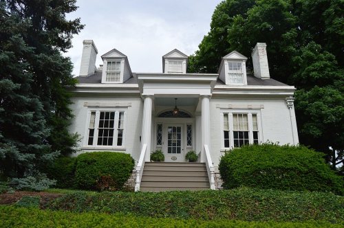 ★ Landmark

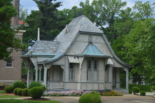


 1833
 1854
 1855
 1857
 1858
 1858
 1865
 1867
 1900
 1908
 1908
 1908
 1908
 1910
 1910
 1910
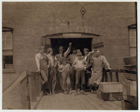 1910
 1910
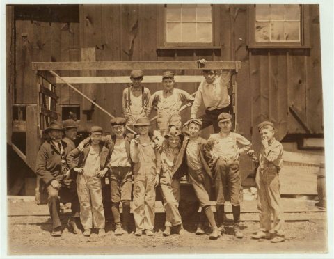 1910
 1917
 1933
 1933
 1933
 1933
 1933
 1933
 1933
 1933
 1933
 1933
 1933
 1933
 1933
 1933
 1933
 1933
 1935
 1935
 1935
 1935
 1935


