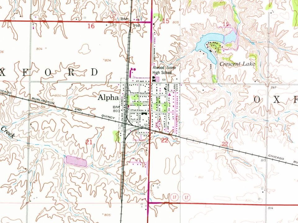
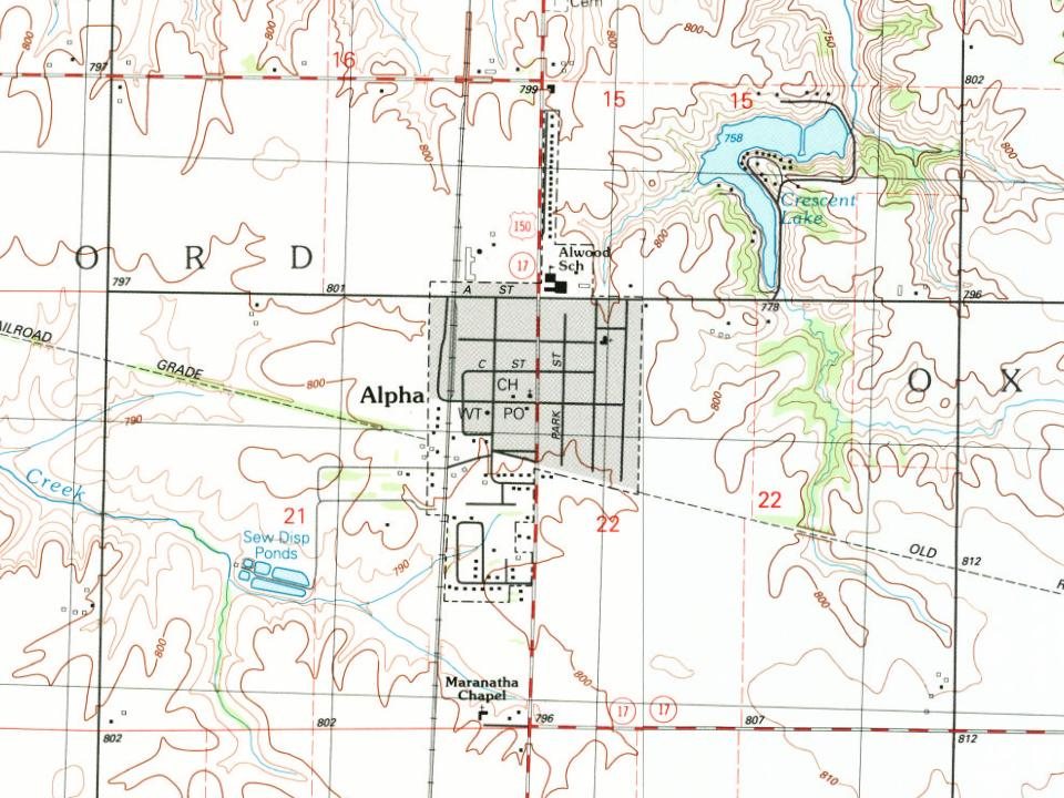
On June 1, 1872, Anson Calkins laid out the village of Alpha. Alpha was created as a railroad town and replaced the town of Oxford, which was located about three miles west of current day Alpha. It was located at the junction between two lines of the Chicago, Burlington, and Quincy Railroad, and a since-razed depot was located at the junction. The north–south branch between Galesburg and Savanna crossed an east–west branch between Galva and New Boston. The east–west line has been abandoned and the north–south line is in operation as the BNSF Barstow Subdivision. The village was named Alpha (the first letter of the Greek alphabet), because Calkins believed it to be the beginnings of a great city. It was incorporated on January 11, 1895.
Passages that mention Alpha, cut from the printed page as they were published.
Portrait and biographical album of Henry County, Illinois1885 · page 815Read the page →
Read the text
The building of the railroads and the laying out of Alpha was practically the doom of the village of Oxford, which was a few miles to the southwest. This latter place was laid out in 1858 by Daniel and James Briggs, on section 30. The "main historical point that may perpetually preserve the history of this village was that it was the location of the wildcat bank in i860, known as the " Bank of the Miss-
Text read by machine from the scan; it may contain errors.
The history of Henry County, Illinois1877 · page 538Read the page →
Read the text
The starting of the towns of Alpha and Windsor, in the count)'' immediately west, both near to Oxford and on the railroad, caused a general removal of all houses to these places, and the town of Oxford is now extinct, the town plat being used for farming land. One church, the , still remains ; the others being taken to Alpha and
Text read by machine from the scan; it may contain errors.
History of Henry County, Illinois1910 · page 764Read the page →
Read the text
Anson Calkins came to Illinois in 1841 and two years later located in Oxford township, Henry county, where he purchased two hundred and eighty acres of land, on part of which the village of Alpha now stands. A carpenter by trade, he put up his own house, which is still standing, though it had been enlarged and remodeled. In 1847 he married and commenced farming, though he still followed his trade whenever there was demand for his services. He also established a nursery in connection with his agricultural interests, which was the first, and for many years the only one, in this part of the state. The
Text read by machine from the scan; it may contain errors.
History of Henry County, Illinois1910 · page 705Read the page →
Read the text
service he returned to the life of a farmer, which he followed for twenty-seven years in Oxford township, near the village of Woodhull. He was progressive in his ideas and met with unequivocal success. In 1891 he was active in the organization of the State Bank of Alpha, the first institution of its kind established in the village, and for seven years was its cashier. In 1898 he retired from participation in the banking business, having witnessed the enterprise assume gratifying proportions, and has since enjoyed a well deserved rest in his comfortable home in Alpha.
Text read by machine from the scan; it may contain errors.
Scans and text from the Internet Archive. Books published in 1930 or earlier, which are in the public domain.
Founding dates: Wikidata, Wikipedia, the U.S. post office records of Blevins & Helbock (CC0) and the Census. Homes by year built: Census ACS 2020–24. National Register of Historic Places: National Park Service (list of May 22, 2026). Old photos, postcards and papers: Wikimedia Commons, the Library of Congress and other public archives, credited on each item’s page. Maps: U.S. Geological Survey historical topographic maps (via Esri) and Sanborn fire-insurance maps (Library of Congress). History text and census tables: Wikipedia (CC BY-SA 4.0). Places that used to be: USGS Geographic Names Information System (2021). How TownRatings grades history →
From Wikimedia Commons (3), Wikipedia, U.S. Geological Survey historical maps, U.S. Census counts (via Wikipedia), the US Post Offices dataset (Blevins & Helbock), the USGS Geographic Names Information System and old county and town histories (Internet Archive). Archive images are copied here with their credits and licenses, shown on each photo’s page. Refreshed monthly.


 2015
 2008
 2006