Guest, Sign inJoin

Post to Wallace

We’ll email a one-tap link to publish your post. No password, and nothing is public until you click it.
Already a member? Sign in
–Not graded
History · Wallace

Wallace dates to 1884, and 84% of its homes were built before 1940

6 places in town are on the National Register, among them a historic district with 786 buildings. Below: 11 old photos and papers, maps from 1891 on, and the census since 1890.

1884founded
6on the National Register
84%homes built before 1940
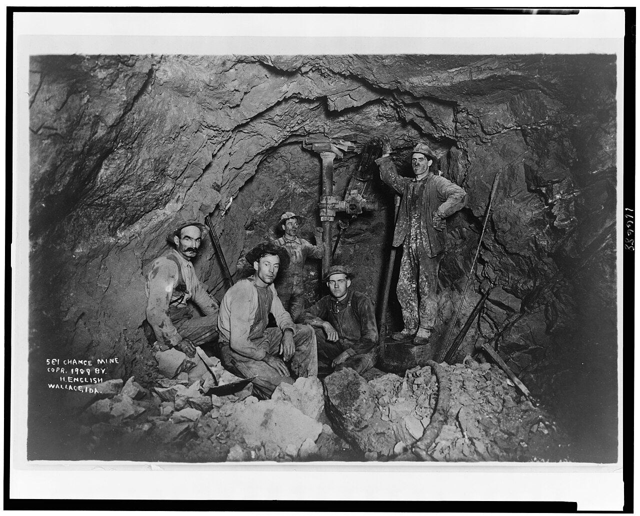
11old photos & papers
13famous people
From Wallace’s archive · credits on each photo
Quick answers

How Wallace began

When was Wallace founded?

1884

Wallace dates its founding to 1884 (Wikidata). The census first counted it in 1890.

First census: 878 in 18902020 census: 791142 years
Founding year: Wikidata. First post office: 1886.The full story ↓

What stands out about Wallace’s past

Read from the archive, the National Register and the record. The page puts what stands out first.

★ What stands out · On the National Register

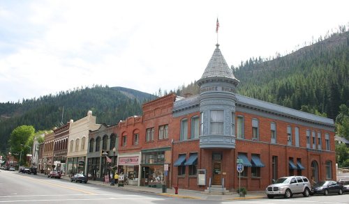
6 listings protect 789 historic buildings

The country’s official list of buildings and places worth saving. Boundary changes and added documentation are counted with their listing.

places listed
6
National Historic Landmarks
0
none yet
historic buildings protected
789
each building in a district counts
first listed
1976
Northern Pacific Railway Depot
BuildingsDistrictsSitesObjects

Architectural styles listings

Chateauesque1
Second Renaissance Revival1
Neoclassical Revival1
Art Deco1
Tudoresque1
English Cottage1
All 6 listings

National Park Service, National Register of Historic Places. Photos from Wikimedia Commons, credited on each place’s page.

On the map

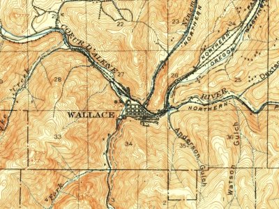
Wallace on the map, 1901 to 1995

Every edition of the U.S. Geological Survey’s map of Wallace. Tap a year, or press play to watch the town change.

Wallace on the 1901 USGS mapWallace on the 1937 USGS mapWallace on the 1957 USGS mapWallace on the 1988 USGS mapWallace on the 1995 USGS map1901Coeur DAlene District sheet · 1:62,500

U.S. Geological Survey historical topographic maps (public domain), via Esri’s collection of the scans. The red ring marks the center of Wallace.

The story

How Wallace came to be

From Wikipedia’s history of Wallace.

Read it all →

In the spring of 1884, Colonel William R. Wallace built a cabin at a site he called "Placer Center". A Civil War veteran, Wallace was heavily involved in mining ventures after the war. The spot's central location in the mining district clearly offered promise as a town site. In fact, a news sheet published at the time extolled the town's favorable prospects because "it is on the Mullan Road, which is the main emigrant road on the Bitter Root divide." Wallace believed in his new venture and invested money to build access roads, put up lot fences and made other improvements. By the spring of 1885, Placer Center had a grocery store and several other small businesses. Within a year or so, there was also a general store, a sawmill, hotel and more.

Text from Wikipedia, licensed CC BY-SA 4.0.

Timeline

Wallace, 1884 to 1941

Woven from the archive, old maps, post office records, the National Register and the people born here.

  1. 19th century
  2. 1884
    FoundingWallace is established
  3. 1886Post officeThe Wallace post office opens
  4. 20th century
  5. 1901On the mapFirst mapped by the U.S. Geological Survey
  6. 1904Born hereGeraldine Knight Scott is born here
  7. 1905In the archiveFiremen H. E. Nordquist and Bill Delaney from Wallace, Idaho, between 1900 and 1910
  8. 1910In the archiveBird's-eye view of Wallace, Idaho showing an automobile on a dirt road in foreground, bet…
  9. 1911BuiltWallace Carnegie Library is built
  10. 1921Born hereLana Turner is born here
  11. 1921Born hereDoris Houck is born here
  12. 1940CensusPopulation peaks at 3,839
  13. 1941Born hereBill Thomas is born here
By decade

Wallace, decade by decade

2 decades in the archive, from the 1900s to the 1910s. Scroll each row; tap a photo for its story.

Every building

Wallace, building by building, 1891–1901

Fire insurance maps drew every building, what it was made of and what it was used for, so insurers could price the risk of fire. Pick a year, then a sheet.

Wallace fire insurance map, 1891, sheet 11891Sheet 1 of 2
Edition
BrickWoodStone

Sanborn Map Company, via the Library of Congress. Editions published in 1930 or earlier, which are in the public domain.

Then & now

Stand where they stood

No then-and-now pairs yet. Take a photo from the same spot as an old one and they appear here side by side.

Firemen H. E. Nordquist and Bill Delaney from Wallace, Idaho, between 1900 and 1910
Retake this viewFiremen H. E. Nordquist and Bill Delaney from Wallace, Idaho, between 1900 and 1910, c. 1905

Find the spot, match the angle, and add your photo. It becomes the first then-and-now pair on Wallace’s page.

Retake this view · +15
People over time

Wallace, census by census

05001,0001,5002,0002,5003,0003,5004,0001900192019401960198020002020Peak: 3,839

Peaked at 3,839 in 1940; 791 people lived here in 2020.

14 censuses, 1890–2020.

U.S. Census Bureau decennial counts, from the census table on Wallace’s Wikipedia page.

Famous people

13 famous people were born in Wallace

Writers, athletes, leaders and more, ranked by how widely they’re known.

See all →
Help out

Finish Wallace’s story

Most archives stop around 1920. The photos from after that are in family albums, not libraries.

Decades since 1900 with photos
00s10s20s30s40s50s60s70s80s90s
2 of 10 decades. The empty ones are waiting for someone’s album.

Questions about Wallace’s history

What year was Wallace founded?

In 1884, according to Wikidata. Wallace’s post office opened in 1886, and the census of 1890 counted 878 people here.

What is on the National Register in Wallace?

6 listings: 3 buildings, among them the Northern Pacific Railway Depot (listed 1976, the first), 1 historic district, the Wallace Historic District, with 786 contributing buildings, 1 site, and 1 object. 789 historic buildings in all.

Memory lane

What the archives can’t tell you, neighbors can.

Town Square →
Start a conversation
Sources

Where this page comes from

Founding dates: Wikidata, Wikipedia, the U.S. post office records of Blevins & Helbock (CC0) and the Census. Homes by year built: Census ACS 2020–24. National Register of Historic Places: National Park Service (list of May 22, 2026). Old photos, postcards and papers: Wikimedia Commons, the Library of Congress and other public archives, credited on each item’s page. Maps: U.S. Geological Survey historical topographic maps (via Esri) and Sanborn fire-insurance maps (Library of Congress). History text and census tables: Wikipedia (CC BY-SA 4.0). Places that used to be: USGS Geographic Names Information System (2021). How TownRatings grades history →

From Wikimedia Commons (9), the Library of Congress (2), Wikidata (1), the National Register of Historic Places (6), Wikipedia, Wikidata and Wikipedia for famous people, U.S. Geological Survey historical maps, U.S. Census counts (via Wikipedia), the US Post Offices dataset (Blevins & Helbock), the USGS Geographic Names Information System and Sanborn fire insurance maps (Library of Congress). Archive images are copied here with their credits and licenses, shown on each photo’s page. Refreshed monthly.