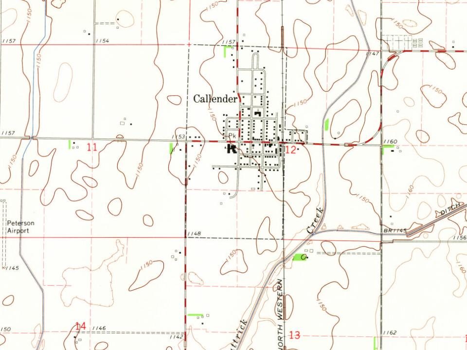
From 1866 to 1870, the Des Moines Valley Railroad Company constructed tracks between Des Moines and Fort Dodge. The other end of the line originated at Keokuk (at the confluence of the Des Moines and Mississippi rivers). As a result, several small towns were created by the railroad along the line to support track maintenance and to grow business. At 7 to 10 mi (11 to 16 km) intervals were 38 stops between Keokuk and Fort Dodge. Kesho, the town that would become Callender, was the 36th stop.
Passages that mention Callender, cut from the printed page as they were published.
Centennial history of Webster county1876 · page 18Read the page →
Read the text
Thk town of Callender is situated upon section 12, town 87. range 30, and was platted and recorded by Aonks and .Iamks Callendkr, June 15th, 1875. This town contains a depot, post olhce, Kesho, one store, an agricultural depot, etc. The Des Moines & Fort Dodge railroad company established a depot at this point in the fall of I8();i, and erected a house— twenty by sixty. There being but little business here, a track was laid under the Imilding, which was then loaded on flat-cars and taken to Tara. and the station abandoned until the fall of !87r>.
Text read by machine from the scan; it may contain errors.
Scans and text from the Internet Archive. Books published in 1930 or earlier, which are in the public domain.
Timeline
Callender, 1867 to 1965
Woven from the archive, old maps, post office records, the National Register and the people born here.
Founding dates: Wikidata, Wikipedia, the U.S. post office records of Blevins & Helbock (CC0) and the Census. Homes by year built: Census ACS 2020–24. National Register of Historic Places: National Park Service (list of May 22, 2026). Old photos, postcards and papers: Wikimedia Commons, the Library of Congress and other public archives, credited on each item’s page. Maps: U.S. Geological Survey historical topographic maps (via Esri) and Sanborn fire-insurance maps (Library of Congress). History text and census tables: Wikipedia (CC BY-SA 4.0). Places that used to be: USGS Geographic Names Information System (2021). How TownRatings grades history →
From Wikimedia Commons (2), Wikipedia, U.S. Geological Survey historical maps, U.S. Census counts (via Wikipedia), the US Post Offices dataset (Blevins & Helbock), the USGS Geographic Names Information System and old county and town histories (Internet Archive). Archive images are copied here with their credits and licenses, shown on each photo’s page. Refreshed monthly.

 2021
 2004