Adel dates to 1847, and 16% of its homes were built before 1940
More historic than 84% of U.S. towns · #35 of 140 in Iowa. What drives it
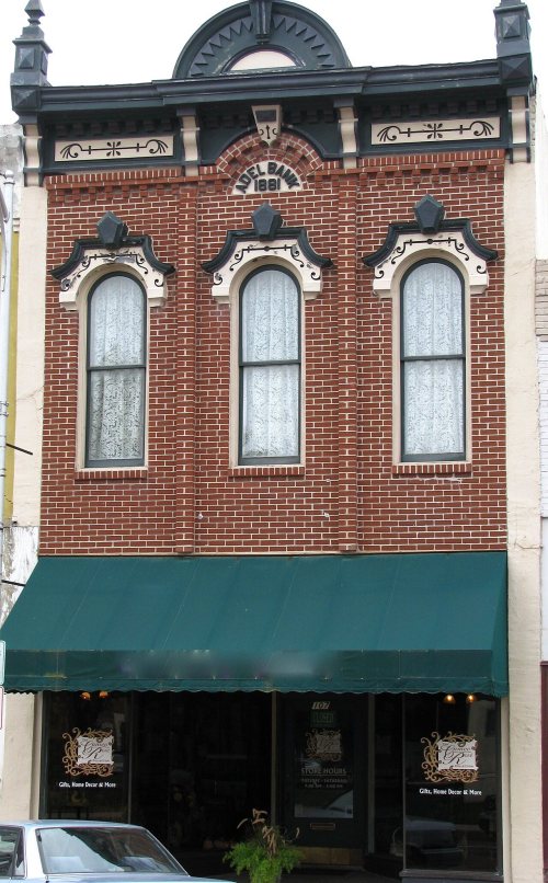
3 places in town are on the National Register, among them a historic district with 35 buildings. Below: 1 old photo or paper, maps from 1915 on, and the census since 1860.
Founding year: Wikidata. First post office: 1847.The full story ↓
History grade
What drives Adel’s History grade
On its age, its old homes and the National Register, Adel is more historic than 84% of U.S. towns, #35 of 140 in Iowa. All 3 inputs are above most U.S. towns; its National Register listings ranks highest and its share of homes from before 1940 lowest.
A−
HistoryA character grade: shown, never part of Adel’s overall grade.
Iowa towns list more on the Register than most of the country (a typical Iowa town has 9.1 per 10,000 residents, the U.S. 2.4), so Adel’s 56.0 sits above most of its state (76% of Iowa towns have fewer) while its 36 historic buildings outnumber those of 83% of U.S. towns.
How sure. Graded on any two of the three inputs instead, the letter would range from B+ to A−. The pre-1940 share is a Census survey estimate (±8.0 points). Two sources give 1847.
Founding year: Wikidata (other dates in Quick answers). Homes: Census ACS 2020–24. National Register: National Park Service, May 2026 list; each listing counted once (boundary changes and added documentation belong to their listing), and a historic district counts its contributing buildings. How TownRatings grades history →
What stands out about Adel’s past
Read from the archive, the National Register and the record. The page puts what stands out first.
Adel is the oldest town within Dallas County. Originally called Penoach, Adel was incorporated in 1847, and changed to its current name in 1849. In 1855, there were about twenty-five houses in Adel and three stores. From that time onward, the city began to grow at a faster rate.
Passages that mention Adel, cut from the printed page as they were published.
The History of Dallas County, Iowa, containing a history of the county, its cities, towns, &c. ..1879 · page 499Read the page →
Read the text
The Des Moines, Adel & Western R. R, running from Waukee to Adel, extends through the south part of the township, entering the east side of the township near the southeast corner of section 25, and extending nearly due west to Adel, which is as far as it is now completed, though the new railroad bridge is now under contract and process of construction, and will be completed before spring, when the road will doubtless be extended on to Redfield and Panora, Guthrie county. This is Adel township's pet railroad, of which it is justly proud, and especially the enterprising citizens of
Text read by machine from the scan; it may contain errors.
The History of Dallas County, Iowa, containing a history of the county, its cities, towns, &c. ..1879 · page 438Read the page →
Read the text
Adel was incorporated in 1856. Kecorded in the minutes of the term of • County Court, held March 3, 1856, the following order, regarding the organization and incorporation of the town of Adel, appears: "On apetition of William Ellis and forty-seven other citizens of Adel, praying for a Town Organization; and it being proven to the satisfaction of this court that there are three hundred inhabitants in the village of A.del, and that one-fourth of the legal voters of said village of Adel were subscribed to the petition aforesaid, it is
Text read by machine from the scan; it may contain errors.
Scans and text from the Internet Archive. Books published in 1930 or earlier, which are in the public domain.
Timeline
Adel, 1847 to 1985
Woven from the archive, old maps, post office records, the National Register and the people born here.
Nothing in the archives for these yearsWeddings on Main Street, storms, parades, school pictures, the old store. If it’s in your family album, it belongs here.
In 1847, according to Wikidata. Adel’s post office opened in 1847, and the census of 1860 counted 466 people here.
How does Adel rank for history?
Adel is more historic than 84% of U.S. towns, #35 of 140 in Iowa. The History grade combines the town’s founding era, the share of homes built before 1940 and its National Register listings. It’s a character grade, so it isn’t part of the overall grade. How it works.
What is on the National Register in Adel?
Three places: the Dallas County Courthouse (listed 1973), the Adel Bridge (2002) and the Adel Public Square Historic District (2009).
How old are the homes in Adel?
16% of Adel’s homes were built before 1940 (Census estimate, ±8.0 points), against a typical 22% for an Iowa town; the median home was built in 1992.
Founding dates: Wikidata, Wikipedia, the U.S. post office records of Blevins & Helbock (CC0) and the Census. Homes by year built: Census ACS 2020–24. National Register of Historic Places: National Park Service (list of May 22, 2026). Old photos, postcards and papers: Wikimedia Commons, the Library of Congress and other public archives, credited on each item’s page. Maps: U.S. Geological Survey historical topographic maps (via Esri) and Sanborn fire-insurance maps (Library of Congress). History text and census tables: Wikipedia (CC BY-SA 4.0). Places that used to be: USGS Geographic Names Information System (2021).
From Wikimedia Commons (6), the National Register of Historic Places (3), Wikipedia, Wikidata and Wikipedia for famous people, U.S. Geological Survey historical maps, U.S. Census counts (via Wikipedia), the US Post Offices dataset (Blevins & Helbock), the USGS Geographic Names Information System, Sanborn fire insurance maps (Library of Congress) and old county and town histories (Internet Archive). Archive images are copied here with their credits and licenses, shown on each photo’s page. Refreshed monthly.




 2018
 2012
 2012
 2012
 2012


