First pick
Parc Marie Astoin
Park or garden · 320 m outside the commune
2.8 ha0.9 km of path
10 minto walk all 0.9 km of path
1.7 km south-eastfrom the center
Promenade des Danese et es Messieurs
Directionsto a point inside
Each edition grades its towns against each other only.
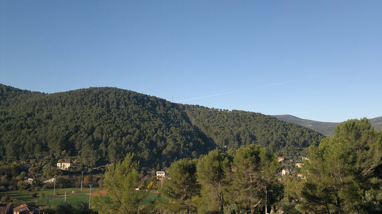 Photo: Fadli Mehmed · CC BY 3.0
Protected areas cover 56% of Solliès-Toucas’ land. Mapped woodland covers 61% of Solliès-Toucas. 73 km of footpaths cross Solliès-Toucas (2.4 km per km²). France has no Outdoors Grade yet: these are the figures, each beside the compared towns’ median.
Throughout this page, the Var median and the France median are the median of compared communes (those with an overall grade), each figure its own median.
Read from the data: what stands out first, good and less good.
What sets Solliès-Toucas apart: the regional nature park around it, then its woods.
Each figure against the 3,798 compared French towns (communes with an overall grade): the marked bar is the town’s, the line the median. Described, not graded.
Percentiles among compared French towns; ties count half.
The 40 compared French towns nearest in population (6,202 to 6,332 residents), by km of footpath per km². Hover for each one’s protected land and woods; click for its page.
From Le Mesnil-le-Roi (3.9 km per km²) to Livarot-Pays-d'Auge (0.3 km per km²).
| Town | Paths (km/km²) | Woodland | Protected | Coast | |
|---|---|---|---|---|---|
| 1 | Le Mesnil-le-Roi Yvelines | 3.9 | 13% | 0% | 133 km |
| 2 | Wimereux Pas-de-Calais | 3.9 | 3.6% | 100% | On it |
| 3 | Jassans-Riottier Ain | 3.9 | 9.6% | 0% | 274 km |
| 4 | Châtel-Guyon Puy-de-Dôme | 3.5 | 41% | 100% | 273 km |
| 5 | Champagne-au-Mont-d'Or Rhône | 3.3 | 15% | 0% | 255 km |
| 6 | Dompierre-sur-Mer Charente-Maritime | 2.8 | 6.2% | 0% | 7 km |
| 7 | Pont-de-Chéruy Isère | 2.8 | 12% | 0% | 257 km |
| 8 | Thyez Haute-Savoie | 2.7 | 29% | 2.7% | 267 km |
| 9 | Lallaing Nord | 2.7 | 16% | 98% | 89 km |
| 10 | Saint-Pryvé-Saint-Mesmin Loiret | 2.7 | 7% | 20% | 206 km |
| 11 | Louvroil Nord | 2.7 | 5.6% | 0% | 131 km |
| 12 | Cuges-les-Pins Bouches-du-Rhône | 2.6 | 37% | 100% | 10 km |
| 13 | Saint-Cyr-au-Mont-d'Or Rhône | 2.4 | 21% | 0% | 257 km |
| 14 | Solliès-Toucas Var | 2.4 | 61% | 56% | 11 km |
| 15 | Bruguières Haute-Garonne | 2.3 | 11% | 0% | 154 km |
| 16 | Homécourt Meurthe-et-Moselle | 2.3 | 28% | 0% | 311 km |
| 17 | Saint-Marcel Saône-et-Loire | 2 | 6% | 0% | 363 km |
| 18 | Avallon Yonne | 1.9 | 45% | 100% | 340 km |
| 19 | Pluneret Morbihan | 1.8 | 19% | 100% | On it |
| 20 | Bonchamp-lès-Laval Mayenne | 1.7 | 1.2% | 0% | 79 km |
| 21 | Châtenoy-le-Royal Saône-et-Loire | 1.5 | 16% | 0% | 364 km |
| 22 | Vaugneray Rhône | 1.5 | 31% | 0% | 246 km |
| 23 | Milhaud Gard | 1.4 | 30% | 8% | 31 km |
| 24 | Pont-Évêque Isère | 1.4 | 17% | 0% | 229 km |
| 25 | Mornant Rhône | 1.3 | 6.3% | 0% | 233 km |
| 26 | Vouneuil-sous-Biard Vienne | 1.2 | 28% | 0% | 112 km |
| 27 | Migné-Auxances Vienne | 1.1 | 7.4% | 16% | 116 km |
| 28 | Esvres Indre-et-Loire | 1 | 31% | 0% | 183 km |
| 29 | Mazan Vaucluse | 1 | 13% | 100% | 70 km |
| 30 | Loches Indre-et-Loire | 0.9 | 17% | 5% | 186 km |
| 31 | Terrasson-Lavilledieu Dordogne | 0.9 | 39% | 7.1% | 149 km |
| 32 | Bellevigny Vendée | 0.9 | 7.1% | 0% | 38 km |
| 33 | Noyal-sur-Vilaine Ille-et-Vilaine | 0.8 | 6.9% | 0% | 55 km |
| 34 | Mer Loir-et-Cher | 0.8 | 8.5% | 22% | 211 km |
| 35 | Malaunay Seine-Maritime | 0.7 | 24% | 0% | 43 km |
| 36 | Saint-Martin-de-Seignanx Landes | 0.7 | 51% | 33% | 9.2 km |
| 37 | Guer Morbihan | 0.7 | 20% | 0% | 50 km |
| 38 | Belin-Béliet Gironde | 0.4 | 86% | 100% | 26 km |
| 39 | Aire-sur-l'Adour Landes | 0.4 | 22% | 2.6% | 93 km |
| 40 | Fleurance Gers | 0.4 | 10% | 0% | 161 km |
| 41 | Livarot-Pays-d'Auge Calvados | 0.3 | 14% | 0.9% | 38 km |
Tap a number to zoom to a park or wood. Tap a layer to hide it. The dashed line is the commune’s boundary.
Named parks, gardens and woods in the commune or within 400 m, the biggest and best-pathed first: Parc Marie Astoin leads, at 2.8 ha. Directions go to a point inside.
Source: © OpenStreetMap contributors (ODbL): named parks, gardens and woods; sizes are the whole site.
The protected areas reaching the commune, and the nearest: national parks, regional nature parks, nature reserves and Natura 2000 sites.
Designations overlap (a regional park can hold a Natura 2000 site), so the rows don’t add up; the first counts each piece of land once.
56% of Solliès-Toucas’ land is protected, more than in 87% of compared French towns; the median compared town in Var has 19%. A regional nature park is a charter between communes to look after a landscape: farming, building and hunting go on inside it.
Source: INPN / PatriNat, protected areas July 2026, Natura 2000 December 2024; shares of IGN’s commune boundary.
Paths, bridleways, steps and tracks open on foot, and waymarked hiking routes, mapped on OpenStreetMap inside the commune; woods are mapped forest and woodland, private woods included.
That is more than in 65% of compared French towns for footpaths per km², and for woodland more than in 96% of compared French towns. Hiking routes often follow paths and lanes already counted, so the two lengths overlap: don’t add them. Every home in Solliès-Toucas is within 800 m of a mapped park or wood, as in most French towns.
Source: © OpenStreetMap contributors (ODbL), extracts of October 25, 2026 (Geofabrik).
Météo-France’s 1991–2020 normals at Cap Cepet, 16 km away, and the daylight at the town’s latitude. Outlined months have long days, highs of 15 to 30 °C and little rain for the place.
| Jan | Feb | Mar | Apr | May | Jun | Jul | Aug | Sep | Oct | Nov | Dec | |
|---|---|---|---|---|---|---|---|---|---|---|---|---|
| Daylight (h) | 9.3 | 10.5 | 11.8 | 13.4 | 14.7 | 15.4 | 15.1 | 13.9 | 12.4 | 10.9 | 9.6 | 9.0 |
| High (°C) | 12 | 12 | 15 | 17 | 21 | 25 | 28 | 28 | 24 | 20 | 15 | 13 |
| Rain (mm) | 72 | 50 | 42 | 55 | 38 | 27 | 7 | 12 | 70 | 108 | 99 | 68 |
July is the driest month (7 mm) and August the warmest (highs of 28 °C). 108 mm of rain falls in October, the wettest month. Frost comes on about 2 nights a year. The climate in Solliès-Toucas →
The nearest towns of 2,500 or more, colored by the share of their land in protected areas.
| Town | Protected | Woodland | Paths (km/km²) | Coast |
|---|---|---|---|---|
| Solliès-Toucas | 56% | 61% | 2.4 | 11 km |
| Solliès-Pont 12,521 · 2.4 km | 0% | 28% | 1.7 | 11 km |
| Solliès-Ville 2,504 · 3.3 km | 47% | 62% | 3.4 | 8.8 km |
| La Farlède 10,014 · 4.9 km | 15% | 8.7% | 1.1 | 7.4 km |
| Cuers 13,271 · 5.6 km | 0% | 32% | 1.5 | 16 km |
| La Valette-du-Var 23,719 · 7.8 km | 32% | 23% | 3.4 | 3.7 km |
| La Crau 19,556 · 8.3 km | 1.8% | 23% | 2.3 | 6.1 km |
Yes: Solliès-Toucas lies in Sainte-Baume Regional Nature Park (55% of the commune).
OpenStreetMap maps 73 km of footpaths and tracks open on foot in the commune, 2.4 km per km² (the median compared town: 1.7 km per km²).
61% of the commune is mapped woodland, private woods included; the median compared French town has 13%.
No: the coast is 11 km from the town center, as the crow flies.
April to August: long days, mild highs and little rain, from Météo-France’s 1991–2020 normals at the nearest suitable station.
TownRatings grades the outdoors in the U.S. and the UK; the French figures are new and not graded yet. This page sets each one beside the median compared French town instead.
Sources: INPN / PatriNat (protected areas 2026, Natura 2000 2024) · © OpenStreetMap contributors, ODbL (paths, hiking routes, woods, coast, gardens) · INSEE, Filosofi 2021 200 m grid (residents) · IGN Admin Express (boundaries) · Météo-France normals 1991–2020 · Medians and percentiles: TownRatings, over compared French towns, updated November 9, 2026. Under the Licence Ouverte / Open Licence 2.0 (Etalab).
Contains public sector information under the Licence Ouverte / Open Licence 2.0 (Etalab): INSEE, DGFiP, the Interior Ministry’s statistics service (SSMSI), the Ministry of Education (DEPP), the Health Ministry’s statistics service (DREES) and the Housing Ministry (Carte des loyers). Commune boundaries: IGN Admin Express.