First pick
La réserve écologique
Park or garden · 330 m outside the commune
1.3 ha0.4 km of path
1.2 km eastfrom the center
Directionsto a point inside
Each edition grades its towns against each other only.
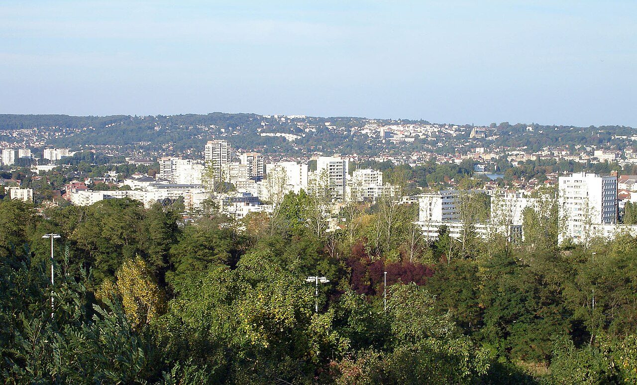 Photo: Clicsouris · CC BY-SA 3.0
16 km of footpaths cross Saint-Gratien (6 km per km²). Mapped woodland covers 0.7% of Saint-Gratien. No protected area reaches Saint-Gratien; the nearest, Sites de Seine-Saint-Denis (Natura 2000), is 1.8 km from the town center. France has no Outdoors Grade yet: these are the figures, each beside the compared towns’ median.
Throughout this page, the Val-d'Oise median and the France median are the median of compared communes (those with an overall grade), each figure its own median.
Read from the data: what stands out first, good and less good.
What sets Saint-Gratien apart: its footpaths, then protected land close by. It is shorter on woodland.
Each figure against the 3,798 compared French towns (communes with an overall grade): the marked bar is the town’s, the line the median. Described, not graded.
Percentiles among compared French towns; ties count half.
The 40 compared French towns nearest in population (20,690 to 22,020 residents), by km of footpath per km². Hover for each one’s protected land and woods; click for its page.
From Sceaux (11.7 km per km²) to Chemillé-en-Anjou (0.4 km per km²).
| Town | Paths (km/km²) | Woodland | Protected | Coast | |
|---|---|---|---|---|---|
| 1 | Sceaux Hauts-de-Seine | 11.7 | 17% | 0% | 154 km |
| 2 | La Madeleine Nord | 8.6 | 0.6% | 0% | 61 km |
| 3 | Fontaine Isère | 8.1 | 37% | 39% | 204 km |
| 4 | Mons-en-Barœul Nord | 7.5 | 2% | 0% | 63 km |
| 5 | Saint-Cyr-l'École Yvelines | 6.3 | 7.8% | 0% | 143 km |
| 6 | Saint-Gratien Val-d'Oise | 6 | 0.7% | 0% | 137 km |
| 7 | Longjumeau Essonne | 5.9 | 4.2% | 0% | 163 km |
| 8 | Carrières-sous-Poissy Yvelines | 5.3 | 5.6% | 0% | 129 km |
| 9 | Saint-Michel-sur-Orge Essonne | 5.3 | 6.7% | 0% | 168 km |
| 10 | Coudekerque-Branche Nord | 5.1 | 14% | 0% | 2.2 km |
| 11 | Fleury-les-Aubrais Loiret | 4.9 | 16% | 0% | 203 km |
| 12 | Montigny-lès-Metz Moselle | 4.9 | 3.4% | 0% | 329 km |
| 13 | Sainte-Foy-lès-Lyon Rhône | 4.8 | 10% | 0% | 249 km |
| 14 | Bruay-la-Buissière Pas-de-Calais | 4.5 | 22% | 0% | 61 km |
| 15 | Lagny-sur-Marne Seine-et-Marne | 4 | 5.7% | 0% | 163 km |
| 16 | Montmorency Val-d'Oise | 3.8 | 20% | 0% | 136 km |
| 17 | Morsang-sur-Orge Essonne | 3.8 | 3.4% | 0% | 168 km |
| 18 | La Chapelle-sur-Erdre Loire-Atlantique | 3.8 | 20% | 1.9% | 43 km |
| 19 | Gardanne Bouches-du-Rhône | 3.8 | 38% | 0% | 16 km |
| 20 | Lingolsheim Bas-Rhin | 3.7 | 4.5% | 0% | 450 km |
| 21 | Ozoir-la-Ferrière Seine-et-Marne | 3.6 | 44% | 0% | 172 km |
| 22 | Neuilly-Plaisance Seine-Saint-Denis | 3.6 | 14% | 14% | 156 km |
| 23 | Le Plessis-Trévise Val-de-Marne | 3.4 | 9.3% | 0% | 163 km |
| 24 | Allauch Bouches-du-Rhône | 3.4 | 28% | 65% | 9.7 km |
| 25 | Nogent-sur-Oise Oise | 3.3 | 19% | 0% | 115 km |
| 26 | Voiron Isère | 3.3 | 28% | 0% | 220 km |
| 27 | Wasquehal Nord | 3.1 | 4.7% | 0% | 60 km |
| 28 | Bourg-la-Reine Hauts-de-Seine | 3.1 | 0% | 0% | 155 km |
| 29 | Mandelieu-la-Napoule Alpes-Maritimes | 2.9 | 48% | 0.1% | On it |
| 30 | Concarneau Finistère | 2.8 | 13% | 0.3% | On it |
| 31 | Plaisance-du-Touch Haute-Garonne | 2.7 | 7.9% | 2.1% | 156 km |
| 32 | Chaumont Haute-Marne | 2.6 | 52% | 0.3% | 342 km |
| 33 | Villeneuve-le-Roi Val-de-Marne | 2.6 | 0.9% | 0% | 164 km |
| 34 | Saint-Genis-Laval Rhône | 2.6 | 6% | 0% | 244 km |
| 35 | Halluin Nord | 2.5 | 4.8% | 0% | 50 km |
| 36 | Carquefou Loire-Atlantique | 2.5 | 14% | 5% | 47 km |
| 37 | Hazebrouck Nord | 1.7 | 0.7% | 0% | 37 km |
| 38 | Givors Rhône | 1.7 | 27% | 0.2% | 232 km |
| 39 | Montaigu-Vendée Vendée | 1.2 | 7.4% | 0% | 51 km |
| 40 | Saint-Mandé Val-de-Marne | 1 | 0% | 0% | 154 km |
| 41 | Chemillé-en-Anjou Maine-et-Loire | 0.4 | 4.3% | 0% | 98 km |
Tap a number to zoom to a park or wood. Tap a layer to hide it. The dashed line is the commune’s boundary.
Named parks, gardens and woods in the commune or within 400 m, the biggest and best-pathed first: La réserve écologique leads, at 1.3 ha. Directions go to a point inside.
Source: © OpenStreetMap contributors (ODbL): named parks, gardens and woods; sizes are the whole site.
The protected areas reaching the commune, and the nearest: national parks, regional nature parks, nature reserves and Natura 2000 sites.
Designations overlap (a regional park can hold a Natura 2000 site), so the rows don’t add up; the first counts each piece of land once.
Source: INPN / PatriNat, protected areas July 2026, Natura 2000 December 2024; shares of IGN’s commune boundary.
Paths, bridleways, steps and tracks open on foot, and waymarked hiking routes, mapped on OpenStreetMap inside the commune; woods are mapped forest and woodland, private woods included.
That is more than in 94% of compared French towns for footpaths per km², and for woodland less than in 95% of compared French towns. Hiking routes often follow paths and lanes already counted, so the two lengths overlap: don’t add them. Every home in Saint-Gratien is within 800 m of a mapped park or wood, as in most French towns.
Source: © OpenStreetMap contributors (ODbL), extracts of October 25, 2026 (Geofabrik).
Météo-France’s 1991–2020 normals at Le Bourget, 10 km away, and the daylight at the town’s latitude. Outlined months have long days, highs of 15 to 30 °C and little rain for the place.
| Jan | Feb | Mar | Apr | May | Jun | Jul | Aug | Sep | Oct | Nov | Dec | |
|---|---|---|---|---|---|---|---|---|---|---|---|---|
| Daylight (h) | 8.7 | 10.1 | 11.7 | 13.6 | 15.3 | 16.2 | 15.8 | 14.4 | 12.5 | 10.7 | 9.1 | 8.2 |
| High (°C) | 8 | 9 | 13 | 16 | 20 | 23 | 26 | 25 | 22 | 17 | 11 | 8 |
| Rain (mm) | 47 | 41 | 44 | 43 | 61 | 54 | 56 | 53 | 45 | 57 | 54 | 63 |
February is the driest month (41 mm) and July the warmest (highs of 26 °C). 63 mm of rain falls in December, the wettest month. Frost comes on about 37 nights a year. The climate in Saint-Gratien →
The nearest towns of 2,500 or more, colored by the share of their land in protected areas.
| Town | Protected | Woodland | Paths (km/km²) |
|---|---|---|---|
| Saint-Gratien | 0% | 0.7% | 6 |
| Enghien-les-Bains 11,432 · 1.6 km | 0% | 0% | 5.4 |
| Épinay-sur-Seine 52,833 · 2.3 km | 0% | 0.8% | 6.3 |
| Sannois 26,924 · 2.4 km | 0% | 17% | 6 |
| Soisy-sous-Montmorency 18,008 · 2.7 km | 0% | 5% | 2.6 |
| Eaubonne 26,211 · 2.8 km | 0% | 1.9% | 5 |
| Deuil-la-Barre 23,099 · 3 km | 0% | 6.1% | 4.6 |
No. The nearest protected area is Sites de Seine-Saint-Denis, 1.8 km from the town center.
OpenStreetMap maps 16 km of footpaths and tracks open on foot in the commune, 6 km per km² (the median compared town: 1.7 km per km²).
0.7% of the commune is mapped woodland, private woods included; the median compared French town has 13%.
No: the coast is 137 km from the town center, as the crow flies.
April to September: long days, mild highs and little rain, from Météo-France’s 1991–2020 normals at the nearest suitable station.
TownRatings grades the outdoors in the U.S. and the UK; the French figures are new and not graded yet. This page sets each one beside the median compared French town instead.
Sources: INPN / PatriNat (protected areas 2026, Natura 2000 2024) · © OpenStreetMap contributors, ODbL (paths, hiking routes, woods, coast, gardens) · INSEE, Filosofi 2021 200 m grid (residents) · IGN Admin Express (boundaries) · Météo-France normals 1991–2020 · Medians and percentiles: TownRatings, over compared French towns, updated November 8, 2026. Under the Licence Ouverte / Open Licence 2.0 (Etalab).
Contains public sector information under the Licence Ouverte / Open Licence 2.0 (Etalab): INSEE, DGFiP, the Interior Ministry’s statistics service (SSMSI), the Ministry of Education (DEPP), the Health Ministry’s statistics service (DREES) and the Housing Ministry (Carte des loyers). Commune boundaries: IGN Admin Express.