Musée gallo-romain de Saint-Romain-en-Gal
Museum in Saint-Romain-en-Gal.
Each edition grades its towns against each other only.

Visitors to Saint-Romain-en-Gal can choose from 9 attractions, 6 museums and 4 châteaux. One place to visit is mapped in Saint-Romain-en-Gal, with 24 more within 5 km of its centre. Travel 28 km and you reach Parc Olympique lyonnais.
Once you have seen Musée gallo-romain de Saint-Romain-en-Gal, try 3 attractions and 2 museums.
 AttractionCathédrale Saint-Maurice de Vienne1.9 km southeast, in VienneAttractionAttractionTemple d'Auguste et de Livie1.9 km southeast, in Vienne
 MuseumÉglise Saint-Pierre de Vienne1.8 km southeast, in VienneAttractionAttractionCirque romain de Vienne2.2 km southeast, in Vienne
 MuseumMusée des Beaux-Arts et d'Archéologie de Vienne2 km southeast, in Vienne
Best known first: by how many Wikipedia and sister-site articles cover each place (Wikidata’s count). It isn’t a ranking of how good they are.
Leave town to the southeast for most of the 24 nearby.
The first 20 on the list, numbered as below. The shape is the commune of Saint-Romain-en-Gal; the orange dot is its centre. © OpenStreetMap contributors · commune boundary: IGN
Ahead are museums or galleries (9); next, other sights (9).
Dark: in Saint-Romain-en-Gal. Light: in the communes within 5 km of its centre.
After the one in town come 24 more within 5 km of its centre.
Museum in Saint-Romain-en-Gal.
Cathedral located in Isère, in France.
Roman temple located in Vienne (Isère), in France.
Church located in Isère, in France.
Abbey located in Isère, in France.
Former abbey located in Isère, in France.
Church located in Isère, in France.
The one place in Saint-Romain-en-Gal, then those within 5 km of its centre.
The history of Saint-Romain-en-Gal → · Parks and trails in Saint-Romain-en-Gal →
Of the 12 day trips, Parc Olympique lyonnais (28 km) is the best known.
 AttractionParc Olympique lyonnais28 km north, in Décines-Charpieu
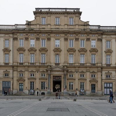 MuseumMusée des Beaux-Arts de Lyon26 km north, in Lyon 1er
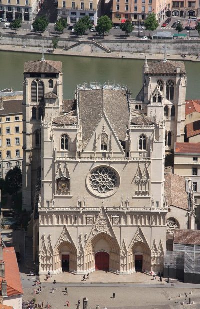 AttractionPrimatiale Saint-Jean de Lyon25 km north, in Lyon 5e
 AttractionCentrale nucléaire de Saint-Alban16 km southwest, in Saint-Maurice-l'ExilGardenGardenParc de la Tête d'Or27 km north, in Lyon 6eAttractionAttractionThéâtre antique de Lyon25 km north, in Lyon 5eMonastery or conventMonastery or conventCouvent Sainte-Marie de La Tourette37 km northwest, in Éveux
 MuseumMusée des Confluences22 km north, in Lyon 2eAttractionAttractionOdéon antique de Lyon25 km north, in Lyon 5e
 AttractionJardin botanique de Lyon27 km north, in Lyon 6e
 MuseumLugdunum25 km north, in Lyon 5e
 MuseumGadagne26 km north, in Lyon 5e
Places within 40 km of Saint-Romain-en-Gal with an article in both French and English Wikipedia, nearest first.
The one place mapped in Saint-Romain-en-Gal is Musée gallo-romain de Saint-Romain-en-Gal. We list 1 place in town. Another 24 are within 5 km of the centre.
9 museums and galleries in town or within 5 km, including Musée gallo-romain de Saint-Romain-en-Gal, Église Saint-Pierre de Vienne, Musée des Beaux-Arts et d'Archéologie de Vienne and Musée du cloître de Saint-André-le-Bas de Vienne.
The nearest with articles in both French and English Wikipedia: Parc Olympique lyonnais (28 km), Musée des Beaux-Arts de Lyon (26 km), Primatiale Saint-Jean de Lyon (25 km), Centrale nucléaire de Saint-Alban (16 km).
From OpenStreetMap and Wikidata: named museums, galleries, châteaux, abbeys, gardens, zoos, theme parks and other visitor attractions whose mapped point lies inside the commune of Saint-Romain-en-Gal, then those in the communes within 5 km of its centre, and well-known places within 40 km. Houses, ruins and gardens need a sign they’re open to visitors; places marked private, closed or disused are left out. The historic-monument link is the Culture ministry’s Mérimée record. A place that isn’t mapped isn’t listed, so this isn’t everything there is to see.
Sources: OpenStreetMap (© OpenStreetMap contributors, ODbL), Wikidata (CC0: descriptions, websites, Wikipedia articles), the Culture ministry’s Mérimée database (Licence Ouverte 2.0), IGN commune boundaries. Distances are from the commune’s centre point.
Photos from Wikimedia Commons, each under its own licence (our copy, resized).
Contains public sector information under the Licence Ouverte / Open Licence 2.0 (Etalab): INSEE, DGFiP, the Interior Ministry’s statistics service (SSMSI), the Ministry of Education (DEPP), the Health Ministry’s statistics service (DREES) and the Housing Ministry (Carte des loyers). Commune boundaries: IGN Admin Express.
 7
 10
 11