
Start with Château du Grand Perron: the sights of Oullins-Pierre-Bénite
Among the places to visit in and near Oullins-Pierre-Bénite are 12 châteaux, 10 forts and 7 gardens. 5 places to visit are mapped in Oullins-Pierre-Bénite, with 47 more within 5 km of its centre. France lists 3 of the town’s sites as historic monuments. Walking distance covers 2 of the places on the list, all within 1 km of the middle. For a full day, there is Parc Olympique lyonnais, 15 km away.
The names to know in Oullins-Pierre-Bénite
Beyond Château du Grand Perron, there are 3 châteaux, a garden and a museum.
 MuseumMusée des Confluences2.4 km north, in Lyon 2e
Best known first: by how many Wikipedia and sister-site articles cover each place (Wikidata’s count). It isn’t a ranking of how good they are.
On the map
Furthest from the centre is Murus gallicus de Lyon, 5 km away.
The first 20 on the list, numbered as below. The shape is the commune of Oullins-Pierre-Bénite; the orange dot is its centre. © OpenStreetMap contributors · commune boundary: IGN
By kind
Châteaux or heritage sites are the biggest group (24), then museums or galleries (9).
Dark: in Oullins-Pierre-Bénite. Light: in the communes within 5 km of its centre.
Full list of places
First the 5 in town, then the 47 within 5 km of its centre.
 7
 9
 11
 12
Basilique funéraire Saint-Laurent de Choulans
Basilica located in Rhône, in France.

Aqueduc du Gier dit du Plat de l'Air
Archaeological site.
The 5 places in Oullins-Pierre-Bénite first, then those within 5 km of its centre. Nearby, the first 40 of 47.
The history of Oullins-Pierre-Bénite → · Parks and trails in Oullins-Pierre-Bénite →
Beyond the town
Top of the 12 day trips: Parc Olympique lyonnais, at 15 km.
 AttractionParc Olympique lyonnais15 km northeast, in Décines-Charpieu
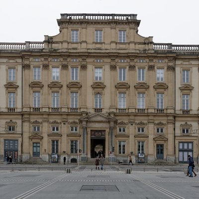 MuseumMusée des Beaux-Arts de Lyon6.4 km north, in Lyon 1er
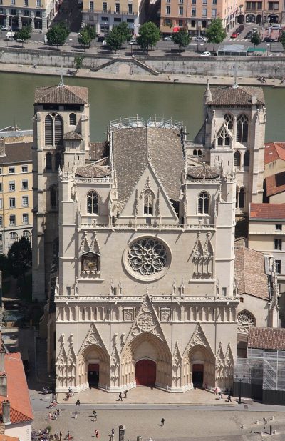 AttractionPrimatiale Saint-Jean de Lyon5.6 km north, in Lyon 5eAttractionAttractionThéâtre antique de Lyon5.4 km north, in Lyon 5eGardenGardenParc de la Tête d'Or8.4 km northeast, in Lyon 6eAttractionAttractionOdéon antique de Lyon5.3 km north, in Lyon 5e
 MuseumLugdunum5.5 km north, in Lyon 5e
 MuseumGadagne6 km north, in Lyon 5e
 AttractionJardin botanique de Lyon8 km northeast, in Lyon 6eMonastery or conventMonastery or conventCouvent Sainte-Marie de La Tourette19 km northwest, in Éveux
 MuseumInstitut Lumière6 km northeast, in Lyon 8eMuseumMuseumMusée d'Art contemporain de Lyon8.7 km north, in Lyon 6e
Places within 40 km of Oullins-Pierre-Bénite with an article in both French and English Wikipedia, nearest first.
Your questions on Oullins-Pierre-Bénite
What is there to see in Oullins-Pierre-Bénite?
The first on our list in Oullins-Pierre-Bénite are Château du Grand Perron, Château du Petit Perron, Maison de la Cadière and Château de La Bussière. We list 5 places in town. Another 47 are within 5 km of the centre.
Are there museums in or near Oullins-Pierre-Bénite?
9 museums and galleries in town or within 5 km, including Musée des Confluences, La Sucrière, Centre d'histoire de la résistance et de la déportation and Musée des Tissus.
Which places in Oullins-Pierre-Bénite are listed historic monuments?
3 places on this page in Oullins-Pierre-Bénite are listed or registered historic monuments (Mérimée), including Château du Grand Perron, Château du Petit Perron and Maison de la Cadière.
What well-known places are within a day out of Oullins-Pierre-Bénite?
The nearest with articles in both French and English Wikipedia: Parc Olympique lyonnais (15 km), Musée des Beaux-Arts de Lyon (6.4 km), Primatiale Saint-Jean de Lyon (5.6 km), Théâtre antique de Lyon (5.4 km).
How is this list made?
From OpenStreetMap and Wikidata: named museums, galleries, châteaux, abbeys, gardens, zoos, theme parks and other visitor attractions whose mapped point lies inside the commune of Oullins-Pierre-Bénite, then those in the communes within 5 km of its centre, and well-known places within 40 km. Houses, ruins and gardens need a sign they’re open to visitors; places marked private, closed or disused are left out. The historic-monument link is the Culture ministry’s Mérimée record. A place that isn’t mapped isn’t listed, so this isn’t everything there is to see.
Sources: OpenStreetMap (© OpenStreetMap contributors, ODbL), Wikidata (CC0: descriptions, websites, Wikipedia articles), the Culture ministry’s Mérimée database (Licence Ouverte 2.0), IGN commune boundaries. Distances are from the commune’s centre point.
Photos from Wikimedia Commons, each under its own licence (our copy, resized).
Photo credits (13)
- Musée des Confluences: Fred Romero from Paris, France, CC BY 2.0, Wikimedia Commons
- La Sucrière: Bourrel, CC BY-SA 3.0, Wikimedia Commons
- Musée des Tissus: Karldupart, CC BY-SA 3.0, Wikimedia Commons
- Jardin des Curiosités: PHILDIC, CC BY-SA 3.0, Wikimedia Commons
- Aquarium de Lyon: Aurelie Chaumat, Public domain, Wikimedia Commons
- Musée urbain Tony Garnier: Gnrc, CC BY-SA 3.0, Wikimedia Commons
- Parc Olympique lyonnais: AsGunReview, CC BY-SA 4.0, Wikimedia Commons
- Musée des Beaux-Arts de Lyon: Jastrow, CC BY 2.5, Wikimedia Commons
- Primatiale Saint-Jean de Lyon: Otourly, CC BY-SA 3.0, Wikimedia Commons
- Lugdunum: Alorange, Public domain, Wikimedia Commons
- Gadagne: Mathilde HOSPITAL (Gadagne), CC BY-SA 4.0, Wikimedia Commons
- Jardin botanique de Lyon: Gonedelyon, CC BY-SA 3.0, Wikimedia Commons
- Institut Lumière: Matt Neale from UK, CC BY 2.0, Wikimedia Commons
Contains public sector information under the Licence Ouverte / Open Licence 2.0 (Etalab): INSEE, DGFiP, the Interior Ministry’s statistics service (SSMSI), the Ministry of Education (DEPP), the Health Ministry’s statistics service (DREES) and the Housing Ministry (Carte des loyers). Commune boundaries: IGN Admin Express.