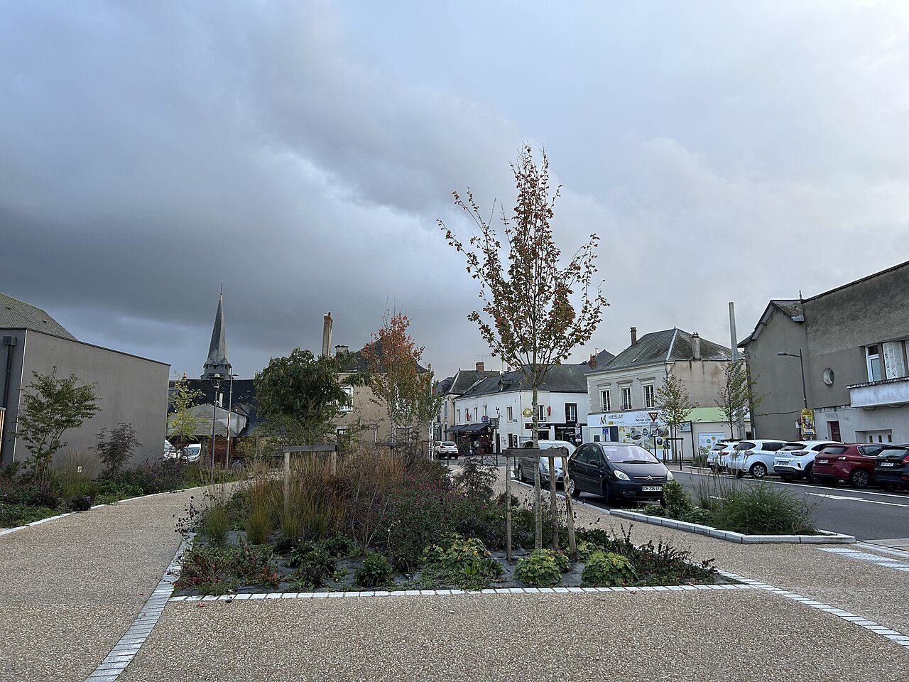
 Photo: Yzergues · CC BY-SA 4.0
Parks, woods and footpaths in Meslay-du-Maine
Mapped woodland covers 1% of Meslay-du-Maine. 17 km of footpaths cross Meslay-du-Maine (0.7 km per km²). No protected area reaches Meslay-du-Maine; the nearest, Vallée de l’Erve en aval de Saint-Pierre-sur-Erve (Natura 2000), is 9.7 km from the town center. France has no Outdoors Grade yet: these are the figures, each beside the compared towns’ median.
Throughout this page, the Mayenne median and the France median are the median of compared communes (those with an overall grade), each figure its own median.
What kind of outdoors place is Meslay-du-Maine?
Read from the data: what stands out first, good and less good.
What sets Meslay-du-Maine apart: protected land close by. It is shorter on woodland.
How Meslay-du-Maine compares with French towns
Each figure against the 3,798 compared French towns (communes with an overall grade): the marked bar is the town’s, the line the median. Described, not graded.
Percentiles among compared French towns; ties count half.
Meslay-du-Maine has the 15th fewest footpaths per km² of 41 towns its size
The 40 compared French towns nearest in population (2,755 to 2,805 residents), by km of footpath per km². Hover for each one’s protected land and woods; click for its page.
From Éleu-dit-Leauwette (5.5 km per km²) to Levroux (0 km per km²).
Every town in the comparison
| Town | Paths (km/km²) | Woodland | Protected | Coast | |
|---|---|---|---|---|---|
| 1 | Éleu-dit-Leauwette Pas-de-Calais | 5.5 | 16% | 0% | 76 km |
| 2 | Argelès-Gazost Hautes-Pyrénées | 4.3 | 17% | 100% | 130 km |
| 3 | Pabu Côtes-d'Armor | 3.6 | 22% | 0% | 15 km |
| 4 | Collioure Pyrénées-Orientales | 3.4 | 6.3% | 4% | On it |
| 5 | Pinsaguel Haute-Garonne | 2.8 | 14% | 29% | 146 km |
| 6 | Cosnes-et-Romain Meurthe-et-Moselle | 2.6 | 35% | 0% | 273 km |
| 7 | Saint-Lunaire Ille-et-Vilaine | 2.6 | 21% | 100% | On it |
| 8 | Montfort-l'Amaury Yvelines | 2.1 | 16% | 100% | 129 km |
| 9 | Malaucène Vaucluse | 2.1 | 57% | 100% | 83 km |
| 10 | Saint-Saturnin Sarthe | 1.9 | 8.9% | 0% | 129 km |
| 11 | Candé Maine-et-Loire | 1.9 | 16% | 0% | 91 km |
| 12 | Peyruis Alpes-de-Haute-Provence | 1.8 | 53% | 6.2% | 90 km |
| 13 | Ampuis Rhône | 1.7 | 36% | 95% | 222 km |
| 14 | Les Adrets-de-l'Estérel Var | 1.6 | 80% | 0% | 9.2 km |
| 15 | Venette Oise | 1.4 | 7.3% | 0% | 117 km |
| 16 | L'Isle-sur-le-Doubs Doubs | 1.4 | 50% | 0% | 413 km |
| 17 | Beaumont-le-Roger Eure | 1.2 | 79% | 2% | 50 km |
| 18 | Charolles Saône-et-Loire | 1.2 | 20% | 0% | 320 km |
| 19 | Mussidan Dordogne | 1.1 | 13% | 1.7% | 75 km |
| 20 | Saint-Aignan Loir-et-Cher | 1 | 31% | 0% | 218 km |
| 21 | La Fère Aisne | 0.9 | 12% | 11% | 134 km |
| 22 | Ducey-Les Chéris Manche | 0.9 | 13% | 7.8% | 5.3 km |
| 23 | Orgon Bouches-du-Rhône | 0.8 | 17% | 100% | 40 km |
| 24 | Amancy Haute-Savoie | 0.8 | 14% | 0% | 271 km |
| 25 | Connerré Sarthe | 0.7 | 23% | 0% | 144 km |
| 26 | Arcis-sur-Aube Aube | 0.7 | 10% | 0% | 256 km |
| 27 | Meslay-du-Maine Mayenne | 0.7 | 1% | 0% | 96 km |
| 28 | Marigny-Le-Lozon Manche | 0.7 | 0.2% | 46% | 21 km |
| 29 | Bourron-Marlotte Seine-et-Marne | 0.7 | 42% | 22% | 211 km |
| 30 | Dieuze Moselle | 0.6 | 21% | 24% | 380 km |
| 31 | Montignac-Lascaux Dordogne | 0.5 | 52% | 1.6% | 138 km |
| 32 | Baixas Pyrénées-Orientales | 0.5 | 0% | 3.9% | 19 km |
| 33 | Wassy Haute-Marne | 0.5 | 61% | 0% | 302 km |
| 34 | Courville-sur-Eure Eure-et-Loir | 0.4 | 0.2% | 0% | 127 km |
| 35 | Grandvilliers Oise | 0.3 | 0.4% | 0% | 60 km |
| 36 | Thuré Vienne | 0.2 | 29% | 0% | 136 km |
| 37 | Rodilhan Gard | 0.2 | 0% | 24% | 40 km |
| 38 | Wignehies Nord | 0.1 | 0.5% | 100% | 156 km |
| 39 | Sérifontaine Oise | 0.1 | 21% | 0% | 80 km |
| 40 | Sains-du-Nord Nord | 0.1 | 34% | 100% | 149 km |
| 41 | Levroux Indre | 0 | 8.7% | 0% | 222 km |
Parks, woods, footpaths & countryside
Tap a layer to hide it. The dashed line is the commune’s boundary.
9 in 10 residents of Meslay-du-Maine live within 800 m of a park or wood
Each square is 1 resident in 100: in green, those within 800 m, as the crow flies, of a mapped park, garden or woodland edge (INSEE’s 200 m population grid against OpenStreetMap).
Residents within 800 m of green space · share of residents
About 100 residents live further away. The distance is a straight line to the edge of a mapped park or wood, not a walk to a gate, and a wood can be private.
Vallée de l’Erve en aval de Saint-Pierre-sur-Erve is the nearest protected area, 9.7 km away
The protected areas reaching the commune, and the nearest: national parks, regional nature parks, nature reserves and Natura 2000 sites.
Vallée de l’Erve en aval de Saint-Pierre-sur-Erve
Share of the commune’s land
Designations overlap (a regional park can hold a Natura 2000 site), so the rows don’t add up; the first counts each piece of land once.
Source: INPN / PatriNat, protected areas July 2026, Natura 2000 December 2024; shares of IGN’s commune boundary.
17 km of footpaths cross Meslay-du-Maine
Paths, bridleways, steps and tracks open on foot, and waymarked hiking routes, mapped on OpenStreetMap inside the commune; woods are mapped forest and woodland, private woods included.
Km per km² of the commune · mapped on OpenStreetMap
Share of the land · mapped woods and forest
That is less than in 79% of compared French towns for footpaths per km², and for woodland less than in 94% of compared French towns. Hiking routes often follow paths and lanes already counted, so the two lengths overlap: don’t add them.
Source: © OpenStreetMap contributors (ODbL), extracts of October 25, 2026 (Geofabrik).
The best walking months in Meslay-du-Maine: April to September
Météo-France’s 1991–2020 normals at St-Georges-Le-Flechard, 9.6 km away, and the daylight at the town’s latitude. Outlined months have long days, highs of 15 to 30 °C and little rain for the place.
| Jan | Feb | Mar | Apr | May | Jun | Jul | Aug | Sep | Oct | Nov | Dec | |
|---|---|---|---|---|---|---|---|---|---|---|---|---|
| Daylight (h) | 8.8 | 10.2 | 11.7 | 13.6 | 15.1 | 16.0 | 15.7 | 14.3 | 12.5 | 10.7 | 9.2 | 8.4 |
| High (°C) | 8 | 10 | 13 | 16 | 20 | 23 | 25 | 25 | 22 | 17 | 12 | 9 |
| Rain (mm) | 82 | 65 | 58 | 57 | 60 | 58 | 54 | 47 | 67 | 79 | 79 | 94 |
August is the driest month (47 mm) and July the warmest (highs of 25 °C). 94 mm of rain falls in December, the wettest month. Frost comes on about 47 nights a year. The climate in Meslay-du-Maine →
Next to Meslay-du-Maine
The nearest towns of 2,500 or more, colored by the share of their land in protected areas.
| Town | Protected | Woodland | Paths (km/km²) |
|---|---|---|---|
| Meslay-du-Maine | 0% | 1% | 0.7 |
| Argentré 2,906 · 16 km | 0% | 3.1% | 0.5 |
| Bonchamp-lès-Laval 6,302 · 18 km | 0% | 1.2% | 1.7 |
| Château-Gontier-sur-Mayenne 16,584 · 18 km | 0% | 3.1% | 0.9 |
| L'Huisserie 4,672 · 18 km | 0% | 16% | 3.8 |
| Laval 49,400 · 21 km | 0% | 8.6% | 4.5 |
| Sablé-sur-Sarthe 12,326 · 21 km | 0% | 12% | 1 |
What this data can and can’t tell you
- Protected areas. National-park cores, national parks’ outer areas, regional nature parks, nature reserves and Natura 2000 sites, from INPN. A national park’s core is strictly protected; its outer area and a regional park are charters between communes, not bans. Designations overlap, so the total counts each piece of land once.
- Woodland. Forest and woods as OpenStreetMap maps them, private woods included: woods nobody has mapped are missing, and a mapped wood isn’t necessarily open to walkers.
- Footpaths and hiking routes. Footpaths, bridleways, steps and tracks open on foot, then waymarked hiking routes (GR and others) measured apart. A route often follows a path or lane already counted: the two overlap. Paths nobody has mapped are missing.
- Green space nearby. The share of residents (INSEE’s 200 m grid) within 800 m, as the crow flies, of a mapped park, garden or wood edge. It measures nearness, not a way in. Guadeloupe and French Guiana have no grid: their pages say whether the town center is within 800 m.
- The coast. The straight-line distance from the town center to OpenStreetMap’s coastline, which follows the tide line into estuaries. A commune is on the coast when the coastline crosses its boundary.
- No grade yet. U.S. and UK towns have an Outdoors Grade; French towns don’t yet. Each figure is set beside the median of compared communes (those with an overall grade) in the département and in France, each figure its own median.
Questions about the outdoors in Meslay-du-Maine
Is Meslay-du-Maine in a national or regional nature park?
No. The nearest protected area is Vallée de l’Erve en aval de Saint-Pierre-sur-Erve, 9.7 km from the town center.
Are there good walks in Meslay-du-Maine?
OpenStreetMap maps 17 km of footpaths and tracks open on foot in the commune, 0.7 km per km² (the median compared town: 1.7 km per km²).
How much of Meslay-du-Maine is woodland?
1% of the commune is mapped woodland, private woods included; the median compared French town has 13%.
Is Meslay-du-Maine near the sea?
No: the coast is 96 km from the town center, as the crow flies.
When is the best time for walking in Meslay-du-Maine?
April to September: long days, mild highs and little rain, from Météo-France’s 1991–2020 normals at the nearest suitable station.
Why is there no Outdoors Grade for French towns?
TownRatings grades the outdoors in the U.S. and the UK; the French figures are new and not graded yet. This page sets each one beside the median compared French town instead.
Sources: INPN / PatriNat (protected areas 2026, Natura 2000 2024) · © OpenStreetMap contributors, ODbL (paths, hiking routes, woods, coast, gardens) · INSEE, Filosofi 2021 200 m grid (residents) · IGN Admin Express (boundaries) · Météo-France normals 1991–2020 · Medians and percentiles: TownRatings, over compared French towns, updated November 9, 2026. Under the Licence Ouverte / Open Licence 2.0 (Etalab).
Contains public sector information under the Licence Ouverte / Open Licence 2.0 (Etalab): INSEE, DGFiP, the Interior Ministry’s statistics service (SSMSI), the Ministry of Education (DEPP), the Health Ministry’s statistics service (DREES) and the Housing Ministry (Carte des loyers). Commune boundaries: IGN Admin Express.