
What to see in Sainte-Mère-Église, from Musée Airborne on
On foot in Sainte-Mère-Église, 8 places to visit are within 1 km of the centre. Look within 5 km of its centre and the list grows by 2 beyond the 13 in Sainte-Mère-Église. The mix takes in 6 attractions, 5 châteaux and 2 museums. France lists 3 of the town’s sites as historic monuments. Batterie d'Azeville, 6.1 km away, is the best-known day out.
Sainte-Mère-Église’s best known
Beyond Musée Airborne, there are 2 châteaux, 2 forts and a museum.
 AttractionMusée Airbornein town
 MuseumFerme-musée du Cotentinin townChâteauChâteauChâteau de Mariévillein townChâteauChâteauManoir de Franquetotin townFortFortRedoute de Ravenovillein townFortFortBatteriein town
Best known first: by how many Wikipedia and sister-site articles cover each place (Wikidata’s count). It isn’t a ranking of how good they are.
Where to go
At the edge of the map sits Batterie, 9.4 km out.
The first 20 on the list, numbered as below. The shape is the commune of Sainte-Mère-Église; the orange dot is its centre. © OpenStreetMap contributors · commune boundary: IGN
What they are
Châteaux or heritage sites lead the count with 7; 6 are other sights.
Dark: in Sainte-Mère-Église. Light: in the communes within 5 km of its centre.
Every entry
The town has 13; within 5 km of its centre, the list finds 2 more.
The 13 places in Sainte-Mère-Église first, then those within 5 km of its centre.
The history of Sainte-Mère-Église → · Parks and trails in Sainte-Mère-Église →
Bigger names, a drive away
Day trips number 12; the best known is Batterie d'Azeville, 6.1 km off.
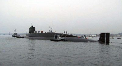 AttractionLe Redoutable34 km northwest, in Cherbourg-en-CotentinAttractionAttractionChâteau de Saint-Sauveur-le-Vicomte15 km west, in Saint-Sauveur-le-VicomteFortFortBatterie de Maisy18 km east, in Grandcamp-MaisyAbbeyAbbeyAbbaye Sainte-Trinité de Lessay26 km southwest, in LessayAbbeyAbbeyAbbaye de Cerisy-la-Forêt36 km southeast, in Cerisy-la-ForêtAttractionAttractionNouveau phare de Gatteville32 km north, in Gatteville-le-PhareAbbeyAbbeyAbbaye de Saint-Sauveur-le-Vicomte15 km west, in Saint-Sauveur-le-Vicomte
 MuseumMusée Thomas-Henry34 km northwest, in Cherbourg-en-CotentinAttractionAttractionThermes antiques d'Alauna15 km northwest, in Valognes
Places within 40 km of Sainte-Mère-Église with an article in both French and English Wikipedia, nearest first.
Seeing Sainte-Mère-Église: your questions
What is there to see in Sainte-Mère-Église?
The first on our list in Sainte-Mère-Église are Musée Airborne, Ferme-musée du Cotentin, Château de Mariéville and Manoir de Franquetot. We list 13 places in town. Another 2 are within 5 km of the centre.
Are there museums in or near Sainte-Mère-Église?
2 museums and galleries in town or within 5 km, including Ferme-musée du Cotentin and Musée a ciel àpert.
Which places in Sainte-Mère-Église are listed historic monuments?
3 places on this page in Sainte-Mère-Église are listed or registered historic monuments (Mérimée), including Château de Mariéville, Manoir de Franquetot and Redoute de Ravenoville.
What well-known places are within a day out of Sainte-Mère-Église?
The nearest with articles in both French and English Wikipedia: Batterie d'Azeville (6.1 km), Batterie de Crisbecq (8.2 km), Château de Plain-Marais (7.3 km), Le Redoutable (34 km).
How is this list made?
From OpenStreetMap and Wikidata: named museums, galleries, châteaux, abbeys, gardens, zoos, theme parks and other visitor attractions whose mapped point lies inside the commune of Sainte-Mère-Église, then those in the communes within 5 km of its centre, and well-known places within 40 km. Houses, ruins and gardens need a sign they’re open to visitors; places marked private, closed or disused are left out. The historic-monument link is the Culture ministry’s Mérimée record. A place that isn’t mapped isn’t listed, so this isn’t everything there is to see.
Sources: OpenStreetMap (© OpenStreetMap contributors, ODbL), Wikidata (CC0: descriptions, websites, Wikipedia articles), the Culture ministry’s Mérimée database (Licence Ouverte 2.0), IGN commune boundaries. Distances are from the commune’s centre point.
Photos from Wikimedia Commons, each under its own licence (our copy, resized).
Photo credits (4)
- Musée Airborne: Musée Airborne, Public domain, Wikimedia Commons
- Ferme-musée du Cotentin: DSMD, Public domain, Wikimedia Commons
- Le Redoutable: Guillaume Rueda, CC BY-SA 3.0, Wikimedia Commons
- Musée Thomas-Henry: HaguardDuNord, CC BY 3.0, Wikimedia Commons
Contains public sector information under the Licence Ouverte / Open Licence 2.0 (Etalab): INSEE, DGFiP, the Interior Ministry’s statistics service (SSMSI), the Ministry of Education (DEPP), the Health Ministry’s statistics service (DREES) and the Housing Ministry (Carte des loyers). Commune boundaries: IGN Admin Express.