First pick
Le Petit Bois de Vezins
Park or garden
1.2 ha0.3 km of path
5.9 km south-westfrom the center
Directionsto a point inside
Each edition grades its towns against each other only.
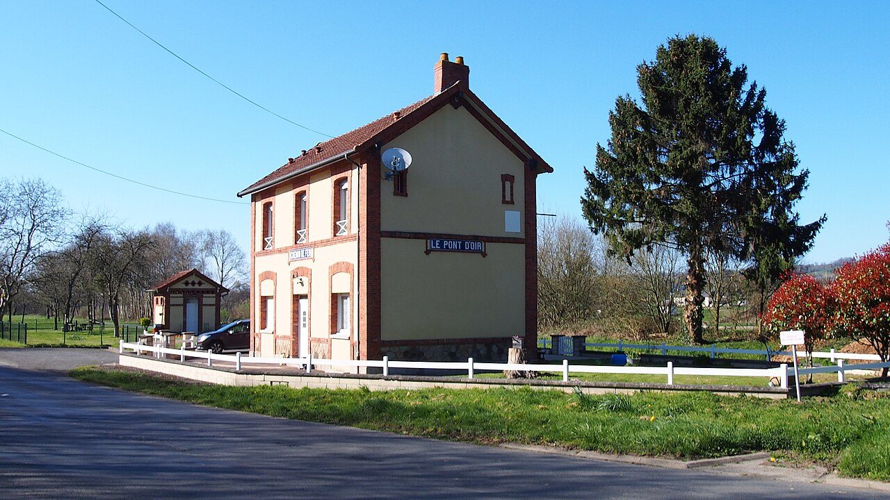 Photo: Ikmo-ned · CC BY-SA 4.0
Footpaths add up to 26 km across Isigny-le-Buat (0.4 km per km²). Mapped woodland covers 5.1% of Isigny-le-Buat. No protected area reaches Isigny-le-Buat; the nearest, Baie du Mont Saint-Michel (Natura 2000), is 7.4 km from the town center. France has no Outdoors Grade yet: these are the figures, each beside the compared towns’ median.
Throughout this page, the Manche median and the France median are the median of compared communes (those with an overall grade), each figure its own median.
Read from the data: what stands out first, good and less good.
What sets Isigny-le-Buat apart: protected land close by. It is shorter on footpaths.
Each figure against the 3,798 compared French towns (communes with an overall grade): the marked bar is the town’s, the line the median. Described, not graded.
Percentiles among compared French towns; ties count half.
The 40 compared French towns nearest in population (3,169 to 3,199 residents), by km of footpath per km². Hover for each one’s protected land and woods; click for its page.
From Saint-Michel (3.4 km per km²) to Saint-Ciers-sur-Gironde (0.1 km per km²).
| Town | Paths (km/km²) | Woodland | Protected | Coast | |
|---|---|---|---|---|---|
| 1 | Saint-Michel Aisne | 3.4 | 55% | 62% | 170 km |
| 2 | Gagnac-sur-Garonne Haute-Garonne | 3 | 15% | 38% | 156 km |
| 3 | Voujeaucourt Doubs | 2.5 | 44% | 0% | 414 km |
| 4 | Saint-Michel Charente | 2.3 | 12% | 3.2% | 71 km |
| 5 | Saint-Gervais-la-Forêt Loir-et-Cher | 2.2 | 63% | 0% | 220 km |
| 6 | Lissieu Rhône | 2 | 19% | 0% | 260 km |
| 7 | Dolus-d'Oléron Charente-Maritime | 1.9 | 31% | 40% | On it |
| 8 | Knutange Moselle | 1.9 | 64% | 0% | 303 km |
| 9 | Salomé Nord | 1.6 | 3% | 0% | 65 km |
| 10 | Lozanne Rhône | 1.6 | 17% | 0% | 259 km |
| 11 | Châteaugay Puy-de-Dôme | 1.6 | 4.7% | 5.2% | 265 km |
| 12 | Nay Pyrénées-Atlantiques | 1.6 | 14% | 8.5% | 109 km |
| 13 | Fontoy Moselle | 1.5 | 48% | 0% | 300 km |
| 14 | Toussieu Rhône | 1.5 | 6.8% | 0% | 243 km |
| 15 | La Machine Nièvre | 1.5 | 65% | 58% | 357 km |
| 16 | Saint-Georges-des-Groseillers Orne | 1.4 | 1.8% | 0% | 59 km |
| 17 | Marsac-sur-l'Isle Dordogne | 1.2 | 33% | 0% | 99 km |
| 18 | Saône Doubs | 1.1 | 43% | 28% | 397 km |
| 19 | Escaudœuvres Nord | 1.1 | 6.3% | 0% | 112 km |
| 20 | Saint-Quentin-la-Poterie Gard | 1.1 | 44% | 0% | 61 km |
| 21 | Druelle Balsac Aveyron | 1.1 | 22% | 0% | 140 km |
| 22 | Breuil-le-Vert Oise | 1 | 31% | 0% | 105 km |
| 23 | Sallèles-d'Aude Aude | 1 | 7.8% | 1.7% | 21 km |
| 24 | La Loupe Eure-et-Loir | 1 | 9.5% | 100% | 118 km |
| 25 | Souillac Lot | 1 | 67% | 6.9% | 163 km |
| 26 | Ploemel Morbihan | 0.9 | 18% | 0% | 3.3 km |
| 27 | Camblanes-et-Meynac Gironde | 0.9 | 12% | 2.8% | 28 km |
| 28 | Baraqueville Aveyron | 0.8 | 13% | 0% | 134 km |
| 29 | Meschers-sur-Gironde Charente-Maritime | 0.6 | 7.4% | 60% | On it |
| 30 | Imphy Nièvre | 0.6 | 32% | 46% | 343 km |
| 31 | Crêches-sur-Saône Saône-et-Loire | 0.6 | 5.5% | 16% | 303 km |
| 32 | Mayet Sarthe | 0.5 | 38% | 40% | 155 km |
| 33 | Cossé-le-Vivien Mayenne | 0.5 | 0.6% | 0% | 83 km |
| 34 | Isigny-le-Buat Manche | 0.4 | 5.1% | 0% | 13 km |
| 35 | Saint-Siméon-de-Bressieux Isère | 0.3 | 15% | 0% | 211 km |
| 36 | Montsûrs Mayenne | 0.3 | 15% | 19% | 80 km |
| 37 | Sainte-Bazeille Lot-et-Garonne | 0.3 | 12% | 5.5% | 76 km |
| 38 | Thierville-sur-Meuse Meuse | 0.2 | 6% | 2.4% | 288 km |
| 39 | Mirepoix Ariège | 0.2 | 34% | 5.4% | 97 km |
| 40 | Tartas Landes | 0.2 | 11% | 3.1% | 47 km |
| 41 | Saint-Ciers-sur-Gironde Gironde | 0.1 | 0.8% | 55% | On it |
Tap a number to zoom to a park or wood. Tap a layer to hide it. The dashed line is the commune’s boundary.
Named parks, gardens and woods in the commune or within 400 m, the biggest and best-pathed first: Le Petit Bois de Vezins leads, at 1.2 ha. Directions go to a point inside.
Source: © OpenStreetMap contributors (ODbL): named parks, gardens and woods; sizes are the whole site.
The protected areas reaching the commune, and the nearest: national parks, regional nature parks, nature reserves and Natura 2000 sites.
Designations overlap (a regional park can hold a Natura 2000 site), so the rows don’t add up; the first counts each piece of land once.
Source: INPN / PatriNat, protected areas July 2026, Natura 2000 December 2024; shares of IGN’s commune boundary.
Paths, bridleways, steps and tracks open on foot, and waymarked hiking routes, mapped on OpenStreetMap inside the commune; woods are mapped forest and woodland, private woods included.
That is less than in 92% of compared French towns for footpaths per km², and for woodland less than in 76% of compared French towns. Hiking routes often follow paths and lanes already counted, so the two lengths overlap: don’t add them. 97% of Isigny-le-Buat’s residents live within 800 m of a mapped park or wood, close to the typical town.
Source: © OpenStreetMap contributors (ODbL), extracts of October 25, 2026 (Geofabrik).
Météo-France’s 1991–2020 normals at St-Hilaire-Du-H, 8.6 km away, and the daylight at the town’s latitude. Outlined months have long days, highs of 15 to 30 °C and little rain for the place.
| Jan | Feb | Mar | Apr | May | Jun | Jul | Aug | Sep | Oct | Nov | Dec | |
|---|---|---|---|---|---|---|---|---|---|---|---|---|
| Daylight (h) | 8.7 | 10.1 | 11.7 | 13.6 | 15.2 | 16.1 | 15.7 | 14.3 | 12.5 | 10.7 | 9.1 | 8.3 |
| High (°C) | 8 | 10 | 12 | 15 | 19 | 22 | 24 | 24 | 21 | 17 | 12 | 9 |
| Rain (mm) | 92 | 74 | 68 | 64 | 68 | 58 | 62 | 67 | 73 | 96 | 98 | 111 |
June is the driest month (58 mm) and July the warmest (highs of 24 °C). 111 mm of rain falls in December, the wettest month. Frost comes on about 41 nights a year. The climate in Isigny-le-Buat →
The nearest towns of 2,500 or more, colored by the share of their land in protected areas.
| Town | Protected | Woodland | Paths (km/km²) | Coast |
|---|---|---|---|---|
| Isigny-le-Buat | 0% | 5.1% | 0.4 | 13 km |
| Saint-Hilaire-du-Harcouët 5,770 · 7.2 km | 0% | 5.5% | 0.4 | 19 km |
| Ducey-Les Chéris 2,784 · 7.7 km | 7.8% | 13% | 0.9 | 5.3 km |
| Grandparigny 2,605 · 7.8 km | 0% | 1.6% | 0.4 | 21 km |
| Avranches 10,143 · 15 km | 0% | 1.5% | 1.9 | 2.5 km |
| Louvigné-du-Désert 3,346 · 15 km | 0% | 4.2% | 0.6 | 24 km |
| Saint-James 5,018 · 17 km | 0% | 6.3% | 0.2 | 12 km |
No. The nearest protected area is Baie du Mont Saint-Michel, 7.4 km from the town center.
OpenStreetMap maps 26 km of footpaths and tracks open on foot in the commune, 0.4 km per km² (the median compared town: 1.7 km per km²); 8 km of waymarked hiking routes cross it.
5.1% of the commune is mapped woodland, private woods included; the median compared French town has 13%.
No: the coast is 13 km from the town center, as the crow flies.
April to September: long days, mild highs and little rain, from Météo-France’s 1991–2020 normals at the nearest suitable station.
TownRatings grades the outdoors in the U.S. and the UK; the French figures are new and not graded yet. This page sets each one beside the median compared French town instead.
Sources: INPN / PatriNat (protected areas 2026, Natura 2000 2024) · © OpenStreetMap contributors, ODbL (paths, hiking routes, woods, coast, gardens) · INSEE, Filosofi 2021 200 m grid (residents) · IGN Admin Express (boundaries) · Météo-France normals 1991–2020 · Medians and percentiles: TownRatings, over compared French towns, updated November 9, 2026. Under the Licence Ouverte / Open Licence 2.0 (Etalab).
Contains public sector information under the Licence Ouverte / Open Licence 2.0 (Etalab): INSEE, DGFiP, the Interior Ministry’s statistics service (SSMSI), the Ministry of Education (DEPP), the Health Ministry’s statistics service (DREES) and the Housing Ministry (Carte des loyers). Commune boundaries: IGN Admin Express.