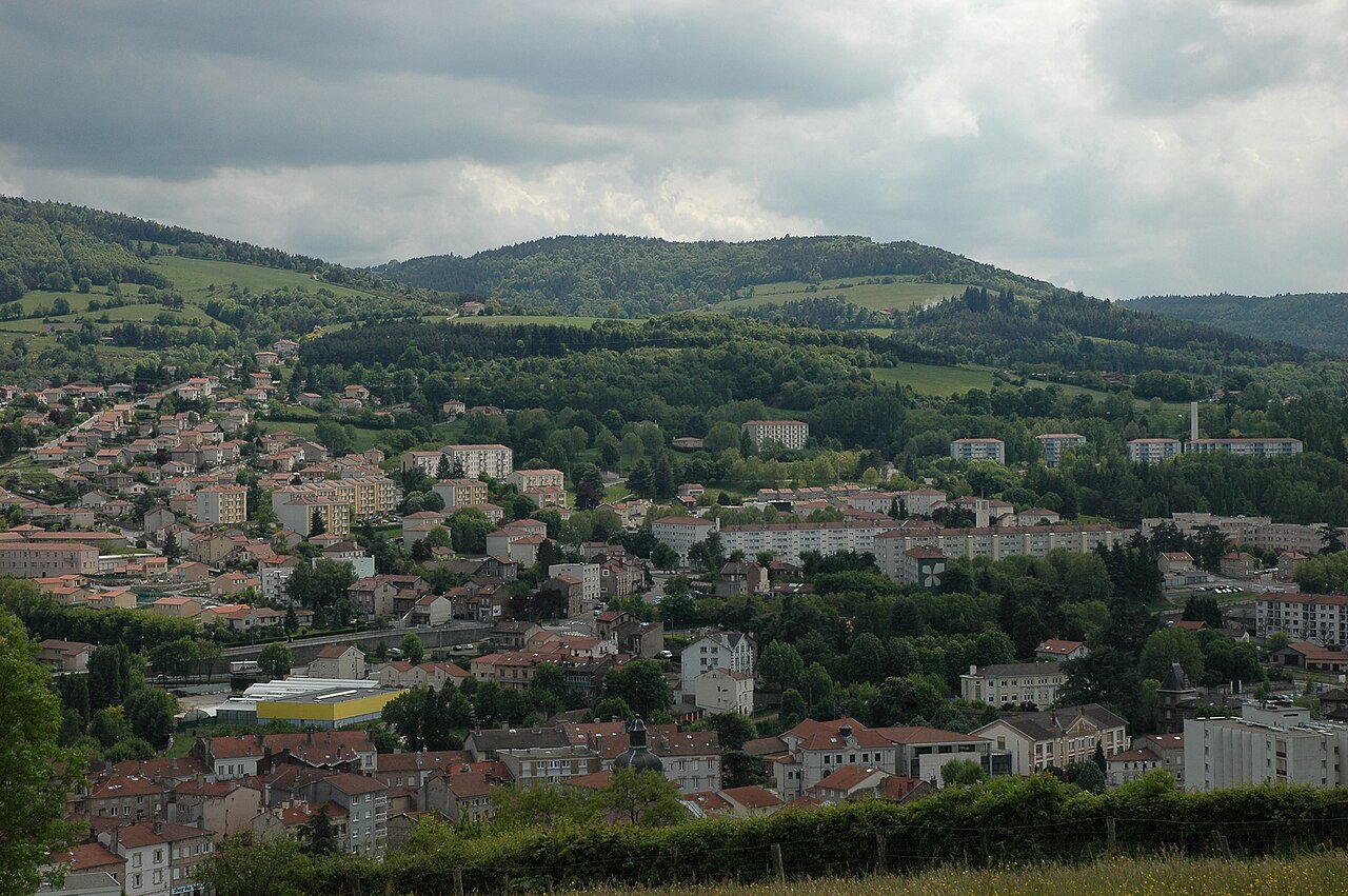
 Photo: Fabienamnet · CC BY-SA 3.0
Le Chambon-Feugerolles is among the frostiest of mainland French towns
The warmest part of a July day comes in at 28.0°C on average. Warm afternoons come more often than in 78% of mainland French towns. The year swings widely: the coldest month’s nights and the warmest month’s afternoons are 30°C apart. An umbrella earns its place on about 101 days a year with 1 mm of rain or more.
Figures from Météo-France’s Bas-en-Basset station, 18 km south-west.
A year in Le Chambon-Feugerolles at a glance
Each month’s typical high and low in °C, at the Bas-en-Basset station.
What a year in Le Chambon-Feugerolles feels like
Typical highs and lows by season and by month, from Météo-France’s 1991–2020 normals at Bas-en-Basset.
About 754 mm of rain a year
May is the wettest month and February the driest. About 22 days a year bring 10 mm or more. 19th wettest of 53 towns of 2,500+ in Loire.
Rain by month
Millimeters
Sunshine by month
Hours of sunshine at Saint-Étienne-Bouthéon
A frosty town: 95 frosts and 88 days of 25°C a year
On about 95 nights a year the air drops to 0°C or below, and on about 5 days it stays below freezing all day. About 88 days a year reach 25°C, and 35 reach 30°C.
Day counts are Météo-France’s 1991–2020 normals at Bas-en-Basset: a frost is a night of 0°C or below, a summer day (jour d’été) 25°C or more, a hot day (forte chaleur) 30°C or more.
The Météo-France station at Bas-en-Basset
Bas-en-Basset is 18 km south-west of Le Chambon-Feugerolles. Every figure on this page is the station’s, not a measurement in Le Chambon-Feugerolles itself.
| Station (Météo-France number) | Bas-en-Basset (43020002) |
| Distance from the town | 18 km south-west |
| Station altitude | 446 m |
| Town altitude (its center) | 505 m |
| Period | 1991–2020 |
| Nearest station of any kind | 5.5 km |
| Sunshine measured at | Saint-Étienne-Bouthéon, 17 km away |
TownRatings matches each commune to one station with at least 24 years of temperature and rain records: the nearest, counting every 100 m of height difference as 10 km, never across the sea.
How Le Chambon-Feugerolles compares
Against the 4,385 towns of 2,500 or more in mainland France, each read from its own matched station. The dots are the other towns of 2,500+ in Loire.
Nearby towns’ climate
The nearest towns of 2,500+ within 29 km. Where a neighbor uses the same station its figures are the same: the differences you’d feel over a few kilometers aren’t in the normals.
| Town | Station | July high | January low | Rain a year |
|---|---|---|---|---|
| Le Chambon-Feugerolles | Bas-en-Basset | 28.0°C | −1.7°C | 754 mm |
| La Ricamarie 3.1 km | Saint-Didier-River | 25.5°C 2.5°C cooler | 0.5°C 2.2°C milder | 856 mm |
| Firminy 3.2 km | same station | 28.0°C about the same | −1.7°C about the same | 754 mm |
| Roche-la-Molière 4 km | Saint-Étienne-Bouthéon | 26.9°C 1.1°C cooler | 0.3°C 2°C milder | 728 mm |
| Unieux 4.5 km | same station | 28.0°C about the same | −1.7°C about the same | 754 mm |
| Fraisses 5 km | same station | 28.0°C about the same | −1.7°C about the same | 754 mm |
| Saint-Just-Malmont 5.8 km | Monistrol-sur-Loire | 24.5°C 3.5°C cooler | −0.8°C 0.9°C milder | 822 mm |
Le Chambon-Feugerolles weather by month
Average daily high and low, mean temperature and rain, 1991–2020, at the Bas-en-Basset station; sunshine at Saint-Étienne-Bouthéon.
| Month | High | Low | Mean | Rain | Sun (hours) |
|---|---|---|---|---|---|
| January | 7.7°C | −1.7°C | 3.0°C | 43 mm | 81 |
| February | 9.8°C | −1.8°C | 4.0°C | 32 mm | 109 |
| March | 14.1°C | 0.3°C | 7.2°C | 37 mm | 162 |
| April | 17.1°C | 2.7°C | 9.9°C | 60 mm | 186 |
| May | 21.3°C | 6.8°C | 14.0°C | 83 mm | 214 |
| June | 25.6°C | 10.3°C | 18.0°C | 77 mm | 241 |
| July | 28.0°C | 11.6°C | 19.8°C | 76 mm | 275 |
| August | 28.2°C | 11.4°C | 19.8°C | 71 mm | 259 |
| September | 23.1°C | 8.3°C | 15.7°C | 75 mm | 193 |
| October | 18.1°C | 6.1°C | 12.1°C | 80 mm | 135 |
| November | 11.7°C | 2.1°C | 6.9°C | 76 mm | 88 |
| December | 8.2°C | −0.6°C | 3.8°C | 44 mm | 76 |
| Year | 17.7°C | 4.6°C | 11.2°C | 754 mm | 2,018 |
Where Le Chambon-Feugerolles’s numbers come from
Averages over 30 years, not a forecast.
- Temperature, rain and day counts: Météo-France’s fiche climatologique for Bas-en-Basset, 18 km away: statistics for 1991–2020.
- Which station: among stations with at least 24 of the 30 years of temperature and rain, the nearest to the commune’s population-weighted center, counting each 100 m of height difference as 10 km; mainland towns use mainland stations and each overseas département its own.
- Altitudes: the town’s from IGN’s RGE ALTI® at its population-weighted center; the station’s from Météo-France.
- Sunshine: the nearest station with at least 10 years of sunshine records, Saint-Étienne-Bouthéon, 17 km away.
- Comparisons: every town of 2,500 or more in mainland France, read the same way; the dots are the towns of 2,500+ in Loire.
Météo-France fiches climatologiques · IGN RGE ALTI®. Licence Ouverte 2.0.
Questions about Le Chambon-Feugerolles’s climate
How warm does Le Chambon-Feugerolles get in summer?
August is the warmest month, with average highs of 28.2°C. About 88 days a year reach 25°C, more than 78% of mainland French towns, and about 35 reach 30°C.
How cold does Le Chambon-Feugerolles get in winter?
February nights average −1.8°C. The air drops to 0°C or below on about 95 nights a year, and about 5 days a year stay below freezing all day.
How much rain does Le Chambon-Feugerolles get?
About 754 mm a year, less than 50% of mainland French towns. May is the wettest month (83 mm) and February the driest (32 mm).
How sunny is it?
The nearest Météo-France station that records sunshine, Saint-Étienne-Bouthéon (17 km away), averages 2,018 hours of sunshine a year.
Are these figures for Le Chambon-Feugerolles itself?
No: they are the normals of the Météo-France station matched to Le Chambon-Feugerolles, Bas-en-Basset, 18 km away. France publishes its climate normals by station, not by commune; a valley, a hill or the sea can make a difference over a few kilometers.
Where do these figures come from?
Météo-France’s fiches climatologiques: 30-year averages (1991–2020) for each of its long-running stations, published as open data since 2024. They are normals, not a forecast.
Source: Météo-France, fiches climatologiques, 1991–2020 statistics (station BAS-EN-BASSET, edited 15/10/2026); altitude: IGN, RGE ALTI®. Licence Ouverte 2.0. Today’s forecast for Le Chambon-Feugerolles →
Contains public sector information under the Licence Ouverte / Open Licence 2.0 (Etalab): INSEE, DGFiP, the Interior Ministry’s statistics service (SSMSI), the Ministry of Education (DEPP), the Health Ministry’s statistics service (DREES) and the Housing Ministry (Carte des loyers). Commune boundaries: IGN Admin Express.