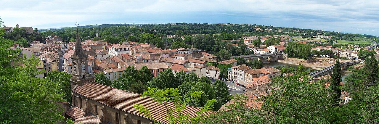
 Photo: Eiku · CC BY-SA 3.0
2 industrial risk plans reach into Béziers
Most residents live on ground that swells and shrinks with the seasons (medium or high exposure); houses there need deeper foundations. Hazard risk is not graded in France: there is no national flood map, so a town outside the mapped areas can’t be called safe from floods.
What stands out about hazards in Béziers
From the state’s records on Géorisques. Nothing here is graded.
6 hazards in Béziers at a glance
Bars show where the town sits among French towns of 2,500+; they are not a grade. Disaster declarations are shown, not compared.
Flood zones
Disasters declared
Clay ground
Earthquakes
Radon
Industrial sites
Why hazards aren’t graded in France
In the UK, the Hazard risk grade is the share of homes in a mapped flood zone; in the U.S., it is FEMA’s modelled yearly damage to buildings. Both rest on maps that cover the whole country. France maps flood zones in detail only in its 125 areas at highest risk (TRI), so most towns have no figure, and a blank would read as “dry”. The state’s disaster declarations don’t fill the gap: they depend on the mayor applying, and they don’t line up with the mapped zones. So Béziers has no Hazard grade, and its overall grade uses the other six subjects.
Everything on this page is shown as published. We’ll grade it when France publishes a national flood map.
Flood zones in Béziers on the map
The state’s own layers from Géorisques, drawn over the street map. Tap a layer to switch it on or off.
Flood zones are drawn only inside the state’s mapped areas (TRI, pink outline). Outside them, the map is blank because nobody has drawn it, not because the ground is dry.
2.9% of Béziers’ residents live in a mapped flood zone
Residents in the state’s medium-probability flood zones, by where the water comes from. Mapped areas only.
Share of residents in a medium-probability flood zone. Béziers has more than 55% of mapped towns. The other 2,833 towns of 2,500+ have no detailed map.
| # | Town | People | In a flood zone | |
|---|---|---|---|---|
| 1 | Paris 10e Paris | 83,873 | 0% | |
| 2 | Mérignac Gironde | 78,090 | 0% | |
| 3 | Lyon 8e Rhône | 85,943 | 0% | |
| … | ||||
| 18 | Marseille 15e Bouches-du-Rhône | 79,161 | 2.7% | |
| 19 | Poitiers Vienne | 89,916 | 2.8% | |
| 20 | Béziers Hérault | 81,545 | 2.9% | |
| 21 | Ajaccio Corse-du-Sud | 76,320 | 3.4% | |
| 22 | Saint-Nazaire Loire-Atlantique | 74,568 | 3.7% | |
| … | ||||
| 40 | Colombes Hauts-de-Seine | 91,053 | 34% | |
| 41 | Avignon Vaucluse | 92,188 | 41% | |
Mapped area: Béziers – Agde (flood directive maps, 2nd cycle, 2020). Medium probability is roughly the 1-in-100-year flood. Residents placed by INSEE’s 200 m income grid (2021).
26 natural disasters declared in Béziers since 1982, 19 for floods
The state’s register of natural-disaster orders, 1982 to January 2026.
- 2023Drought: clay subsidenceJanuary 1, 2023 – December 31, 2023 · order published July 2, 2024
- 2021Drought: clay subsidenceJuly 1, 2021 – December 31, 2021 · order published October 29, 2022
- 2019Floods and mudflowsOctober 22–23, 2019 · order published October 31, 2019
- 2019Drought: clay subsidenceJuly 1, 2019 – September 30, 2019 · order published June 12, 2020
- 2018Floods and mudflowsOctober 15, 2018 · order published April 7, 2019
- 2018Drought: clay subsidenceJanuary 1, 2018 – March 31, 2018 · order published October 26, 2019
Show all 25 events
- 2016Floods and mudflowsOctober 12–14, 2016 · order published January 27, 2017
- 2016Drought: clay subsidenceApril 1, 2016 – December 31, 2016 · order published February 16, 2018
- 2014Floods and mudflowsNovember 27–30, 2014 · order published December 11, 2014
- 2014Floods and mudflowsSeptember 29–30, 2014 · order published November 7, 2014
- 2012Ground movementApril 25, 2012 – November 15, 2012 · order published August 2, 2013
- 2002Floods and mudflowsOctober 30–31, 2002 · order published August 2, 2003
- 1997Floods and mudflowsDecember 16–19, 1997 · order published February 18, 1998
- 1996Floods and mudflowsNovember 4–8, 1996 · order published May 25, 1997
- 1996Floods and mudflowsJanuary 28–30, 1996 · order published February 3, 1996
- 1995Floods and mudflowsDecember 15–18, 1995 · order published February 3, 1996
- 1994Floods and mudflowsNovember 4–6, 1994 · order published November 25, 1994
- 1994Floods and mudflowsOctober 17–28, 1994 · order published November 25, 1994
- 1993Floods and mudflowsOctober 28, 1993 – November 3, 1993 · order published March 24, 1994
- 1992Floods and mudflowsSeptember 26–30, 1992 · order published February 27, 1993
- 1987Floods and mudflowsDecember 2–5, 1987 · order published February 23, 1988
- 1987Floods and mudflowsOctober 9–10, 1987 · order published February 20, 1988
- 1987Floods and mudflowsOctober 2–5, 1987 · order published February 20, 1988
- 1986Floods and mudflowsOctober 13–17, 1986 · order published February 14, 1987
- 1982Floods and mudflows · StormNovember 6–10, 1982 · order published November 19, 1982
Declarations by hazard · 1982–2025
Each line is a state order recognizing a natural disaster in the commune (“CatNat”), which lets insured owners claim. The latest flood began October 22, 2019; 10 flood declarations since 1995.
This count partly reflects how often a mayor applies for a declaration, so it isn’t compared between towns. It is a record of recognized claims, not a flood map. Source: GASPAR, Géorisques, file of 5 October 2026 (orders published to January 2026).
The state lists 9 hazards for Béziers
Risk plans in force or in preparation, and the prefecture’s list of major risks.
| Hazard | Risk plan (PPR) | Listed by the prefecture |
|---|---|---|
| River flooding and runoff | Approved 2010 | ✓ |
| Landslides and rockfalls | Approved 2010 | ✓ |
| Clay shrink-swell | Approved 2010 | ✓ |
| Earthquake | — | ✓ |
| Forest fire | — | ✓ |
| Radon | — | ✓ |
| Industrial site | Approved 2015 | ✓ |
| Dam failure | — | ✓ |
| Dangerous goods in transit | — | ✓ |
A risk plan (plan de prévention des risques, PPR) is the state’s map of where building is banned or restricted because of a hazard; it is attached to the town’s planning rules, and a seller or landlord must tell you if the home is in one. The prefecture’s file of major risks (DDRM) lists the hazards it expects in each commune.
Plans: PPRN- Multi - Orb · PPRT - Minguez · PPRT - SBM et Gazechim
Earthquake zone 2 (low); 100% of residents on shrink-swell clay
What the ground under Béziers does: national maps, the same for every town.
Residents on shrink-swell clay · share of residents
Clay ground swells when wet and shrinks in drought, which cracks walls of houses on shallow foundations. Since 2020, a soil study is required before selling a building plot in a medium or high zone. 5 drought (clay) declarations here since 1982.
Béziers is in zone 2 (low). New buildings must follow the earthquake building code (Eurocode 8) for their type. The zone sets building rules; it isn’t a forecast.
Clay: BRGM shrink-swell exposure map 2025, residents placed by INSEE’s 200 m grid. Earthquakes: national seismic zoning, decree of 22 October 2010.
Radon potential in Béziers: category 1 of 3 (low)
Radon is a natural radioactive gas from granite and volcanic rock; it builds up indoors.
Béziers is in category 1, the lowest: the rocks here release little radon.
The category describes the rocks under the commune, not any home: a test is the only way to know.
Source: radon potential by commune, IRSN (now ASNR), 2019.
Béziers is inside 2 industrial risk plans
Hazardous sites whose danger zone reaches the town, and the technological risks the prefecture lists.
| SBM et Gazechim | approved 2015 · blast |
| Minguez | approved 2013 · fire and heat |
A PPRT is drawn around every upper-tier Seveso site. It covers each commune its danger zone reaches and limits building there; it measures the danger of an accident, not pollution.
| Industrial site | a hazardous site in or near the town |
| Dam failure | downstream of a large dam |
| Dangerous goods in transit | road, rail, pipeline or waterway through the town |
Seveso sites store or use large amounts of dangerous substances; upper-tier sites have a risk plan around them. Distances are from the town’s center.
Sources: GASPAR (PPRT, DDRM), Géorisques, 5 October 2026; Seveso sites from Géorisques’ register of classified installations.
Hazards in Béziers’ neighbors
Towns of 2,500+ within 30 km. Tap one to open its hazards page.
| Town | Flood zone* | Seismic zone | Radon |
|---|---|---|---|
| Béziers | 2.9% | 2 | 1 |
| Boujan-sur-Libron 3,619 · 3 km | 4.1% | 2 | 1 |
| Villeneuve-lès-Béziers 4,500 · 5 km | 66% | 2 | 1 |
| Lignan-sur-Orb 3,227 · 6 km | 9.9% | 2 | 1 |
| Maraussan 4,789 · 6 km | 0.2% | 2 | 1 |
| Sauvian 5,608 · 7 km | 11% | 2 | 1 |
| Cers 2,503 · 7 km | 3.5% | 2 | 1 |
* Share of residents in a mapped medium-probability flood zone; a dash means no detailed map, not no risk. Radon: category 1 to 3.
Being ready in Béziers
Where France publishes warnings, and what to ask before you buy or rent.
- Météo-France’s vigilance map gives the day’s warnings by département, from yellow to red.
- Vigicrues shows river levels and flood warnings for the main rivers, updated twice a day.
- FR-Alert sends emergency alerts to every phone in the area; no sign-up needed.
- The seller or landlord must give you a risk statement (état des risques) for the address, listing the plans it is in.
- They must also tell you about any natural-disaster claim paid on the home.
- Géorisques gives the same statement for any address, free.
- Don’t drive or walk through floodwater.
- Go upstairs, not to the cellar or car park.
- Call 112 if you’re in danger.
- Ask for the risk statement and read which plans the address is in.
- Ask the town hall for its risk booklet (DICRIM) and safety plan (PCS).
- For a house, look for cracks and ask about the foundations: much of the town is on shrink-swell clay.
- Check that home insurance includes natural-disaster cover (it comes with fire cover).
What this data can and can’t tell you
- Not graded. France has no national flood map, so we don’t grade hazard risk. Comparisons on this page are with other French towns of 2,500+, shown for context.
- Mapped areas only. Flood shares exist only where the state has mapped flooding in detail (the TRI areas). A town without a figure has no map, not no risk.
- Disaster declarations. A CatNat order recognizes a disaster so that insurers pay; it follows the commune’s application. The count partly reflects how often a mayor applies, so we show it but don’t compare towns on it.
- Plans. A risk plan maps where building is limited; it doesn’t say any one home will flood.
- Clay, earthquakes, radon. National maps of the ground: they describe susceptibility and set building rules, not damage or forecasts.
Questions about hazards in Béziers
Does Béziers flood?
The state has declared 19 flood disasters in Béziers since 1982, the last starting October 22, 2019. On the state’s detailed map, 2.9% of residents live in a medium-probability flood zone. A flood risk plan is in force.
Is Béziers at risk of earthquakes?
Béziers is in seismic zone 2 of 5 (low). The zone sets building rules for new construction; it isn’t a forecast.
Is there radon in Béziers?
Radon potential is category 1 of 3 (low). It describes the ground under the commune; only a test tells you a home’s level.
Are there dangerous industrial sites near Béziers?
Béziers is inside 2 industrial risk plans (Minguez; SBM et Gazechim), drawn around hazardous sites whose danger zone reaches the town.
Why doesn’t Béziers have a Hazard grade?
France maps flood zones in detail only in its areas at highest risk, so most towns would have no figure, and a blank would look like no risk. We show the data instead, and will grade it if France publishes a national flood map.
Sources: Géorisques (Ministry of Ecological Transition), GASPAR file of 5 October 2026: CatNat orders, risk plans (PPRN, PPRT, PPRM), flood atlases, DDRM, DICRIM · flood directive maps, 2020 (TRI 2nd cycle) and 2024 outlines · BRGM clay shrink-swell map 2025 · seismic zoning, decree of 22 October 2010 · ASNR (formerly IRSN) radon potential 2019 · INSEE 200 m income grid 2021 (where residents live) · map: Géorisques layers over © OpenStreetMap contributors · Seveso sites: Géorisques register of classified installations. Licence Ouverte / Open Licence (Etalab). Not graded.
Contains public sector information under the Licence Ouverte / Open Licence 2.0 (Etalab): INSEE, DGFiP, the Interior Ministry’s statistics service (SSMSI), the Ministry of Education (DEPP), the Health Ministry’s statistics service (DREES) and the Housing Ministry (Carte des loyers). Commune boundaries: IGN Admin Express.