
Vestiges archéologiques is Aigues-Vives’ place to visit
4 of the 7 places to visit in and around Aigues-Vives are châteaux or heritage sites. We list one place to visit in Aigues-Vives and 6 within 5 km of its centre. In town, one site is a listed historic monument. Maison carrée is worth a day, 18 km from the centre.
Highlights of Aigues-Vives
2 museums, 2 châteaux and an archaeological site follow Vestiges archéologiques.
 Archaeological siteVestiges archéologiquesin town
 Archaeological sitePont Ambroix3 km southwest, in Gallargues-le-MontueuxMuseumMuseumAmbrussum3.1 km southwest, in Villetelle
 ChâteauChâteau d'Aubais3.1 km northwest, in AubaisChâteauChâteauChâteau de Thomas Burnet1.8 km south, in Gallargues-le-MontueuxMuseumMuseumAncienne Maison Consulaire1.8 km south, in Gallargues-le-Montueux
Best known first: by how many Wikipedia and sister-site articles cover each place (Wikidata’s count). It isn’t a ranking of how good they are.
Plotted on the map
Leave town to the south for most of the 6 nearby.
The first 20 on the list, numbered as below. The shape is the commune of Aigues-Vives; the orange dot is its centre. © OpenStreetMap contributors · commune boundary: IGN
The mix
Most are châteaux or heritage sites, 4 in all, ahead of museums or galleries (2).
Dark: in Aigues-Vives. Light: in the communes within 5 km of its centre.
The places, one by one
It starts in town with one place and goes on to 6 within 5 km of its centre.
Pont Ambroix
Bridge guaranteeing the crossing of the Vidourle by the Via Domitia, Roman road that ran from Italy to Spain.
Château de Thomas Burnet
18th century bastide and gardens of Thomas Burnet's estate in Gallargues-le-Montueux.
The one place in Aigues-Vives, then those within 5 km of its centre.
The history of Aigues-Vives → · Parks and trails in Aigues-Vives →
For a day out
Start with Maison carrée, 18 km off, the best known of 12.
 MuseumMaison carrée18 km northeast, in NîmesAttractionAttractionPont du Gard37 km northeast, in Vers-Pont-du-Gard
 AttractionArènes de Nîmes18 km northeast, in Nîmes
 AttractionTerrasse du café le soir37 km east, in ArlesAttractionAttractionLa Nuit étoilée37 km east, in Arles
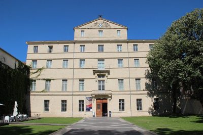 Art galleryMusée Fabre28 km southwest, in MontpellierCathedralCathedralCathédrale Saint-Pierre de Montpellier28 km southwest, in Montpellier
 Archaeological siteArènes d'Arles37 km east, in ArlesAttractionAttractionAncienne cathédrale Saint-Trophime à Arles37 km east, in ArlesCathedralCathedralCathédrale Notre-Dame-et-Saint-Castor de Nîmes18 km northeast, in NîmesFortFortArc de triomphe de Montpellier28 km southwest, in Montpellier
 AttractionCC 710020 km northeast, in Nîmes
Places within 40 km of Aigues-Vives with an article in both French and English Wikipedia, nearest first.
Aigues-Vives, answered
What is there to see in Aigues-Vives?
The one place mapped in Aigues-Vives is Vestiges archéologiques. We list 1 place in town. Another 6 are within 5 km of the centre.
Are there museums in or near Aigues-Vives?
2 museums and galleries in town or within 5 km, including Ambrussum and Ancienne Maison Consulaire.
Which places in Aigues-Vives are listed historic monuments?
One place on this page in Aigues-Vives is a listed or registered historic monument (Mérimée): Vestiges archéologiques.
What well-known places are within a day out of Aigues-Vives?
The nearest with articles in both French and English Wikipedia: Maison carrée (18 km), Pont du Gard (37 km), Arènes de Nîmes (18 km), Terrasse du café le soir (37 km).
How is this list made?
From OpenStreetMap and Wikidata: named museums, galleries, châteaux, abbeys, gardens, zoos, theme parks and other visitor attractions whose mapped point lies inside the commune of Aigues-Vives, then those in the communes within 5 km of its centre, and well-known places within 40 km. Houses, ruins and gardens need a sign they’re open to visitors; places marked private, closed or disused are left out. The historic-monument link is the Culture ministry’s Mérimée record. A place that isn’t mapped isn’t listed, so this isn’t everything there is to see.
Sources: OpenStreetMap (© OpenStreetMap contributors, ODbL), Wikidata (CC0: descriptions, websites, Wikipedia articles), the Culture ministry’s Mérimée database (Licence Ouverte 2.0), IGN commune boundaries. Distances are from the commune’s centre point.
Photos from Wikimedia Commons, each under its own licence (our copy, resized).
Photo credits (9)
- Vestiges archéologiques: John030Walsh, CC BY-SA 4.0, Wikimedia Commons
- Pont Ambroix: Xabi Rome-Hérault, CC BY 3.0, Wikimedia Commons
- Château d'Aubais: Daniel VILLAFRUELA ., CC BY-SA 4.0, Wikimedia Commons
- Maison carrée: Krzysztof Golik, CC BY-SA 4.0, Wikimedia Commons
- Arènes de Nîmes: Daniel VILLAFRUELA ., CC BY-SA 3.0, Wikimedia Commons
- Terrasse du café le soir: Vincent van Gogh, Public domain, Wikimedia Commons
- Musée Fabre: Björn S., CC BY-SA 3.0, Wikimedia Commons
- Arènes d'Arles: PierreSelim, CC BY 3.0, Wikimedia Commons
- CC 7100: bukk, CC BY-SA 3.0, Wikimedia Commons
Contains public sector information under the Licence Ouverte / Open Licence 2.0 (Etalab): INSEE, DGFiP, the Interior Ministry’s statistics service (SSMSI), the Ministry of Education (DEPP), the Health Ministry’s statistics service (DREES) and the Housing Ministry (Carte des loyers). Commune boundaries: IGN Admin Express.