
From Sainte-Valière, 4.4 km to Oppidum de Cayla
This is a list led by châteaux or heritage sites, 5 of its 8. None of them is inside Sainte-Valière itself. Côte magnétique is worth a day, 16 km from the centre.
Where to start near Sainte-Valière
Following Oppidum de Cayla are 3 châteaux and 2 attractions.
Best known first: by how many Wikipedia and sister-site articles cover each place (Wikidata’s count). It isn’t a ranking of how good they are.
Where things are
The outermost point is Borie, at 5 km.
The first 20 on the list, numbered as below. The shape is the commune of Sainte-Valière; the orange dot is its centre. © OpenStreetMap contributors · commune boundary: IGN
Kinds of place
Ahead are châteaux or heritage sites (5); next, other sights (3).
Dark: in Sainte-Valière. Light: in the communes within 5 km of its centre.
The whole list for Sainte-Valière
Everything here is within 5 km of its centre, 8 places in all.
Nothing is mapped in Sainte-Valière itself; these are within 5 km of its centre.
The history of Sainte-Valière → · Parks and trails in Sainte-Valière →
Further out, the best known
The pick of the 12 is Côte magnétique, 16 km off.
 AttractionVoie Domitienne16 km southeast, in NarbonneCathedralCathedralCathédrale Saint-Just-et-Saint-Pasteur de Narbonne16 km southeast, in Narbonne
 AttractionCité de Carcassonne40 km west, in Carcassonne
 AttractionAbbaye Sainte-Marie de Fontfroide17 km south, in Narbonne
 AttractionPalais des archevêques de Narbonne16 km southeast, in NarbonneAttractionAttractionCathédrale Saint-Nazaire-et-Saint-Celse de Béziers31 km east, in Béziers
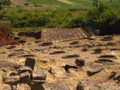 AttractionOppidum d'Ensérune22 km east, in Nissan-lez-EnseruneAttractionAttractionPont des Marchands16 km southeast, in Narbonne
 ZooRéserve africaine de Sigean25 km south, in SigeanAttractionAttractionPic de Nore35 km northwest, in Pradelles-Cabardès
 ChurchBasilique Saint-Nazaire-et-Saint-Celse de Carcassonne40 km west, in Carcassonne
Places within 40 km of Sainte-Valière with an article in both French and English Wikipedia, nearest first.
Seeing Sainte-Valière: your questions
Are there attractions near Sainte-Valière?
Nothing is mapped in Sainte-Valière itself, but within 5 km there are Oppidum de Cayla, Château de Paraza, Bibliothèque Le Trouve Tout du Livre and Borie.
Are there museums in or near Sainte-Valière?
No museum or gallery is mapped in Sainte-Valière or within 5 km.
What well-known places are within a day out of Sainte-Valière?
The nearest with articles in both French and English Wikipedia: Côte magnétique (16 km), Voie Domitienne (16 km), Cathédrale Saint-Just-et-Saint-Pasteur de Narbonne (16 km), Cité de Carcassonne (40 km).
How is this list made?
From OpenStreetMap and Wikidata: named museums, galleries, châteaux, abbeys, gardens, zoos, theme parks and other visitor attractions whose mapped point lies inside the commune of Sainte-Valière, then those in the communes within 5 km of its centre, and well-known places within 40 km. Houses, ruins and gardens need a sign they’re open to visitors; places marked private, closed or disused are left out. The historic-monument link is the Culture ministry’s Mérimée record. A place that isn’t mapped isn’t listed, so this isn’t everything there is to see.
Sources: OpenStreetMap (© OpenStreetMap contributors, ODbL), Wikidata (CC0: descriptions, websites, Wikipedia articles), the Culture ministry’s Mérimée database (Licence Ouverte 2.0), IGN commune boundaries. Distances are from the commune’s centre point.
Photos from Wikimedia Commons, each under its own licence (our copy, resized).
Photo credits (7)
- Voie Domitienne: Benoît Strepenne, CC BY 2.5, Wikimedia Commons
- Cité de Carcassonne: Jondu11, CC BY-SA 4.0, Wikimedia Commons
- Abbaye Sainte-Marie de Fontfroide: Pinpin 20:15, 10 July 2006 (UTC), CC BY-SA 3.0, Wikimedia Commons
- Palais des archevêques de Narbonne: Didier Descouens, CC BY-SA 4.0, Wikimedia Commons
- Oppidum d'Ensérune: classe unique St-Sulpice-des-Rivoires Isère - FRANCE, CC BY-SA 3.0, Wikimedia Commons
- Réserve africaine de Sigean: Gordito1869, CC BY 3.0, Wikimedia Commons
- Basilique Saint-Nazaire-et-Saint-Celse de Carcassonne: Diego Delso, CC BY-SA 4.0, Wikimedia Commons
Contains public sector information under the Licence Ouverte / Open Licence 2.0 (Etalab): INSEE, DGFiP, the Interior Ministry’s statistics service (SSMSI), the Ministry of Education (DEPP), the Health Ministry’s statistics service (DREES) and the Housing Ministry (Carte des loyers). Commune boundaries: IGN Admin Express.