
The nearest draw to Mirepeisset: Amphoralis, 3.2 km away
5 of the 8 places to visit in and around Mirepeisset are châteaux or heritage sites. All of them lie outside Mirepeisset. Allow a day for Voie Domitienne, 14 km off.
Just outside Mirepeisset, the best known
After Amphoralis, look out for 4 châteaux and an attraction.
 MuseumAmphoralis3.2 km east, in Sallèles-d'AudeChâteauChâteauChâteau de Sallèles4.9 km southeast, in Sallèles-d'AudeChâteauChâteauChâteau d'Argeliers3.5 km north, in ArgeliersAttractionAttractionBibliothèque Le Trouve Tout du Livre1.9 km south, in Saint-Nazaire-d'AudeChâteauChâteauChâteau de Cabezac3 km northwest, in Bize-MinervoisChâteauChâteauChâteau de la Sellette2.8 km northwest, in Bize-Minervois
Best known first: by how many Wikipedia and sister-site articles cover each place (Wikidata’s count). It isn’t a ranking of how good they are.
Map of the places
The list reaches out to Château de Sallèles, 4.9 km away.
The first 20 on the list, numbered as below. The shape is the commune of Mirepeisset; the orange dot is its centre. © OpenStreetMap contributors · commune boundary: IGN
The list by type
Ahead are châteaux or heritage sites (5); next, other sights (2).
Dark: in Mirepeisset. Light: in the communes within 5 km of its centre.
All 8 on the list
Everything here is within 5 km of its centre, 8 places in all.
Nothing is mapped in Mirepeisset itself; these are within 5 km of its centre.
The history of Mirepeisset → · Parks and trails in Mirepeisset →
Beyond Mirepeisset
The pick of the 12 is Voie Domitienne, 14 km off.
 AttractionVoie Domitienne14 km southeast, in NarbonneAttractionAttractionCôte magnétique20 km west, in SiranCathedralCathedralCathédrale Saint-Just-et-Saint-Pasteur de Narbonne14 km southeast, in Narbonne
 AttractionAbbaye Sainte-Marie de Fontfroide17 km south, in Narbonne
 AttractionPalais des archevêques de Narbonne14 km southeast, in Narbonne
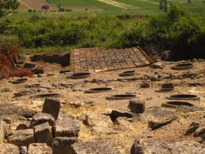 AttractionOppidum d'Ensérune17 km east, in Nissan-lez-EnseruneAttractionAttractionCathédrale Saint-Nazaire-et-Saint-Celse de Béziers26 km east, in BéziersAttractionAttractionPont des Marchands14 km southeast, in Narbonne
 ZooRéserve africaine de Sigean25 km south, in SigeanAttractionAttractionPic de Nore39 km northwest, in Pradelles-CabardèsAttractionAttractionAbbaye de Sainte-Marie de Lagrasse31 km southwest, in Lagrasse
 Art galleryMusée d'art et d'histoire de Narbonne14 km southeast, in Narbonne
Places within 40 km of Mirepeisset with an article in both French and English Wikipedia, nearest first.
Before a day out in Mirepeisset
Are there attractions near Mirepeisset?
Nothing is mapped in Mirepeisset itself, but within 5 km there are Amphoralis, Château de Sallèles, Château d'Argeliers and Bibliothèque Le Trouve Tout du Livre.
Are there museums in or near Mirepeisset?
One, in town or within 5 km: Amphoralis.
What well-known places are within a day out of Mirepeisset?
The nearest with articles in both French and English Wikipedia: Voie Domitienne (14 km), Côte magnétique (20 km), Cathédrale Saint-Just-et-Saint-Pasteur de Narbonne (14 km), Abbaye Sainte-Marie de Fontfroide (17 km).
How is this list made?
From OpenStreetMap and Wikidata: named museums, galleries, châteaux, abbeys, gardens, zoos, theme parks and other visitor attractions whose mapped point lies inside the commune of Mirepeisset, then those in the communes within 5 km of its centre, and well-known places within 40 km. Houses, ruins and gardens need a sign they’re open to visitors; places marked private, closed or disused are left out. The historic-monument link is the Culture ministry’s Mérimée record. A place that isn’t mapped isn’t listed, so this isn’t everything there is to see.
Sources: OpenStreetMap (© OpenStreetMap contributors, ODbL), Wikidata (CC0: descriptions, websites, Wikipedia articles), the Culture ministry’s Mérimée database (Licence Ouverte 2.0), IGN commune boundaries. Distances are from the commune’s centre point.
Photos from Wikimedia Commons, each under its own licence (our copy, resized).
Photo credits (7)
- Amphoralis: Christelle Molinié, CC BY-SA 4.0, Wikimedia Commons
- Voie Domitienne: Benoît Strepenne, CC BY 2.5, Wikimedia Commons
- Abbaye Sainte-Marie de Fontfroide: Pinpin 20:15, 10 July 2006 (UTC), CC BY-SA 3.0, Wikimedia Commons
- Palais des archevêques de Narbonne: Didier Descouens, CC BY-SA 4.0, Wikimedia Commons
- Oppidum d'Ensérune: classe unique St-Sulpice-des-Rivoires Isère - FRANCE, CC BY-SA 3.0, Wikimedia Commons
- Réserve africaine de Sigean: Gordito1869, CC BY 3.0, Wikimedia Commons
- Musée d'art et d'histoire de Narbonne: Didier Descouens, CC BY-SA 4.0, Wikimedia Commons
Contains public sector information under the Licence Ouverte / Open Licence 2.0 (Etalab): INSEE, DGFiP, the Interior Ministry’s statistics service (SSMSI), the Ministry of Education (DEPP), the Health Ministry’s statistics service (DREES) and the Housing Ministry (Carte des loyers). Commune boundaries: IGN Admin Express.