Château de Villemartin is Gaja-et-Villedieu’s place to visit
Around Gaja-et-Villedieu, the places to visit include 4 museums, 2 châteaux and 2 attractions. We list one place to visit in Gaja-et-Villedieu and 9 within 5 km of its centre. The town’s list includes one listed historic monument. Further afield lies Cité de Carcassonne, at 20 km.
Gaja-et-Villedieu’s big names
After Château de Villemartin come 2 museums, a château and a church.
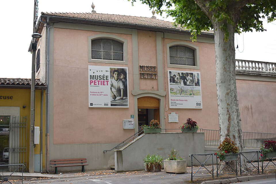
 MuseumMusée Petiet3.5 km southeast, in Limoux
 MuseumMusée du piano de Limoux3.8 km southeast, in LimouxMonastery or conventMonastery or conventCouvent des Cordeliers de Limoux3.9 km southeast, in Limoux
Best known first: by how many Wikipedia and sister-site articles cover each place (Wikidata’s count). It isn’t a ranking of how good they are.
Where to go
The map shows most of the 9 nearby to the southeast.
The first 20 on the list, numbered as below. The shape is the commune of Gaja-et-Villedieu; the orange dot is its centre. © OpenStreetMap contributors · commune boundary: IGN
What they are
Ahead are châteaux or heritage sites (4); next, museums or galleries (4).
Dark: in Gaja-et-Villedieu. Light: in the communes within 5 km of its centre.
Every place to visit in and near Gaja-et-Villedieu
After the one in town come 9 more within 5 km of its centre.
Basilique Notre-Dame de Marceille
Basilica located in Aude, in France.
Couvent des Cordeliers de Limoux
Convent located in Aude, in France.
The one place in Gaja-et-Villedieu, then those within 5 km of its centre.
The history of Gaja-et-Villedieu → · Parks and trails in Gaja-et-Villedieu →
Well-known places further afield
Out of town, Cité de Carcassonne (20 km) leads 12 names to know.
 AttractionCité de Carcassonne20 km northeast, in Carcassonne
 AttractionCathédrale Saint-Michel de Carcassonne20 km northeast, in CarcassonneAttractionAttractionAbbaye d'Alet-les-Bains11 km southeast, in Alet-les-Bains
 ChurchBasilique Saint-Nazaire-et-Saint-Celse de Carcassonne20 km northeast, in CarcassonneAttractionAttractionChâteau de Montségur37 km southwest, in MontségurAttractionAttractionChâteau de Puivert21 km southwest, in PuivertChâteauChâteauChâteau de Puilaurens32 km south, in PuilaurensChâteauChâteauChâteau d'Arques20 km southeast, in ArquesMonastery or conventMonastery or conventMonastère Sainte-Marie de Prouilhe17 km northwest, in FanjeauxAttractionAttractionChâteau de Peyrepertuse38 km southeast, in Rouffiac-des-CorbièresAttractionAttractionChâteau de Termes31 km east, in TermesChâteauChâteauChâteaux de Lastours33 km northeast, in Lastours
Places within 40 km of Gaja-et-Villedieu with an article in both French and English Wikipedia, nearest first.
Your questions on Gaja-et-Villedieu
What is there to see in Gaja-et-Villedieu?
The one place mapped in Gaja-et-Villedieu is Château de Villemartin. We list 1 place in town. Another 9 are within 5 km of the centre.
Are there museums in or near Gaja-et-Villedieu?
4 museums and galleries in town or within 5 km, including Musée Petiet, Musée du piano de Limoux, Musée de l'Imprimerie and Musée des Automates.
Which places in Gaja-et-Villedieu are listed historic monuments?
One place on this page in Gaja-et-Villedieu is a listed or registered historic monument (Mérimée): Château de Villemartin.
What well-known places are within a day out of Gaja-et-Villedieu?
The nearest with articles in both French and English Wikipedia: Cité de Carcassonne (20 km), Cathédrale Saint-Michel de Carcassonne (20 km), Abbaye d'Alet-les-Bains (11 km), Basilique Saint-Nazaire-et-Saint-Celse de Carcassonne (20 km).
How is this list made?
From OpenStreetMap and Wikidata: named museums, galleries, châteaux, abbeys, gardens, zoos, theme parks and other visitor attractions whose mapped point lies inside the commune of Gaja-et-Villedieu, then those in the communes within 5 km of its centre, and well-known places within 40 km. Houses, ruins and gardens need a sign they’re open to visitors; places marked private, closed or disused are left out. The historic-monument link is the Culture ministry’s Mérimée record. A place that isn’t mapped isn’t listed, so this isn’t everything there is to see.
Sources: OpenStreetMap (© OpenStreetMap contributors, ODbL), Wikidata (CC0: descriptions, websites, Wikipedia articles), the Culture ministry’s Mérimée database (Licence Ouverte 2.0), IGN commune boundaries. Distances are from the commune’s centre point.
Photos from Wikimedia Commons, each under its own licence (our copy, resized).
Photo credits (5)
- Musée Petiet: Tylwyth Eldar, CC BY-SA 4.0, Wikimedia Commons
- Musée du piano de Limoux: Tylwyth Eldar, CC BY-SA 4.0, Wikimedia Commons
- Cité de Carcassonne: Jondu11, CC BY-SA 4.0, Wikimedia Commons
- Cathédrale Saint-Michel de Carcassonne: Didier Descouens, CC BY-SA 4.0, Wikimedia Commons
- Basilique Saint-Nazaire-et-Saint-Celse de Carcassonne: Diego Delso, CC BY-SA 4.0, Wikimedia Commons
Contains public sector information under the Licence Ouverte / Open Licence 2.0 (Etalab): INSEE, DGFiP, the Interior Ministry’s statistics service (SSMSI), the Ministry of Education (DEPP), the Health Ministry’s statistics service (DREES) and the Housing Ministry (Carte des loyers). Commune boundaries: IGN Admin Express.