Tour Notre-Dame
This is Tour Notre-Dame, a fort in Saint-Malo. 40 more places to visit are within 5 km. Nearby, Cathédrale Saint-Vincent de Saint-Malo (200 m) leads the list.
Fort in Saint-Malo
In Saint-Malo
Tour Notre-Dame is in the commune of Saint-Malo, with 40 more places to visit within 5 km. Towns near it ↓
Written from OpenStreetMap, Wikidata and Météo-France 1991–2020 normals.
Choosing a month
Expect highs of 17–22°C in Saint-Malo from May to September.
Tour Notre-Dame
Fort.
Tour Notre-Dame is in Saint-Malo, Ille-et-Vilaine.
- Type
- Fort
- Commune
- Saint-Malo, Ille-et-Vilaine
Getting your bearings
The numbers show what else is near Tour Notre-Dame, in the order listed below.
© OpenStreetMap contributors · The dashed line is the commune of Saint-Malo. · commune boundary: IGN
Bases near Tour Notre-Dame
Saint-Malo, with 47,439 people, is the largest of the 8. Each of these towns lists it on its own page of things to do.
- 1Saint-Malo
- 2Dinard
- 3La Richardais
- 4Saint-Lunaire
- 5Saint-Jouan-des-Guérets
- 6Pleurtuit
- 7Saint-Coulomb
- 8Saint-Méloir-des-Ondes
Saint-Malo
Dinard
La Richardais
Saint-Lunaire
Compare the 8 towns
| Town | Where Tour Notre-Dame is | People |
|---|---|---|
| Saint-Malo | It’s in this commune | 47,439 |
| Dinard | 3.4 km southwest of it | 10,772 |
| La Richardais | 4.5 km south of it | 2,664 |
| Saint-Lunaire | 6 km southwest of it | 2,768 |
| Saint-Jouan-des-Guérets | 6.7 km southeast of it | 2,847 |
| Pleurtuit | 7.8 km south of it | 7,167 |
| Saint-Coulomb | 8.8 km east of it | 2,969 |
| Saint-Méloir-des-Ondes | 9.2 km east of it | 4,720 |
Next door to Tour Notre-Dame
2 châteaux, 2 forts and 2 attractions are among the 81 within 15 km.
 FortFort National700 m northeast, in Saint-Malo4ChâteauChâteauTour Solidor1.7 km south, in Saint-Malo5FortFortFort du Petit Bé800 m northwest, in Saint-Malo6
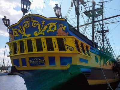 AttractionÉtoile du Roy600 m east, in Saint-Malo7
 AquariumGrand aquarium de Saint-Malo4.1 km southeast, in Saint-Malo8AttractionAttractionTombeau de Chateaubriand600 m northwest, in Saint-Malo
Within 15 km, close and well known first. Numbers match the map.
Planning a visit to Tour Notre-Dame
Where is Tour Notre-Dame?
Tour Notre-Dame is in Saint-Malo, in Ille-et-Vilaine (Brittany).
What is Tour Notre-Dame?
Fort.
When is the best time to visit Tour Notre-Dame?
May to September are the warmest months in Saint-Malo, with afternoon highs of 17–22°C (Météo-France 1991–2020 normals).
What else is there to see near Tour Notre-Dame?
Within 15 km: Cathédrale Saint-Vincent de Saint-Malo (200 m), Château de Saint-Malo (500 m), Fort National (700 m) and Tour Solidor (1.7 km).
Sources: OpenStreetMap (© OpenStreetMap contributors, ODbL), Wikidata (CC0: what it is, its articles, how widely it is covered), the Culture ministry’s Mérimée database (Licence Ouverte 2.0), IGN commune boundaries, Météo-France 1991–2020 normals (Licence Ouverte 2.0).
Photos from Wikimedia Commons, each under its own licence (our copy, resized).
Photo credits (3)
- Fort National: Pline, CC BY-SA 3.0, Wikimedia Commons
- Étoile du Roy: Proullon, CC BY-SA 4.0, Wikimedia Commons
- Grand aquarium de Saint-Malo: MaxTab, CC BY 3.0, Wikimedia Commons
Contains public sector information under the Licence Ouverte / Open Licence 2.0 (Etalab): INSEE, DGFiP, the Interior Ministry’s statistics service (SSMSI), the Ministry of Education (DEPP), the Health Ministry’s statistics service (DREES) and the Housing Ministry (Carte des loyers). Commune boundaries: IGN Admin Express.