Parc botanique de Launay
One of the places to visit in Bures-sur-Yvette is Parc botanique de Launay, a garden. Within 5 km there are 28 more places to visit. Top of the list nearby is Château de Versailles, 12 km away.
Garden in Bures-sur-Yvette
One of the best-known places to visit in France
#2,141 of the 37,318 museums, châteaux, gardens and other attractions we list in France, by how widely it is covered (4 Wikipedia and sister-site articles). About ↓
In Bures-sur-Yvette
Parc botanique de Launay is in the commune of Bures-sur-Yvette, with 28 more places to visit within 5 km. Towns near it ↓
Written from OpenStreetMap, Wikidata and Météo-France 1991–2020 normals.
Which month to go
Warm weather in Bures-sur-Yvette runs May to September, with highs of 19–25°C.
Parc botanique de Launay
Wikipedia covers it in 4 languages.
- Type
- Garden
- Covered in
- 4 Wikipedia and sister-site articles
- Commune
- Bures-sur-Yvette, Essonne
Getting your bearings
The map puts Parc botanique de Launay in orange and numbers its neighbours as in the list.
© OpenStreetMap contributors · The dashed line is the commune of Bures-sur-Yvette. · commune boundary: IGN
Where to base yourself
Of these 8 towns, the largest is Les Ulis (25,886 people). Every one of these towns counts it as a place to visit.
- 1Bures-sur-Yvette
- 2Orsay
- 3Les Ulis
- 4Gometz-le-Châtel
- 5Gif-sur-Yvette
- 6Villebon-sur-Yvette
- 7Saclay
- 8Villejust
Bures-sur-Yvette
Orsay
Les Ulis
Gometz-le-Châtel
Compare the 8 towns
| Town | Where Parc botanique de Launay is | People |
|---|---|---|
| Bures-sur-Yvette | It’s in this commune | 9,548 |
| Orsay | 1.4 km southeast of it | 16,498 |
| Les Ulis | 2 km south of it | 25,886 |
| Gometz-le-Châtel | 3.2 km southwest of it | 2,630 |
| Gif-sur-Yvette | 3.8 km west of it | 22,544 |
| Villebon-sur-Yvette | 4.2 km east of it | 10,291 |
| Saclay | 4.5 km north of it | 4,437 |
| Villejust | 4.9 km southeast of it | 2,558 |
Beyond Parc botanique de Launay
301 more lie within 15 km, 5 attractions, a museum and a cathedral among them.
 AttractionChâteau de Versailles12 km north, in Versailles2
 AttractionPetit Trianon14 km north, in Versailles3
 AttractionGrand Trianon14 km north, in Versailles4AttractionAttractionAbbaye de Port-Royal-des-Champs à Magny-les-Hameaux12 km northwest, in Magny-les-Hameaux5
 MuseumManufacture nationale de Sèvres15 km north, in Sèvres6CathedralCathedralCathédrale Saint-Louis de Versailles11 km north, in Versailles7
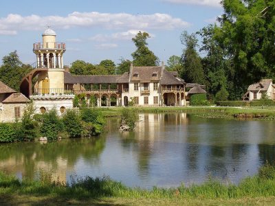 AttractionHameau de la Reine14 km north, in Versailles8
 GardenJardin de Versailles13 km north, in Versailles
Within 15 km, close and well known first. Numbers match the map.
Good to know about Parc botanique de Launay
Where is Parc botanique de Launay?
Parc botanique de Launay is in Bures-sur-Yvette, in Essonne (Île-de-France).
What is Parc botanique de Launay?
Garden in France.
How well known is Parc botanique de Launay?
Parc botanique de Launay has 4 Wikipedia and sister-site articles in different languages: #2,141 of the 37,318 French places we list.
When is the best time to visit Parc botanique de Launay?
May to September are the warmest months in Bures-sur-Yvette, with afternoon highs of 19–25°C (Météo-France 1991–2020 normals).
What else is there to see near Parc botanique de Launay?
Within 15 km: Château de Versailles (12 km), Petit Trianon (14 km), Grand Trianon (14 km) and Abbaye de Port-Royal-des-Champs à Magny-les-Hameaux (12 km).
Sources: OpenStreetMap (© OpenStreetMap contributors, ODbL), Wikidata (CC0: what it is, its articles, how widely it is covered), the Culture ministry’s Mérimée database (Licence Ouverte 2.0), IGN commune boundaries, Météo-France 1991–2020 normals (Licence Ouverte 2.0).
Photos from Wikimedia Commons, each under its own licence (our copy, resized).
Photo credits (6)
- Château de Versailles: ToucanWings, CC BY-SA 3.0, Wikimedia Commons
- Petit Trianon: KimonBerlin, CC BY-SA 2.0, Wikimedia Commons
- Grand Trianon: Lionel Allorge, CC BY-SA 3.0, Wikimedia Commons
- Manufacture nationale de Sèvres: Coyau, CC BY-SA 3.0, Wikimedia Commons
- Hameau de la Reine: Daderot, CC BY-SA 3.0, Wikimedia Commons
- Jardin de Versailles: Anonymous Unknown author, Public domain, Wikimedia Commons
Contains public sector information under the Licence Ouverte / Open Licence 2.0 (Etalab): INSEE, DGFiP, the Interior Ministry’s statistics service (SSMSI), the Ministry of Education (DEPP), the Health Ministry’s statistics service (DREES) and the Housing Ministry (Carte des loyers). Commune boundaries: IGN Admin Express.