Manoir de Gruchy
Manoir de Gruchy is a manor house in Rosel (Calvados). Since 1927 it has been a registered historic monument (inscrit). Top of the 168 other places within 15 km is Abbaye Royale aux Hommes, 6.1 km off.
Château in Rosel
In Rosel
Manoir de Gruchy is in the commune of Rosel, with 32 more places to visit within 5 km. Towns near it ↓
Registered historic monument (inscrit)
Protected as a historic monument since 1927 (Mérimée record PA00111639). About ↓
Written from OpenStreetMap, Wikidata, the Culture ministry’s Mérimée database and Météo-France 1991–2020 normals.
Weather, month by month
Warm weather in Rosel runs May to September, with highs of 17–23°C.
Manoir de Gruchy
Manor house in Rosel (Calvados).
Manoir de Gruchy is in Rosel, Calvados.
- Type
- Château
- Protection
- Registered historic monument (inscrit) · 1927
- Commune
- Rosel, Calvados
Map of Manoir de Gruchy and nearby
The map centres on Manoir de Gruchy, in orange, with nearby places numbered.
© OpenStreetMap contributors · The dashed line is the commune of Rosel. · commune boundary: IGN
Towns within reach of Manoir de Gruchy
The most populous of the 8 is Caen, at 109,400. Each of these towns lists it on its own page of things to do.
Rosel
Rots
Carpiquet
Bretteville-sur-Odon
Compare the 8 towns
| Town | Where Manoir de Gruchy is | People |
|---|---|---|
| Rosel | It’s in this commune | 696 |
| Rots | 3.1 km west of it | 2,544 |
| Carpiquet | 3.4 km south of it | 3,428 |
| Bretteville-sur-Odon | 5.4 km south of it | 4,494 |
| Thue et Mue | 6.1 km west of it | 6,182 |
| Caen | 6.1 km southeast of it | 109,400 |
| Verson | 6.9 km south of it | 4,059 |
| Louvigny | 7.2 km southeast of it | 2,612 |
Places to add to Manoir de Gruchy
168 more lie within 15 km, 3 museums, a monastery and a château among them.
 ChâteauChâteau de Caen6.3 km southeast, in Caen3AbbeyAbbeyAbbaye aux Dames de Caen7 km southeast, in Caen4MuseumMuseumMémorial de Caen4.4 km southeast, in Caen5AttractionAttractionAbbaye d'Ardenne2.8 km southeast, in Saint-Germain-la-Blanche-Herbe6
 MuseumMusée des Beaux-Arts de Caen6.4 km southeast, in Caen7
 Theme parkFestyland3.8 km south, in Bretteville-sur-Odon8
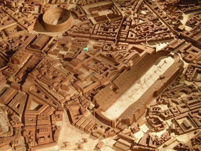 MuseumPlan de Rome par Paul Bigot5.9 km southeast, in Caen
Within 15 km, close and well known first. Numbers match the map.
Manoir de Gruchy in questions
Where is Manoir de Gruchy?
Manoir de Gruchy is in Rosel, in Calvados (Normandy).
What is Manoir de Gruchy?
Manor house in Rosel (Calvados).
Is Manoir de Gruchy a historic monument?
Yes: Registered historic monument (inscrit), since 1927, Mérimée record PA00111639.
When is the best time to visit Manoir de Gruchy?
May to September are the warmest months in Rosel, with afternoon highs of 17–23°C (Météo-France 1991–2020 normals).
What else is there to see near Manoir de Gruchy?
Within 15 km: Abbaye Royale aux Hommes (6.1 km), Château de Caen (6.3 km), Abbaye aux Dames de Caen (7 km) and Mémorial de Caen (4.4 km).
Sources: OpenStreetMap (© OpenStreetMap contributors, ODbL), Wikidata (CC0: what it is, its articles, how widely it is covered), the Culture ministry’s Mérimée database (Licence Ouverte 2.0), IGN commune boundaries, Météo-France 1991–2020 normals (Licence Ouverte 2.0).
Photos from Wikimedia Commons, each under its own licence (our copy, resized).
Photo credits (4)
- Château de Caen: Nikater, Public domain, Wikimedia Commons
- Musée des Beaux-Arts de Caen: Own work, CC BY-SA 3.0, Wikimedia Commons
- Festyland: Copyleft, CC BY-SA 4.0, Wikimedia Commons
- Plan de Rome par Paul Bigot: Pascal Radigue, CC BY-SA 3.0, Wikimedia Commons
Contains public sector information under the Licence Ouverte / Open Licence 2.0 (Etalab): INSEE, DGFiP, the Interior Ministry’s statistics service (SSMSI), the Ministry of Education (DEPP), the Health Ministry’s statistics service (DREES) and the Housing Ministry (Carte des loyers). Commune boundaries: IGN Admin Express.