La Mine image
In La Motte-d'Aveillans stands La Mine image, a museum. 2 more places to visit are within 5 km. A drive of 13 km reaches Musée de la Révolution française.
Museum in La Motte-d'Aveillans
In La Motte-d'Aveillans
La Mine image is in the commune of La Motte-d'Aveillans, with 2 more places to visit within 5 km. Towns near it ↓
Written from OpenStreetMap, Wikidata and Météo-France 1991–2020 normals.
Weather, month by month
Afternoons in La Motte-d'Aveillans peak at 18–25°C, May to September.
La Mine image
Its Wikipedia coverage spans 2 languages.
- Type
- Museum
- Covered in
- 2 Wikipedia and sister-site articles
- Commune
- La Motte-d'Aveillans, Isère
- Official site
- mine-image.com
Practical details
- EntryA fee is charged
Getting your bearings
The map centres on La Mine image, in orange, with nearby places numbered.
© OpenStreetMap contributors · The dashed line is the commune of La Motte-d'Aveillans. · commune boundary: IGN
Which towns are near La Mine image
In size, Varces-Allières-et-Risset comes first of the 8, with 8,542 people. The list runs from its own town outward.
- 1La Motte-d'Aveillans
- 2La Mure
- 3Saint-Georges-de-Commiers
- 4Vif
- 5Vizille
- 6Champ-sur-Drac
- 7Varces-Allières-et-Risset
- 8Jarrie
La Motte-d'Aveillans
La Mure
Saint-Georges-de-Commiers
Vif
Compare the 8 towns
| Town | Where La Mine image is | People |
|---|---|---|
| La Motte-d'Aveillans | It’s in this commune | 1,711 |
| La Mure | 7.2 km southeast of it | 4,963 |
| Saint-Georges-de-Commiers | 9 km north of it | 2,699 |
| Vif | 11 km northwest of it | 8,530 |
| Vizille | 13 km north of it | 7,292 |
| Champ-sur-Drac | 13 km north of it | 3,335 |
| Varces-Allières-et-Risset | 16 km north of it | 8,542 |
| Jarrie | 16 km north of it | 3,952 |
Other places close by
Within 15 km are 22 places, among them 4 museums, 2 châteaux and an attraction.
 MuseumMusée de la Révolution française13 km north, in Vizille2
 ChâteauChâteau de Vizille13 km north, in Vizille3
 MuseumMusée Champollion12 km northwest, in Vif4
 MuseumMusée matheysin7.1 km southeast, in La Mure5AttractionAttractionFontaine ardente du Gua9.8 km west, in Le Gua6ChâteauChâteauChâteau de Bardonenche9.5 km southwest, in Monestier-de-Clermont7AbbeyAbbeyPrieuré de Saint-Michel de Connexe11 km north, in Champ-sur-Drac8
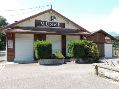 MuseumMusée Autrefois14 km north, in Champ-sur-Drac
Within 15 km, close and well known first. Numbers match the map.
What people ask about La Mine image
Where is La Mine image?
La Mine image is in La Motte-d'Aveillans, in Isère (Auvergne-Rhône-Alpes).
What is La Mine image?
Museum in France.
How well known is La Mine image?
La Mine image has 2 Wikipedia and sister-site articles in different languages: #5,252 of the 37,318 French places we list.
When is the best time to visit La Mine image?
May to September are the warmest months in La Motte-d'Aveillans, with afternoon highs of 18–25°C (Météo-France 1991–2020 normals).
What else is there to see near La Mine image?
Within 15 km: Musée de la Révolution française (13 km), Château de Vizille (13 km), Musée Champollion (12 km) and Musée matheysin (7.1 km).
Sources: OpenStreetMap (© OpenStreetMap contributors, ODbL), Wikidata (CC0: what it is, its articles, how widely it is covered), the Culture ministry’s Mérimée database (Licence Ouverte 2.0), IGN commune boundaries, Météo-France 1991–2020 normals (Licence Ouverte 2.0).
Photos from Wikimedia Commons, each under its own licence (our copy, resized).
Photo credits (5)
- Musée de la Révolution française: ThomasBigot, CC BY-SA 3.0, Wikimedia Commons
- Château de Vizille: Bogdanmoisuc, CC BY-SA 3.0, Wikimedia Commons
- Musée Champollion: Julien Peytard, CC BY-SA 4.0, Wikimedia Commons
- Musée matheysin: Patafisik, CC BY-SA 4.0, Wikimedia Commons
- Musée Autrefois: Quentin DIETRICH, CC BY-SA 3.0, Wikimedia Commons
Contains public sector information under the Licence Ouverte / Open Licence 2.0 (Etalab): INSEE, DGFiP, the Interior Ministry’s statistics service (SSMSI), the Ministry of Education (DEPP), the Health Ministry’s statistics service (DREES) and the Housing Ministry (Carte des loyers). Commune boundaries: IGN Admin Express.