Prieuré de Saint-Michel de Connexe
Prieuré de Saint-Michel de Connexe is a priory located. The town it belongs to is Champ-sur-Drac. Add Musée de la Révolution française, 4 km away, to a visit; it leads 112 places within 15 km.
Abbey in Champ-sur-Drac
In Champ-sur-Drac
Prieuré de Saint-Michel de Connexe is in the commune of Champ-sur-Drac, with 11 more places to visit within 5 km. Towns near it ↓
Written from OpenStreetMap, Wikidata and Météo-France 1991–2020 normals.
When to go
Aim for April to October, when Champ-sur-Drac reaches 17–28°C.
Prieuré de Saint-Michel de Connexe
Wikipedia covers it in 2 languages.
Prieuré de Saint-Michel de Connexe on Wikipedia (in French) ↗
- Type
- Abbey
- Covered in
- 2 Wikipedia and sister-site articles
- Commune
- Champ-sur-Drac, Isère
Locating Prieuré de Saint-Michel de Connexe
On this map, Prieuré de Saint-Michel de Connexe is orange and its neighbours are numbered.
© OpenStreetMap contributors · The dashed line is the commune of Champ-sur-Drac. · commune boundary: IGN
Towns that count Prieuré de Saint-Michel de Connexe
In size, Le Pont-de-Claix comes first of the 8, with 10,956 people. The list runs from its own town outward.
- 1Champ-sur-Drac
- 2Saint-Georges-de-Commiers
- 3Vizille
- 4Vif
- 5Varces-Allières-et-Risset
- 6Jarrie
- 7Claix
- 8Le Pont-de-Claix
Champ-sur-Drac
Saint-Georges-de-Commiers
Vizille
Vif
Compare the 8 towns
| Town | Where Prieuré de Saint-Michel de Connexe is | People |
|---|---|---|
| Champ-sur-Drac | It’s in this commune | 3,335 |
| Saint-Georges-de-Commiers | 3.1 km southwest of it | 2,699 |
| Vizille | 3.8 km northeast of it | 7,292 |
| Vif | 4.5 km west of it | 8,530 |
| Varces-Allières-et-Risset | 5.3 km northwest of it | 8,542 |
| Jarrie | 5.3 km north of it | 3,952 |
| Claix | 7.9 km northwest of it | 7,836 |
| Le Pont-de-Claix | 8.4 km north of it | 10,956 |
While you are near Prieuré de Saint-Michel de Connexe
Around it, within 15 km, lie 112 more, including 4 museums, 2 attractions and a château.
 MuseumMusée de la Révolution française4 km northeast, in Vizille2
 ChâteauChâteau de Vizille3.9 km northeast, in Vizille3
 MuseumMusée Champollion4.7 km west, in Vif4CathedralCathedralCathédrale Notre-Dame de Grenoble15 km north, in Grenoble5
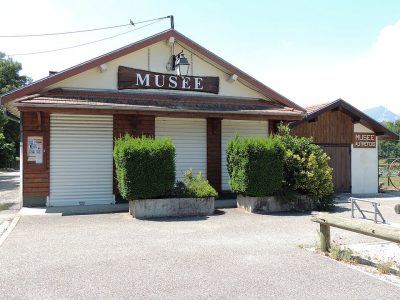 MuseumMusée Autrefois2.9 km north, in Champ-sur-Drac6AttractionAttractionUriage-les-Bains11 km northeast, in Vaulnaveys-le-Haut7
 AttractionTour Perret14 km north, in Grenoble8
 MuseumMagasin-CNAC14 km north, in Grenoble
Within 15 km, close and well known first. Numbers match the map.
Questions people have about Prieuré de Saint-Michel de Connexe
Where is Prieuré de Saint-Michel de Connexe?
Prieuré de Saint-Michel de Connexe is in Champ-sur-Drac, in Isère (Auvergne-Rhône-Alpes).
What is Prieuré de Saint-Michel de Connexe?
Priory located in Isère, in France.
How well known is Prieuré de Saint-Michel de Connexe?
Prieuré de Saint-Michel de Connexe has 2 Wikipedia and sister-site articles in different languages: #5,252 of the 37,318 French places we list.
When is the best time to visit Prieuré de Saint-Michel de Connexe?
April to October are the warmest months in Champ-sur-Drac, with afternoon highs of 17–28°C (Météo-France 1991–2020 normals).
What else is there to see near Prieuré de Saint-Michel de Connexe?
Within 15 km: Musée de la Révolution française (4 km), Château de Vizille (3.9 km), Musée Champollion (4.7 km) and Cathédrale Notre-Dame de Grenoble (15 km).
Sources: OpenStreetMap (© OpenStreetMap contributors, ODbL), Wikidata (CC0: what it is, its articles, how widely it is covered), the Culture ministry’s Mérimée database (Licence Ouverte 2.0), IGN commune boundaries, Météo-France 1991–2020 normals (Licence Ouverte 2.0).
Photos from Wikimedia Commons, each under its own licence (our copy, resized).
Photo credits (6)
- Musée de la Révolution française: ThomasBigot, CC BY-SA 3.0, Wikimedia Commons
- Château de Vizille: Bogdanmoisuc, CC BY-SA 3.0, Wikimedia Commons
- Musée Champollion: Julien Peytard, CC BY-SA 4.0, Wikimedia Commons
- Musée Autrefois: Quentin DIETRICH, CC BY-SA 3.0, Wikimedia Commons
- Tour Perret: simdaperce, CC BY-SA 3.0, Wikimedia Commons
- Magasin-CNAC: Milky, CC BY-SA 3.0, Wikimedia Commons
Contains public sector information under the Licence Ouverte / Open Licence 2.0 (Etalab): INSEE, DGFiP, the Interior Ministry’s statistics service (SSMSI), the Ministry of Education (DEPP), the Health Ministry’s statistics service (DREES) and the Housing Ministry (Carte des loyers). Commune boundaries: IGN Admin Express.