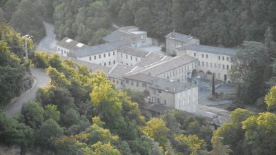
Château de Gourdan
Visitors to Saint-Clair can see Château de Gourdan. Nearby, 15 more places to visit are within 5 km. It was listed in 1967 as a registered historic monument (inscrit, in part).
Château in Saint-Clair
In Saint-Clair
Château de Gourdan is in the commune of Saint-Clair, with 15 more places to visit within 5 km. Towns near it ↓
Registered historic monument (inscrit, in part)
Protected as a historic monument since 1967; built in the 18th century (Mérimée record PA00116779). About ↓
Written from OpenStreetMap, Wikidata, the Culture ministry’s Mérimée database and Météo-France 1991–2020 normals.
Picking your season
For warmth, aim for April to October (17–28°C highs in Saint-Clair).
Château de Gourdan
There are Wikipedia articles on it in 2 languages. Top of the list nearby is Safari de Peaugres, 1.6 km away.
- Type
- Château
- Protection
- Registered historic monument (inscrit, in part) · 1967
- Built
- 18th century
- Covered in
- 2 Wikipedia and sister-site articles
- Commune
- Saint-Clair, Ardèche
- Official site
- chateau-de-gourdan.com
Locating Château de Gourdan
The numbers show what else is near Château de Gourdan, in the order listed below.
© OpenStreetMap contributors · The dashed line is the commune of Saint-Clair. · commune boundary: IGN
Bases near Château de Gourdan
The most populous of the 8 is Annonay, at 17,274. The towns are in order of distance, its own town first.
- 1Saint-Clair
- 2Davézieux
- 3Annonay
- 4Vernosc-lès-Annonay
- 5Roiffieux
- 6Saint-Rambert-d'Albon
- 7Chanas
- 8Bourg-Argental
Saint-Clair
Davézieux
Annonay
Vernosc-lès-Annonay
Compare the 8 towns
| Town | Where Château de Gourdan is | People |
|---|---|---|
| Saint-Clair | It’s in this commune | 1,348 |
| Davézieux | 2.3 km south of it | 3,205 |
| Annonay | 4.2 km southwest of it | 17,274 |
| Vernosc-lès-Annonay | 5.8 km south of it | 2,725 |
| Roiffieux | 6.5 km southwest of it | 2,743 |
| Saint-Rambert-d'Albon | 10 km east of it | 7,001 |
| Chanas | 11 km northeast of it | 2,706 |
| Bourg-Argental | 11 km west of it | 2,886 |
Pair Château de Gourdan with these
Around it, within 15 km, lie 68 more, including 3 châteaux, 2 monasteries and a zoo.
 MuseumMusée des Papeteries Canson et Montgolfier2.8 km southwest, in Davézieux3ChâteauChâteauDomaine de Marc Seguin3 km southwest, in Annonay4Monastery or conventMonastery or conventMonastère de Colombier-le-Cardinal3.1 km east, in Colombier-le-Cardinal5ChâteauChâteauChâteau des Célestins3.1 km east, in Colombier-le-Cardinal6Monastery or conventMonastery or conventCouvent Sainte-Marie d'Annonay4.6 km southwest, in Annonay7ChâteauChâteauChâteau d'Albon14 km east, in Albon8ChurchChurchChapelle Notre-Dame-de-Pitié de Serrières6.8 km northeast, in Serrières
Within 15 km, close and well known first. Numbers match the map.
Visiting Château de Gourdan: the answers
Where is Château de Gourdan?
Château de Gourdan is in Saint-Clair, in Ardèche (Auvergne-Rhône-Alpes).
What is Château de Gourdan?
Château.
Is Château de Gourdan a historic monument?
Yes: Registered historic monument (inscrit, in part), since 1967, Mérimée record PA00116779.
How well known is Château de Gourdan?
Château de Gourdan has 2 Wikipedia and sister-site articles in different languages: #5,252 of the 37,318 French places we list.
When is the best time to visit Château de Gourdan?
April to October are the warmest months in Saint-Clair, with afternoon highs of 17–28°C (Météo-France 1991–2020 normals).
What else is there to see near Château de Gourdan?
Within 15 km: Safari de Peaugres (1.6 km), Musée des Papeteries Canson et Montgolfier (2.8 km), Domaine de Marc Seguin (3 km) and Monastère de Colombier-le-Cardinal (3.1 km).
Sources: OpenStreetMap (© OpenStreetMap contributors, ODbL), Wikidata (CC0: what it is, its articles, how widely it is covered), the Culture ministry’s Mérimée database (Licence Ouverte 2.0), IGN commune boundaries, Météo-France 1991–2020 normals (Licence Ouverte 2.0).
Photos from Wikimedia Commons, each under its own licence (our copy, resized).
Photo credits (1)
- Musée des Papeteries Canson et Montgolfier: Mattho69, CC BY-SA 4.0, Wikimedia Commons
Contains public sector information under the Licence Ouverte / Open Licence 2.0 (Etalab): INSEE, DGFiP, the Interior Ministry’s statistics service (SSMSI), the Ministry of Education (DEPP), the Health Ministry’s statistics service (DREES) and the Housing Ministry (Carte des loyers). Commune boundaries: IGN Admin Express.