Château de Cour-sur-Loire
Look for Château de Cour-sur-Loire in Cour-sur-Loire. Its neighbours on our list number 10 within 5 km. Since 1961 it has been a registered historic monument (inscrit, in part).
Château in Cour-sur-Loire
In Cour-sur-Loire
Château de Cour-sur-Loire is in the commune of Cour-sur-Loire, with 10 more places to visit within 5 km. Towns near it ↓
Registered historic monument (inscrit, in part)
Protected as a historic monument since 1961; built in the 15th, 16th, 18th and 19th centuries (Mérimée record PA00098425). About ↓
Written from OpenStreetMap, Wikidata, the Culture ministry’s Mérimée database and Météo-France 1991–2020 normals.
Picking your season
Highs of 17–26°C mark May to October in Cour-sur-Loire.
Château de Cour-sur-Loire
A short trip away is Château de Chambord, 7.8 km off.
- Type
- Château
- Protection
- Registered historic monument (inscrit, in part) · 1961
- Built
- 15th, 16th, 18th and 19th centuries
- Commune
- Cour-sur-Loire, Loir-et-Cher
Map of Château de Cour-sur-Loire and nearby
Orange marks Château de Cour-sur-Loire, and the numbered points match the list of places below.
© OpenStreetMap contributors · The dashed line is the commune of Cour-sur-Loire. · commune boundary: IGN
Towns a short way from Château de Cour-sur-Loire
Among the 8, Blois is the biggest, home to 47,219 people. Closest first, each of these towns names it on its page.
- 1Cour-sur-Loire
- 2La Chaussée-Saint-Victor
- 3Vineuil
- 4Villebarou
- 5Mer
- 6Mont-près-Chambord
- 7Saint-Gervais-la-Forêt
- 8Blois
Cour-sur-Loire
La Chaussée-Saint-Victor
Vineuil
Villebarou
Compare the 8 towns
| Town | Where Château de Cour-sur-Loire is | People |
|---|---|---|
| Cour-sur-Loire | It’s in this commune | 259 |
| La Chaussée-Saint-Victor | 6.7 km southwest of it | 4,471 |
| Vineuil | 8 km southwest of it | 8,064 |
| Villebarou | 8.2 km west of it | 2,584 |
| Mer | 8.3 km northeast of it | 6,250 |
| Mont-près-Chambord | 11 km south of it | 3,386 |
| Saint-Gervais-la-Forêt | 11 km southwest of it | 3,180 |
| Blois | 11 km southwest of it | 47,219 |
Around Château de Cour-sur-Loire
3 attractions, 2 châteaux and a cathedral are among the 69 within 15 km.
 AttractionChâteau de Blois10 km southwest, in Blois3ChâteauChâteauChâteau de Menars1.7 km southwest, in Menars4CathedralCathedralCathédrale Saint-Louis de Blois9.6 km southwest, in Blois5GardenGardenChâteau de Talcy14 km north, in Talcy6
 AttractionChâteau de Beauregard13 km south, in Cellettes7ChâteauChâteauChâteau de Villesavin13 km southeast, in Tour-en-Sologne8
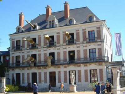 MuseumMaison de la Magie10 km southwest, in Blois
Within 15 km, close and well known first. Numbers match the map.
Questions before you go
Where is Château de Cour-sur-Loire?
Château de Cour-sur-Loire is in Cour-sur-Loire, in Loir-et-Cher (Centre-Val de Loire).
What is Château de Cour-sur-Loire?
Château.
Is Château de Cour-sur-Loire a historic monument?
Yes: Registered historic monument (inscrit, in part), since 1961, Mérimée record PA00098425.
When is the best time to visit Château de Cour-sur-Loire?
May to October are the warmest months in Cour-sur-Loire, with afternoon highs of 17–26°C (Météo-France 1991–2020 normals).
What else is there to see near Château de Cour-sur-Loire?
Within 15 km: Château de Chambord (7.8 km), Château de Blois (10 km), Château de Menars (1.7 km) and Cathédrale Saint-Louis de Blois (9.6 km).
Sources: OpenStreetMap (© OpenStreetMap contributors, ODbL), Wikidata (CC0: what it is, its articles, how widely it is covered), the Culture ministry’s Mérimée database (Licence Ouverte 2.0), IGN commune boundaries, Météo-France 1991–2020 normals (Licence Ouverte 2.0).
Photos from Wikimedia Commons, each under its own licence (our copy, resized).
Photo credits (3)
- Château de Blois: Tango7174, CC BY-SA 4.0, Wikimedia Commons
- Château de Beauregard: Gerd Eichmann, CC BY-SA 4.0, Wikimedia Commons
- Maison de la Magie: You may select the license of your choice., CC BY-SA 3.0, Wikimedia Commons
Contains public sector information under the Licence Ouverte / Open Licence 2.0 (Etalab): INSEE, DGFiP, the Interior Ministry’s statistics service (SSMSI), the Ministry of Education (DEPP), the Health Ministry’s statistics service (DREES) and the Housing Ministry (Carte des loyers). Commune boundaries: IGN Admin Express.