Château de Chambord
Château de Chambord is a castle in Chambord, Centre-Val de Loire. Add Château de Blois, 14 km away, to a visit; it leads 81 places within 15 km. Readers can find it on Wikipedia in 55 languages.
Attraction in Chambord
One of the best-known places to visit in France
#40 of the 37,318 museums, châteaux, gardens and other attractions we list in France, by how widely it is covered (55 Wikipedia and sister-site articles). About ↓
In Chambord
Château de Chambord is in the commune of Chambord, with 6 more places to visit within 5 km. Towns near it ↓
Written from OpenStreetMap, Wikidata and Météo-France 1991–2020 normals.
A month-by-month guide
For warmth, aim for May to October (17–26°C highs in Chambord).
Château de Chambord
Castle in Chambord, Centre-Val de Loire, France.
Château de Chambord is in Chambord, Loir-et-Cher.
- Type
- Attraction
- Covered in
- 55 Wikipedia and sister-site articles
- Commune
- Chambord, Loir-et-Cher
- Official site
- chambord.org
Entry, hours, address
Château de Chambord and what surrounds it
On this map, Château de Chambord is orange and its neighbours are numbered.
© OpenStreetMap contributors · The dashed line is the commune of Chambord. · commune boundary: IGN
Towns that count Château de Chambord
Vineuil tops the 8 for size, at 8,064 people. The town it is in comes first, then the others whose pages list it, nearest first.
- 1Chambord
- 2Mont-près-Chambord
- 3Mer
- 4Vineuil
- 5La Chaussée-Saint-Victor
- 6Saint-Laurent-Nouan
- 7Cour-Cheverny
- 8Saint-Gervais-la-Forêt
Chambord
Mont-près-Chambord
Mer
Vineuil
Compare the 8 towns
| Town | Where Château de Chambord is | People |
|---|---|---|
| Chambord | It’s in this commune | 102 |
| Mont-près-Chambord | 8.1 km southwest of it | 3,386 |
| Mer | 9.7 km north of it | 6,250 |
| Vineuil | 11 km west of it | 8,064 |
| La Chaussée-Saint-Victor | 12 km west of it | 4,471 |
| Saint-Laurent-Nouan | 12 km northeast of it | 4,236 |
| Cour-Cheverny | 12 km south of it | 2,831 |
| Saint-Gervais-la-Forêt | 13 km southwest of it | 3,180 |
Around Château de Chambord
Around it, within 15 km, lie 81 more, including 3 attractions, 2 châteaux and a cathedral.
 AttractionChâteau de Blois14 km west, in Blois2AttractionAttractionChâteau de Cheverny14 km south, in Cheverny3ChâteauChâteauChâteau de Menars8.4 km west, in Menars4ChâteauChâteauChâteau de Villesavin7.7 km south, in Tour-en-Sologne5CathedralCathedralCathédrale Saint-Louis de Blois14 km west, in Blois6
 AttractionChâteau de Beauregard13 km southwest, in Cellettes7GardenGardenJardins de Chambord200 m north, in Chambord8
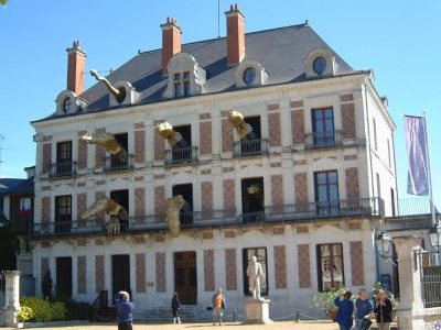 MuseumMaison de la Magie14 km west, in Blois
Within 15 km, close and well known first. Numbers match the map.
Questions before you go
Where is Château de Chambord?
Château de Chambord is in Chambord, in Loir-et-Cher (Centre-Val de Loire).
What is Château de Chambord?
Castle in Chambord, Centre-Val de Loire, France.
How well known is Château de Chambord?
Château de Chambord has 55 Wikipedia and sister-site articles in different languages: #40 of the 37,318 French places we list.
When is the best time to visit Château de Chambord?
May to October are the warmest months in Chambord, with afternoon highs of 17–26°C (Météo-France 1991–2020 normals).
What else is there to see near Château de Chambord?
Within 15 km: Château de Blois (14 km), Château de Cheverny (14 km), Château de Menars (8.4 km) and Château de Villesavin (7.7 km).
Sources: OpenStreetMap (© OpenStreetMap contributors, ODbL), Wikidata (CC0: what it is, its articles, how widely it is covered), the Culture ministry’s Mérimée database (Licence Ouverte 2.0), IGN commune boundaries, Météo-France 1991–2020 normals (Licence Ouverte 2.0).
Photos from Wikimedia Commons, each under its own licence (our copy, resized).
Photo credits (3)
- Château de Blois: Tango7174, CC BY-SA 4.0, Wikimedia Commons
- Château de Beauregard: Gerd Eichmann, CC BY-SA 4.0, Wikimedia Commons
- Maison de la Magie: You may select the license of your choice., CC BY-SA 3.0, Wikimedia Commons
Contains public sector information under the Licence Ouverte / Open Licence 2.0 (Etalab): INSEE, DGFiP, the Interior Ministry’s statistics service (SSMSI), the Ministry of Education (DEPP), the Health Ministry’s statistics service (DREES) and the Housing Ministry (Carte des loyers). Commune boundaries: IGN Admin Express.