First pick
Bois de Han
Wood or forest
8.9 ha0.4 km of path
0.9 km south-eastfrom the center
Directionsto a point inside
Each edition grades its towns against each other only.
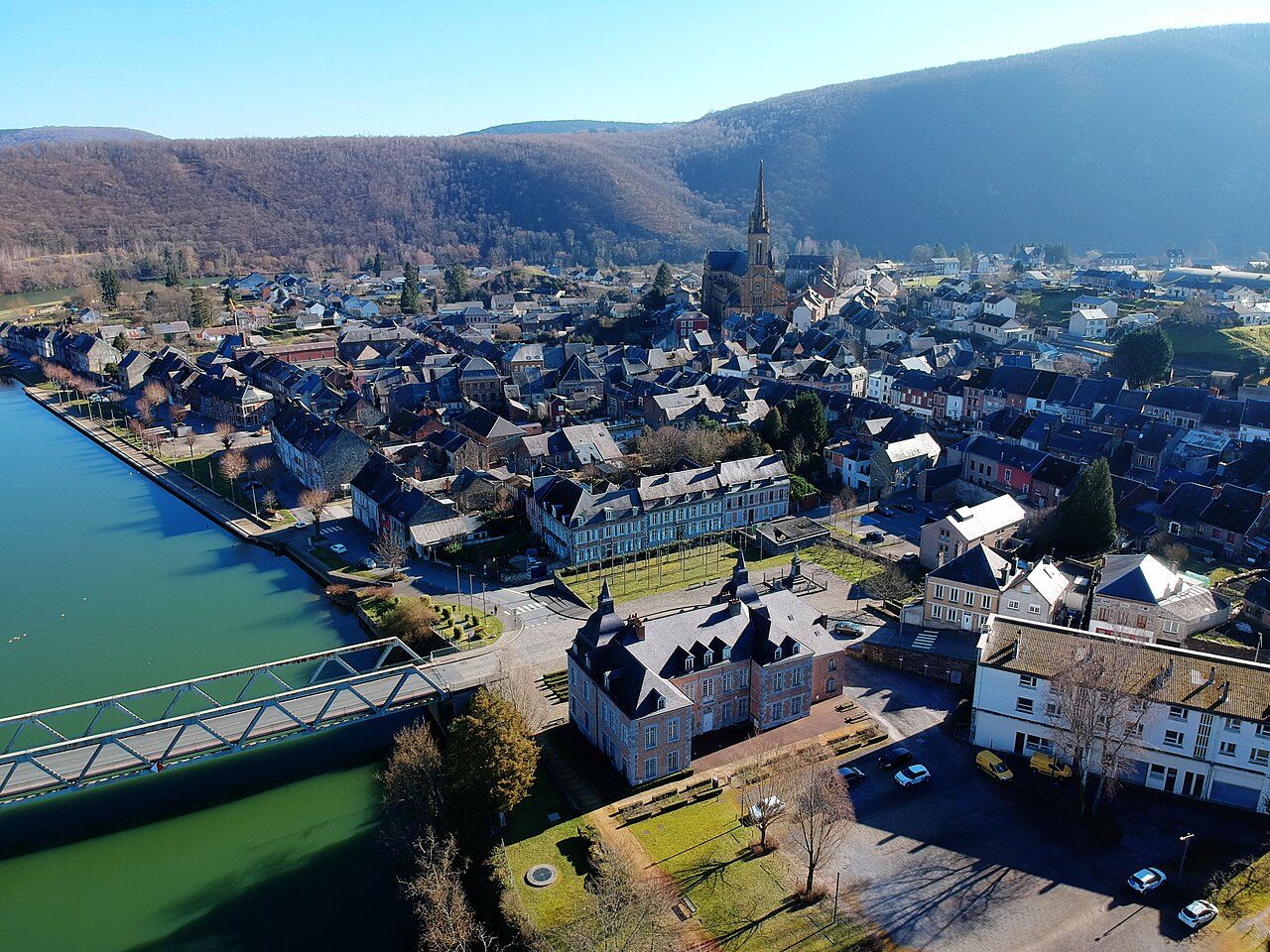 Photo: Papagon · CC BY-SA 4.0
100% of Fumay’s land lies in protected areas. 92% of Fumay is mapped woodland. Footpaths add up to 74 km across Fumay (2 km per km²). France has no Outdoors Grade yet: these are the figures, each beside the compared towns’ median.
Throughout this page, the Ardennes median and the France median are the median of compared communes (those with an overall grade), each figure its own median.
Read from the data: what stands out first, good and less good.
What sets Fumay apart: the regional nature park around it, then its woods.
Each figure against the 3,798 compared French towns (communes with an overall grade): the marked bar is the town’s, the line the median. Described, not graded.
Percentiles among compared French towns; ties count half.
The 40 compared French towns nearest in population (3,057 to 3,114 residents), by km of footpath per km². Hover for each one’s protected land and woods; click for its page.
From Coupvray (4.3 km per km²) to Bérat (0 km per km²).
| Town | Paths (km/km²) | Woodland | Protected | Coast | |
|---|---|---|---|---|---|
| 1 | Coupvray Seine-et-Marne | 4.3 | 19% | 0% | 164 km |
| 2 | Étiolles Essonne | 3.7 | 72% | 0% | 175 km |
| 3 | Buhl Haut-Rhin | 3.7 | 74% | 100% | 461 km |
| 4 | Villers-Bocage Calvados | 3.1 | 7.7% | 0% | 29 km |
| 5 | Tarascon-sur-Ariège Ariège | 3 | 48% | 1.5% | 118 km |
| 6 | La Chapelle-en-Serval Oise | 2.9 | 45% | 100% | 132 km |
| 7 | Pont-à-Vendin Pas-de-Calais | 2.9 | 13% | 0% | 72 km |
| 8 | Chéreng Nord | 2.5 | 11% | 0% | 69 km |
| 9 | Beaumont Haute-Savoie | 2.2 | 40% | 48% | 280 km |
| 10 | Chapareillan Isère | 2.2 | 57% | 98% | 221 km |
| 11 | Béthisy-Saint-Pierre Oise | 2.1 | 37% | 21% | 127 km |
| 12 | Custines Meurthe-et-Moselle | 2 | 38% | 0% | 355 km |
| 13 | Fumay Ardennes | 2 | 92% | 100% | 185 km |
| 14 | Chens-sur-Léman Haute-Savoie | 1.9 | 41% | 5% | 299 km |
| 15 | La Sentinelle Nord | 1.9 | 3.3% | 0.5% | 104 km |
| 16 | Damelevières Meurthe-et-Moselle | 1.6 | 46% | 0% | 386 km |
| 17 | Arbois Jura | 1.4 | 51% | 12% | 373 km |
| 18 | Plancoët Côtes-d'Armor | 1.4 | 13% | 100% | 3.9 km |
| 19 | La Motte Var | 1.3 | 34% | 25% | 18 km |
| 20 | Gréoux-les-Bains Alpes-de-Haute-Provence | 1.2 | 62% | 20% | 63 km |
| 21 | Saint-Genix-les-Villages Savoie | 1.2 | 33% | 4.4% | 247 km |
| 22 | Guichainville Eure | 1.1 | 15% | 0% | 78 km |
| 23 | Appoigny Yonne | 1 | 46% | 2.7% | 289 km |
| 24 | Gasny Eure | 0.8 | 35% | 9.7% | 98 km |
| 25 | Anor Nord | 0.8 | 37% | 100% | 162 km |
| 26 | Nontron Dordogne | 0.7 | 37% | 100% | 110 km |
| 27 | Colayrac-Saint-Cirq Lot-et-Garonne | 0.7 | 14% | 3.8% | 126 km |
| 28 | Port-Saint-Père Loire-Atlantique | 0.7 | 9.5% | 16% | 20 km |
| 29 | Soulac-sur-Mer Gironde | 0.7 | 23% | 100% | On it |
| 30 | Breuillet Charente-Maritime | 0.7 | 20% | 13% | On it |
| 31 | Noé Haute-Garonne | 0.7 | 7.6% | 5.6% | 150 km |
| 32 | Saint-Denis-de-l'Hôtel Loiret | 0.4 | 38% | 4% | 217 km |
| 33 | Le Grand-Lemps Isère | 0.4 | 24% | 10% | 220 km |
| 34 | Châtillon-sur-Loire Loiret | 0.4 | 15% | 9.3% | 271 km |
| 35 | Blancs-Coteaux Marne | 0.2 | 35% | 2.1% | 220 km |
| 36 | Dissay Vienne | 0.2 | 34% | 24% | 127 km |
| 37 | Miramont-de-Guyenne Lot-et-Garonne | 0.2 | 11% | 0% | 88 km |
| 38 | Lailly-en-Val Loiret | 0.1 | 52% | 60% | 210 km |
| 39 | Chasseneuil-sur-Bonnieure Charente | 0.1 | 23% | 0% | 103 km |
| 40 | La Roche-Chalais Dordogne | 0.1 | 56% | 6.7% | 50 km |
| 41 | Bérat Haute-Garonne | 0 | 11% | 0% | 159 km |
Tap a number to zoom to a park or wood. Tap a layer to hide it. The dashed line is the commune’s boundary.
Named parks, gardens and woods in the commune or within 400 m, the biggest and best-pathed first: Bois de Han leads, at 8.9 ha. Directions go to a point inside.
Source: © OpenStreetMap contributors (ODbL): named parks, gardens and woods; sizes are the whole site.
The protected areas reaching the commune, and the nearest: national parks, regional nature parks, nature reserves and Natura 2000 sites.
Designations overlap (a regional park can hold a Natura 2000 site), so the rows don’t add up; the first counts each piece of land once.
100% of Fumay’s land is protected, more than in 97% of compared French towns; the median compared town in Ardennes has 36%. A regional nature park is a charter between communes to look after a landscape: farming, building and hunting go on inside it.
Source: INPN / PatriNat, protected areas July 2026, Natura 2000 December 2024; shares of IGN’s commune boundary.
Paths, bridleways, steps and tracks open on foot, and waymarked hiking routes, mapped on OpenStreetMap inside the commune; woods are mapped forest and woodland, private woods included.
That is more than in 57% of compared French towns for footpaths per km², and for woodland more than in 99% of compared French towns. Hiking routes often follow paths and lanes already counted, so the two lengths overlap: don’t add them. Every home in Fumay is within 800 m of a mapped park or wood, as in most French towns.
GR 12 passes within 2 km of Fumay.
Source: © OpenStreetMap contributors (ODbL), extracts of October 25, 2026 (Geofabrik).
Météo-France’s 1991–2020 normals at Charleville-Mez, 23 km away, and the daylight at the town’s latitude. Outlined months have long days, highs of 15 to 30 °C and little rain for the place.
| Jan | Feb | Mar | Apr | May | Jun | Jul | Aug | Sep | Oct | Nov | Dec | |
|---|---|---|---|---|---|---|---|---|---|---|---|---|
| Daylight (h) | 8.5 | 10.0 | 11.7 | 13.7 | 15.4 | 16.3 | 15.9 | 14.5 | 12.5 | 10.6 | 8.9 | 8.1 |
| High (°C) | 6 | 7 | 11 | 15 | 19 | 22 | 24 | 24 | 20 | 15 | 9 | 6 |
| Rain (mm) | 100 | 78 | 69 | 57 | 68 | 67 | 72 | 74 | 63 | 80 | 84 | 116 |
April is the driest month (57 mm) and July the warmest (highs of 24 °C). 116 mm of rain falls in December, the wettest month. Frost comes on about 80 nights a year. The climate in Fumay →
The nearest towns of 2,500 or more, colored by the share of their land in protected areas.
| Town | Protected | Woodland | Paths (km/km²) |
|---|---|---|---|
| Fumay | 100% | 92% | 2 |
| Revin 5,716 · 7.1 km | 100% | 88% | 3.3 |
| Bogny-sur-Meuse 4,889 · 16 km | 100% | 79% | 4.3 |
| Givet 6,364 · 19 km | 100% | 23% | 1.5 |
| Nouzonville 5,523 · 20 km | 100% | 67% | 3 |
| Charleville-Mézières 45,560 · 25 km | 0.5% | 32% | 5 |
| Villers-Semeuse 3,615 · 28 km | 0% | 7.8% | 1.5 |
Yes: Fumay lies in Ardennes Regional Nature Park (100% of the commune).
OpenStreetMap maps 74 km of footpaths and tracks open on foot in the commune, 2 km per km² (the median compared town: 1.7 km per km²); 15 km of waymarked hiking routes cross it.
92% of the commune is mapped woodland, private woods included; the median compared French town has 13%.
No: the coast is 185 km from the town center, as the crow flies.
April to September: long days, mild highs and little rain, from Météo-France’s 1991–2020 normals at the nearest suitable station.
TownRatings grades the outdoors in the U.S. and the UK; the French figures are new and not graded yet. This page sets each one beside the median compared French town instead.
Sources: INPN / PatriNat (protected areas 2026, Natura 2000 2024) · © OpenStreetMap contributors, ODbL (paths, hiking routes, woods, coast, gardens) · INSEE, Filosofi 2021 200 m grid (residents) · IGN Admin Express (boundaries) · Météo-France normals 1991–2020 · Medians and percentiles: TownRatings, over compared French towns, updated November 4, 2026. Under the Licence Ouverte / Open Licence 2.0 (Etalab).
Contains public sector information under the Licence Ouverte / Open Licence 2.0 (Etalab): INSEE, DGFiP, the Interior Ministry’s statistics service (SSMSI), the Ministry of Education (DEPP), the Health Ministry’s statistics service (DREES) and the Housing Ministry (Carte des loyers). Commune boundaries: IGN Admin Express.