Oxoboxo RiverCT
A town of 2,782.
Is Oxoboxo River a good place to live?
24% of residents live below the poverty line in Oxoboxo River, against 5.8% in Connecticut’s towns and 9.6% across U.S. towns. Only 1 of the 156 Connecticut towns we compare have a lower share of working residents who work in town than Oxoboxo River. We don’t grade Oxoboxo River yet; the figures below are still real.
97% of working residents leave Oxoboxo River for work
Where Oxoboxo River’s working residents go each day. Line width shows the share.
Census LEHD 2023
Mohegan Sun Arena and 64 more within 40 miles
Museums, parks, gardens and other places to visit around Oxoboxo River. Close and well known come first.
 4 mi Stadium & arenaMohegan Sun Arena
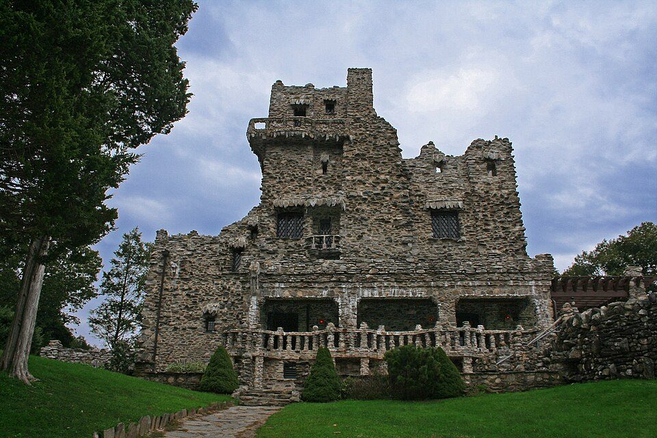 16 mi State parkGillette Castle State Park
 36 mi Stadium & arenaPeoplesBank Arena
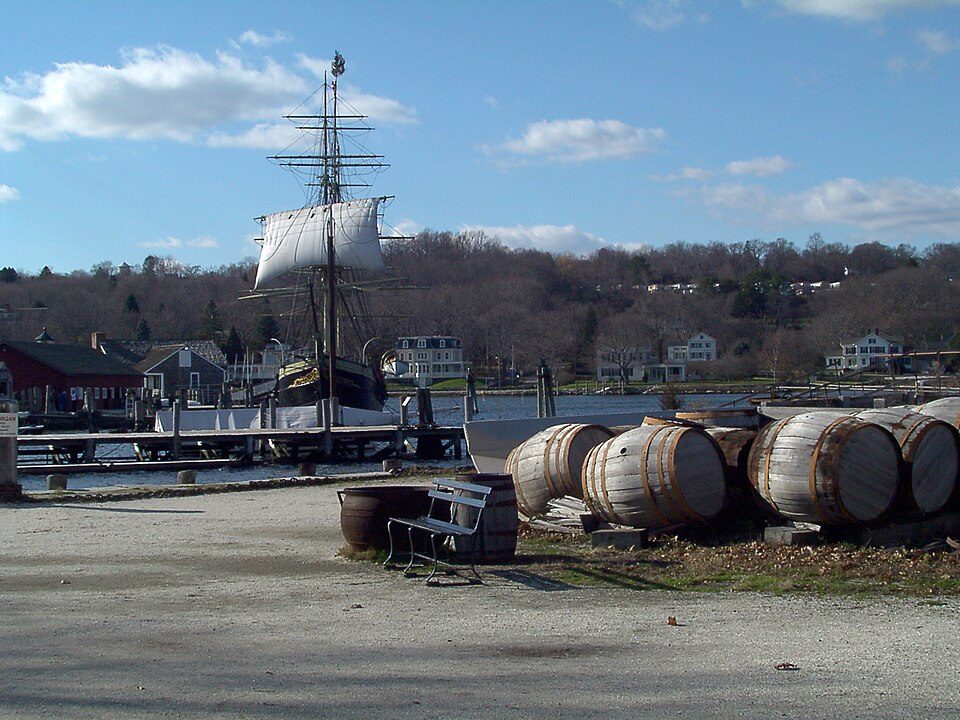 10 mi MuseumMystic Seaport
 4 mi MuseumSubmarine Force Library and Museum150K visitors a year
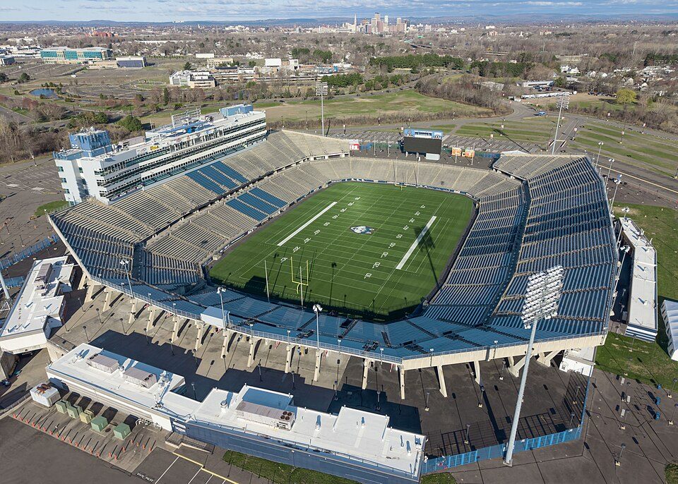 33 mi Stadium & arenaPratt & Whitney Stadium
Photo credits
Mohegan Sun Arena: Bbjeter, CC BY-SA 3.0 · Gillette Castle State Park: Original uploader was Kevinpepin at en.wikipedia, Public domain · PeoplesBank Arena: PeoplesBank Arena, CC BY 2.5 · Mystic Seaport: Joethon, Public domain · Submarine Force Library and Museum: Flickr user : https://www.flickr.com/photos/divemasterking2000, CC BY 2.0 · Pratt & Whitney Stadium: Quintin Soloviev, CC BY 4.0


Moving to Oxoboxo River: who provides what
Oxoboxo River is unincorporated, so New London County and regional agencies provide most services.
EPA SDWIS (Oct 9, 2026) · HIFLD + EIA-861 2025 · Census 2020 ZCTAs · NCES 2024–25 · registration: vote.gov, updated Sep 30, 2026.
The data
Ordered by what stands out in Oxoboxo River.
Oxoboxo River has 0.7 jobs for every working resident, so most commute out
Most working residents leave Oxoboxo River for work: only 3% work in town. The median household income in Oxoboxo River is $69,000. The top destinations are Groton (17%), Montville (14%) and Norwich (8%).
| Oxoboxo River | Connecticut towns | U.S. towns | |
|---|---|---|---|
| Median household income | $69,000 | $109,000 | $80,000 |
| Average trip to work | 25 minutes | 27 minutes | 25 minutes |
Where working residents work
Census LEHD 2023 · ACS
High risk in Oxoboxo River, with inland flooding at the top
Expected storm and flood damage is higher than in 72% of U.S. communities.
FEMA National Risk Index · OpenFEMA
Oxoboxo River has four seasons and pleasant summers
Oxoboxo River has chilly winters and pleasant summers. July afternoons reach 83°, January nights drop to 21° and about 28 inches of snow falls in a winter.
Typical low → high °F
NOAA U.S. Climate Normals, 1991–2020
More of Oxoboxo River’s adults have high blood pressure than in the typical Connecticut or U.S. town
39% of Oxoboxo River adults have high blood pressure. Oxoboxo River beats the Connecticut average on 4 of 32 CDC measures and trails it on 9. 33% of Oxoboxo River adults have obesity.
| Oxoboxo River | Connecticut towns | U.S. towns | |
|---|---|---|---|
| High blood pressure (CDC PLACES) | 39% | 33% | 35% |
| Frequent physical distress (CDC PLACES) | 15% | 12% | 14% |
| Get no exercise (CDC PLACES) | 28% | 22% | 25% |
| Yearly checkup (CDC PLACES) | 82% | 81% | 79% |
| What stands out | Oxoboxo River | CT |
|---|---|---|
| Fewer adults facing housing insecurity | 10.2% | 12.5% |
| Fewer adults facing a utility shut-off | 7% | 8.4% |
| More adults with COPD | 7.9% | 5.6% |
CDC PLACES 2025 · modeled estimates for adults · CMS · HRSA
| Biggest places to walk | Trails | Acres |
|---|---|---|
| 1. Oakdale Road Open Space | — | 16 |
| 2. Moxley Road Open Space | — | 6 |
| 3. Lynch Hill Road Open Space | — | 1 |
Trails & parks © OpenStreetMap contributors · Conserved land: USGS PAD-US
Homes in Oxoboxo River sell for about $355K
67% of households own their home in Oxoboxo River.
| Oxoboxo River | Connecticut towns | U.S. towns | |
|---|---|---|---|
| Households that own their home | 67% | 81% | 73% |
| Median rent | $1,179 a month | $1,450 a month | $1,185 a month |
Census ACS, 2020–24 · Zillow Home Value Index · Redfin Data Center
Everything we know about Oxoboxo River
Colleges nearby
4 within 15 miles of the center of Oxoboxo River
About 2 of every 100 Oxoboxo River residents are enrolled in college, against 7 across Connecticut.
About Oxoboxo River
Census-designated place in Connecticut, United States
Oxoboxo River () is a census-designated place (CDP) in the town of Montville in New London County, Connecticut, United States. The population was 2,938 at the 2000 census, 3,165 at the 2010 census, and 2,955 at the 2020 census. The statistical area encompasses the town center of Montville, as well as the adjacent villages of Palmertown and Uncasville. The name of the statistical area is from the river of the same name running through the CDP. The U.S. Postal Service includes the entire area of the CDP in ZIP code 06382, for which the USPS uses "Uncasville" as the place name. The Uncasville ZIP code also encompasses the Mohegan reservation, including the Mohegan Sun casino complex, and other…
From Wikipedia, licensed CC BY-SA 4.0 · facts via Wikidata (CC0)
- Area
- 4.5 sq mi
- Elevation
- 138 ft
- Area code
- 860
Oxoboxo River’s neighbors
4 towns share a border with Oxoboxo River.
| Town | CT rank | Overall | Cost | Safety | Schools | Health |
|---|---|---|---|---|---|---|
| Oxoboxo River | — | — | — | — | — | — |
| Montville | #105 | B− | C+ | — | C+ | A− |
| Ledyard | #67 | B+ | D | A | B− | A |
| Gales Ferry | — | — | — | — | — | — |
| Waterford | #92 | B | C− | B | B− | A− |
Montville reports no FBI crime data of its own. Oxoboxo River and Gales Ferry aren’t graded (fewer than 1,000 residents, or not enough data). Compare Oxoboxo River with a neighbor →
Questions about Oxoboxo River
Short answers, built from the data on this page.
Is Oxoboxo River, CT a good place to live?
We don’t grade Oxoboxo River yet; the figures below are still real.