Founding year: Wikidata. First post office: 1792.The full story ↓
History grade
What drives Litchfield’s History grade
On its age, its old homes and the National Register, Litchfield is among the most historic 1% of U.S. towns. All 3 inputs put Litchfield near the top nationally; its share of homes from before 1940 ranks highest.
A+
HistoryA character grade: shown, never part of Litchfield’s overall grade.
Connecticut towns list more on the Register than most of the country (a typical Connecticut town has 73.3 per 10,000 residents, the U.S. 2.4), so Litchfield’s 3,813 sits above most of its state (99% of Connecticut towns have fewer) while its 477 historic buildings outnumber those of 97% of U.S. towns.
NoteThe founding year comes from Wikidata alone; no second source gives 1719.
How sure. Graded on any two of the three inputs instead, the letter would still be A+. The pre-1940 share is a Census survey estimate (±11.3 points).
Founding year: Wikidata (other dates in Quick answers). Homes: Census ACS 2020–24. National Register: National Park Service, May 2026 list; each listing counted once (boundary changes and added documentation belong to their listing), and a historic district counts its contributing buildings. How TownRatings grades history →
What stands out about Litchfield’s past
Read from the archive, the National Register and the record. The page puts what stands out first.
Originally called Bantam township, Litchfield incorporated in 1719. The town derives its name from Lichfield, in England.
In 1751 it became the county seat of Litchfield County, and at the same time the borough of Litchfield (incorporated in 1879) was laid out. From 1776 to 1780, two depots for military stores and a workshop for the Continental army were maintained in Litchfield. A leaden statue of George III, erected on the Bowling Green in New York City in 1770, was torn down by citizens on July 9, 1776, cut up and then taken to Litchfield, where, in the house of Oliver Wolcott, it was melted into bullets for the Continental Army by Wolcott's daughter and sister.
Passages that mention Litchfield, cut from the printed page as they were published.
History of the town of Litchfield, Connecticut1845 · page 25Read the page →
Read the text
ants, and Deputies in General Court assembled, and by the authoriiy of the same, that whosoever hath or ought to have been an Inhabitant and is a proprietor of any of the Lands within the said Town of Litchfield, or have deserted and left said Town since difficulties have arisen there on the account of an Enemy, and shall neglect for the space of one month after the rising of this Assembly to return to the said Town and there abide, or send some man in their room and stead to per-
Text read by machine from the scan; it may contain errors.
Sketches and chronicles of the town of Litchfield, Connecticut1859 · page 169Read the page →
Read the text
munication of town with town. Turnpike Com})anies were organized in all parts of the State, and turnpike stock was regarded by capitalists as a safe, profitable and permanent investment. The Litchfield and New Milford Turnpike Company was incorporated in October, 1797 ; the Litchfield and Harwinton Company, in October, 1798 ; and the Litchfield and Canaan Company, in May, 1799. Then followed Straits' Turnpike, from Litchfield to New Haven, the Litchfield and
Text read by machine from the scan; it may contain errors.
The history of the town of Litchfield, Connecticut, 1720-19201920Read the page →
Read the text
was until after 1750, and this was the case in England as much or nearly as much as in New England. In the English records of the early Seventeenth Century, Lichfield is spelled Litchfield very frequently; and there is still a small village of Litchfield in the northern part of the county of Hampshire. In Windsor, where so many of our first settlers came from, we find resident about 1700 a certain John Wichfield, whose name was also often spelled Witchfield and gradually took this form exclusively. On the whole it
Text read by machine from the scan; it may contain errors.
The history of the town of Litchfield, Connecticut, 1720-19201920 · page 27Read the page →
Read the text
The earliest records of the town of Litchfield are found in the Becord Book of the Proprietors in Hartford and of the Town Meetings in Litchfield. This old manuscript covers all the ground from 1715 to 1803. The long narrow pages are often difficult to decipher from age and from the unusual characters of the ancient caligraphy. It is without doubt the most valuable and curious single volume in our town. Through the wise forethought of our Town- Clerk, George H. Hunt, these old pages have been faced with trans-
Text read by machine from the scan; it may contain errors.
Scans and text from the Internet Archive. Books published in 1930 or earlier, which are in the public domain.
Timeline
Litchfield, 1719 to 1940
Woven from the archive, old maps, post office records, the National Register and the people born here.
Nothing in the archives for these yearsWeddings on Main Street, storms, parades, school pictures, the old store. If it’s in your family album, it belongs here.
Fire insurance maps drew every building, what it was made of and what it was used for, so insurers could price the risk of fire. Pick a year, then a sheet.
In 1719, according to Wikidata. Litchfield’s post office opened in 1792, and the first U.S. census counted 20,342 people here in 1790.
How does Litchfield rank for history?
Litchfield is among the most historic 1% of U.S. towns. The History grade combines the town’s founding era, the share of homes built before 1940 and its National Register listings. It’s a character grade, so it isn’t part of the overall grade. How it works.
How old are the homes in Litchfield?
51% of Litchfield’s homes were built before 1940 (Census estimate, ±11.3 points), against a typical 15% for a Connecticut town; the median home was built in 1938.
Founding dates: Wikidata, Wikipedia, the U.S. post office records of Blevins & Helbock (CC0) and the Census. Homes by year built: Census ACS 2020–24. National Register of Historic Places: National Park Service (list of May 22, 2026). Old photos, postcards and papers: Wikimedia Commons, the Library of Congress and other public archives, credited on each item’s page. Maps: U.S. Geological Survey historical topographic maps (via Esri) and Sanborn fire-insurance maps (Library of Congress). History text and census tables: Wikipedia (CC BY-SA 4.0). Places that used to be: USGS Geographic Names Information System (2021).
From Wikimedia Commons (19), the Library of Congress (3), Wikidata (2), Wikipedia, Wikidata and Wikipedia for famous people, U.S. Geological Survey historical maps, U.S. Census counts (via Wikipedia), Sanborn fire insurance maps (Library of Congress) and old county and town histories (Internet Archive). Archive images are copied here with their credits and licenses, shown on each photo’s page. Refreshed monthly.


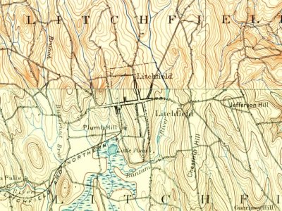


 1906
 1907
 1909
 2011
 2011
 2011
 2011
 2011
 2011
 2011
 2011
 2011
 2011
 2011
 2010
 2007
 2006
 2004

