Guest, Sign inJoin

Post to Fairfield

We’ll email a one-tap link to publish your post. No password, and nothing is public until you click it.
Already a member? Sign in
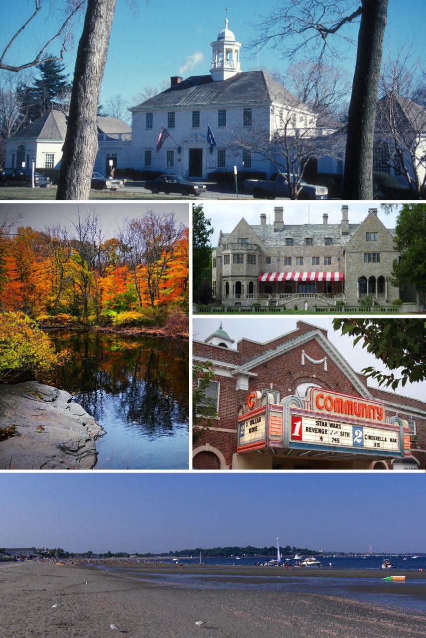
Fairfield photo montagePhoto: Aab254 · CC BY-SA 4.0
A−Outdoors
Outdoors in Fairfield

Fairfield has 48 miles of mapped trails, 1.6 for every square mile of land

The biggest trail networks: Lake Mohegan Recreation Area (7.6 mi), Roy & Margot Larsen Sanctuary (5.9 mi), Brett Woods Open Space (4.3 mi). 85% of residents live within a half mile of a park. 4% of Fairfield’s land is conserved, about 848 acres.

Ahead of 76% of U.S. towns · #105 of 155 in Connecticut. What drives it

Conserved land
4%
848 acres · of 29.9 sq mi of land
Trails
48 mi
1.6 per sq mi of land
Park land
734 ac
12 acres per 1,000 residents
Near a park
85%
of residents within ½ mile
Highest peak
440 ft
Hoyden Hill
Lakes & rivers
30
16 beaches · 3 boat launches

What kind of outdoors town is Fairfield?

Read from the map. The page puts what stands out first.

Outdoors grade

How much outdoors does Fairfield have?

On conserved land, trails, park land and how close residents live to a park, Fairfield is ahead of 76% of U.S. towns, #105 of 155 in Connecticut. All four inputs are above most U.S. towns; trail miles rank highest, park acres per resident lowest.

A−
OutdoorsA character grade: shown, never part of Fairfield’s overall grade.
All U.S. towns we grade (21,298)Ahead of 76%
LessMore
Connecticut towns of 2,500+ (155)Ahead of 32%

Connecticut towns conserve more land than most (a typical one, 15%; the U.S., 4%), so Fairfield’s 4% is ahead of 3% of Connecticut towns, while its trails per square mile lead 64% of them.

How sure. Graded on any three of the four inputs instead, the letter would range from B to A−. Trails and many small parks come from OpenStreetMap, mapped by volunteers, so coverage varies from town to town; the half mile is a straight line from each census block, so a river or highway in the way isn’t counted against it.

PAD-US, OpenStreetMap (© OpenStreetMap contributors), Census 2025 Gazetteer and 2020 blocks; details in Sources below. How TownRatings grades the outdoors →

The map

Conserved land, trails & bike routes

Tap a number to zoom to a park. Tap a layer to hide it.

12345678
Easements protect land from building but are usually private.© OpenStreetMap contributors · USGS PAD-US
Places to walk

Pick a walk

The longest trail network is Lake Mohegan Recreation Area, with 7.6 miles. Directions go to the nearest trailhead or public parking.

Lake Mohegan Recreation Area

Park
171 acres7.6 mi of trail
Dog rules not recorded
Directionsto the parking lot

Roy & Margot Larsen Sanctuary

Managed by Connecticut Audubon Society
156 acres5.9 mi of trail
Dear Meadow LoopEdna Strub Chiboucas Special Use TrailDirty Swamp TrailChipmunk Run+1
Dogs usually not allowed
Directionsto the parking lot

Brett Woods Open Space

Park
191 acres4.3 mi of trail
Dog rules not recorded
Directionsto the parking lot

Grace Richardson Conservation Area Open Space

Nature preserve
86 acres2.7 mi of trail
Dog rules not recorded
Directionsto the parking lot

Hoydens Hill Open Space

Park
60 acres2 mi of trail
Dog rules not recorded
Directionsto the parking lot

Springer Glen

Nature preserve
37 acres1.2 mi of trail
Dog rules not recorded
Directionsto the parking lot

Mountain Laurel Park Open Space Area

Nature preserve
25 acres1.2 mi of trail
Dog rules not recorded
Directionsto the parking lot

Ash Creek Open Space

Park
25 acres1.2 mi of trail
Dog rules not recorded
Directionsto the parking lot
All 77 parks & preserves
Lake Mohegan Recreation Area171 acres · 7.6 mi of trail
Directions
Roy & Margot Larsen Sanctuary156 acres · 5.9 mi of trail · Connecticut Audubon Society
Directions
Brett Woods Open Space191 acres · 4.3 mi of trail
Directions
Grace Richardson Conservation Area Open Space86 acres · 2.7 mi of trail
Directions
Hoydens Hill Open Space60 acres · 2 mi of trail
Directions
Springer Glen37 acres · 1.2 mi of trail
Directions
Mountain Laurel Park Open Space Area25 acres · 1.2 mi of trail
Directions
Ash Creek Open Space25 acres · 1.2 mi of trail
Directions
Tunxis Hill Park25 acres · 1.1 mi of trail
Directions
Drew Park10 acres · 0.9 mi of trail
Directions
Fairfield Village Green19 acres · 0.7 mi of trail
Directions
Old Dam Road Marsh Open Space34 acres · 0.6 mi of trail
Directions
Ernest Hillman Jr. Nature Preserve11 acres · 0.6 mi of trail · Aspetuck Land Trust
Acorn Lane Uplands Preserve6 acres · 0.5 mi of trail · Aspetuck Land Trust
Pine Creek Marsh67 acres · 0.4 mi of trail
Directions
Putnam Preserve8 acres · 0.4 mi of trail · Aspetuck Land Trust
Riverside Park5 acres · 0.4 mi of trail
Directions
Butkus Pond Preserve4 acres · 0.3 mi of trail · Aspetuck Land Trust
Directions
Owen Fish Park11 acres · 0.2 mi of trail
Directions
Samp Mortar Rock10 acres · 0.2 mi of trail
Burroughs Park5 acres · 0.2 mi of trail
Directions
Old Field Marsh Open Space33 acres · 0.1 mi of trail
Gould Manor Park13 acres · 0.1 mi of trail
Directions
Gould Manor Walking Paths6 acres · 0.1 mi of trail
Directions
Gypsy Springs Open Space4 acres · 0.1 mi of trail
Directions
Melville Playground4 acres · 0.1 mi of trail
Mary A. Katona Open Space2 acres · 0.1 mi of trail
Audubon Center at Fairfield2 acres · 0.1 mi of trail · Audubon
Directions
Fairfield Town Gazebo1 acres · 0.1 mi of trail
Directions
Perrys Millponds Open Space56 acres
Municipal Open Space (Hoydens Lane)26 acres
Directions
Welch Terrace Marsh Open Space24 acres
Directions
Southport Park14 acres
Directions
Mill Hollow Park13 acres
Morehouse Highway12 acres
Directions
L. A. Sturges Park9 acres
Directions
Veterans Park9 acres
Denise A. D. Dougiello Park8 acres
Directions
Municipal Open Space (Blue Bell Lane)8 acres
Sturges Ponds Open Space7 acres
Tanaka Park7 acres
Birdcraft Museum & Sanctuary6 acres · CT Audubon Society
Directions
Hulls Highway-Arbor Drive Open Space6 acres
Wakeman Boys & Girls Club5 acres
Directions
Henry Rowland Memorial Playground4 acres
Directions
Highwood Park4 acres
Sasco River-Kirik Open Space3 acres
Lobdell Calf Pond Preserve3 acres · Aspetuck Land Trust
Veres Park3 acres
Directions
Knapps Green3 acres
Directions
Trillium Road Open Space3 acres
Sasco Creek Marsh Open Space3 acres
Directions
Dover Park2 acres
Jennings Park2 acres
Directions
Mill Plain Green2 acres
Directions
Timothy Dwight Park2 acres
Westway Road Open Space2 acres
Nutmeg Lane2 acres
Mill River Open Space2 acres
Old Fording Place2 acres
Directions
Woodside Circle Open Space1 acres
Directions
Sunnie Holm Park1 acres
Directions
Lincoln Park1 acres
Directions
Palmers Neck Park1 acres
Directions
Congress Place1 acres
New England Avenue Playground1 acres
Directions
Flower House Drive Open Space1 acres
Rugby Park1 acres
Directions
Whitewood Knoll1 acres
Directions
Horse Tavern Brook Open Space1 acres
Perry"s Green1 acres
Ludlowe Road Community Park1 acres · Ludlow Park Association
Directions
Greenfield Hill Village Green1 acres
Sargent Murphy Memorial Plaground1 acres
Directions
Birchbrook Park1 acres
Pine Creek Avenue Playground1 acres
Windmill Open Space1 acres
Who protects it

848 conserved acres

4% of Fairfield’s land. Who manages Fairfield’s conserved land, from the USGS Protected Areas Database. Approximate, because parcels can overlap.

Town or city219 ac
State conservation36 ac
Not recorded603 ac
Local Other or Unknown · 246 acLocal Park · 240 acPrivate Conservation · 226 acWatershed Protection Area · 91 acUnknown Easement · 36 ac
Good to know

Conserved doesn’t always mean open to visitors. 36 acres are conservation easements, usually private land. Public access isn’t recorded for 40 of 60 parcels. The walks above are places people visit.

The biggest protected parcels
Parcel (PAD-US)Managed byAcresPublic access
Unknown
Private Conservation
Not recorded299Unknown
Lake Mohegan Recreation Area
Local Park
Town or city112Open
The State Of Connecticut
Watershed Protection Area
Not recorded89Unknown
Old Dam Road--marsh
Local Other or Unknown
Not recorded51Unknown
Brett Woods
Local Other or Unknown
Not recorded40Unknown
Springer Green
Local Park
Town or city36Open
Mount Laurel Park
Local Other or Unknown
Not recorded23Unknown
South Pine Creek Park
Local Park
Town or city21Open
Perry's Mill Ponds
Local Other or Unknown
Not recorded17Unknown
Southport Park
Local Park
Not recorded16Open

5 smaller protected places aren’t shown.

Things to do

93 places to go in Fairfield

Beaches, playgrounds, peaks, falls and more. Pick a kind.

Beaches in Fairfield
Fairfield Beach
Directions
Fairfield Beach
Directions
Fairfield Public Beach
Directions
Jennings Beach
Directions
Lake Mohegan BeachIn Lake Mohegan Recreation Area
Directions
Penfield Beach
Directions
Sasco Hill Beach
Directions
South Pine Creek Beach
Directions
1 more beach
Southport Beach
Directions

Plus 7 beaches without a name on the map. Tap “Show all on map” to see them.

Trails & water

21 named trails and 30 lakes & rivers

Named trails
Horses · 0.5 miUnpaved · 16.1 mi
Dear Meadow Loop0.8 mi
Edna Strub Chiboucas Special Use Trail0.7 mi
Dirty Swamp Trail0.5 mi
Saint Timothy's Loop0.3 mi
Chipmunk Run0.3 mi
Serenity Loop0.3 mi
Muskrat Hollow0.3 mi
West Woods Trail0.3 mi
Ox Cart Trail0.2 mi
Sturges Pond Trail0.2 mi
11 more trails
Ash Creek Path
0.2 mi
Rock Ledge Trail
0.2 mi
Dear Meadow Trail
0.2 mi
Fragrance Loop
0.2 mi
Azalea Trail
0.2 mi
Streamside Trail
0.1 mi
Trillium Trail
0.1 mi
Cottontail Cutoff
0.1 mi
Stream Side Trail
0.1 mi
Old Farm Trail
0.1 mi
Sturges End Trail
0.1 mi
Lakes & rivers tap for directions
Biking & sports

0.0 miles of bike routes

Bike lanes are often missing from the map in smaller towns, so that number is likely low.

Courts & fields
87Tennis
25Baseball
21Soccer
14Basketball
6Softball
6Football
6Pickleball
3Lacrosse

Includes school and college facilities, which aren’t always open to the public.

History along the way

13 places on the National Register, 2 of them National Historic Landmarks

The country’s official list of places worth saving (National Park Service). The map also marks 9 historic points from OpenStreetMap: plaques, memorials and old buildings.

History →
★
Birdcraft SanctuaryNational Historic Landmark · Site · listed 1982
About it
★
Jonathan Sturges HouseNational Historic Landmark · Building · listed 1984
About it
Greenfield Hill Historic DistrictDistrict · listed 1971
About it
Fairfield Historic DistrictBuilding · listed 1971
About it
Southport Historic DistrictDistrict · listed 1971
About it
Bronson WindmillStructure · listed 1971
About it
David Ogden HouseBuilding · listed 1979
About it
John Osborne HouseBuilding · listed 1987
About it
Fairfield Railroad StationsBuilding · listed 1989
About it
Southport Railroad StationsBuilding · listed 1989
About it
Pine Creek Park BridgeStructure · listed 1992
About it
Greenfield Hill Grange #133Building · listed 2008
About it

1 more on the History page.

When to get out

The best walking months in Fairfield: April to September

NOAA’s 1991–2020 normals for the town and the daylight at its latitude. Outlined months have long days, highs of 59 to 86 °F and little rain for the place.

JanFebMarAprMayJunJulAugSepOctNovDec
Daylight (h)9.510.611.813.314.515.114.913.812.411.09.89.2
High (°F)384148607079848275645343
Rain (in)3.63.14.24.33.94.43.94.04.54.53.84.4

February is the driest month (3.1 in) and July the warmest (highs of 84 °F). 4.5 inches fall in October, the wettest month. The climate in Fairfield →

Next door

Fairfield and its neighbors

Fairfield has the most mapped trails of the 8 towns around it. Tap a town to see its outdoors.

TownConserved
of land
Trail mi
per sq mi
Park acres
per 1,000
Near a park
½ mile
Outdoors
Fairfield4%1.61285%A−
Bridgeport7%1.4590%B+
Westport7%0.72672%A−
Easton20%1.32435%A−
Staples— not graded: under 1,000 residents or part of its town
Weston13%1.71966%A−
Southport— not graded: under 1,000 residents or part of its town
Greens Farms— not graded: under 1,000 residents or part of its town

The four inputs of the Outdoors grade, from the engine; shares are of land, not water.

Questions about parks and trails in Fairfield

Where can I hike in Fairfield?

The longest trail networks: Lake Mohegan Recreation Area, 7.6 miles; Roy & Margot Larsen Sanctuary, 5.9 miles; Brett Woods Open Space, 4.3 miles; Grace Richardson Conservation Area Open Space, 2.7 miles. Each one is on the map above, with directions to the nearest trailhead or parking.

How much of Fairfield is conserved land?

4% of its land, against a typical 15% for a Connecticut town and 4% nationally (PAD-US). Conserved doesn’t always mean open to visitors: easements are usually private land.

Are dogs allowed on Fairfield’s trails?

Lake Mohegan Recreation Area and Roy & Margot Larsen Sanctuary don’t have dog rules recorded on the map; check the signs at the trailhead.

Is there public land near Fairfield?

9,535 acres of parks and open public land lie inside Fairfield or within 10 miles of it (PAD-US), 734 of them inside the town line.

How much outdoors does Fairfield have?

Ahead of 76% of U.S. towns on the Outdoors grade, #105 of 155 in Connecticut. The grade combines the share of land that is conserved, miles of mapped trail per square mile of land, park acres per 1,000 residents and the share of residents within a half mile of a park. It’s a character grade, so it isn’t part of the overall grade. How it works.

Trail talk

Conditions, parking and favorite walks from Fairfield neighbors.

Town Square →
Share a tip
Sources

Where this page comes from

Conserved and public land: USGS Protected Areas Database of the United States (PAD-US), service updated July 2026. Parks, trails, playgrounds, beaches and other places: OpenStreetMap (© OpenStreetMap contributors, ODbL), map data as of 2026-10-28. Land and water area: Census 2025 Gazetteer. Residents near a park: 2020 Census blocks. National Register: National Park Service. How TownRatings grades the outdoors →