382 years in pictures
Census counts: 1,180 in 1820, 28,273 in 2020. The archive holds 18 old photos and papers going back to 1670 and 6 maps from 1892 on.
31 places on the National Register of Historic Places.
- 1644Branford is settled
Each edition grades its towns against each other only.

For most people who can afford it, yes. Branford grades B overall, 90th among Connecticut's 151 graded towns. Residents are healthier than 88% of U.S. towns on CDC estimates and the median household earns $105K. The catch is cost: homes are expensive, about $462K for a typical one and 5.2 times the New Haven metro’s $88K median household income. History is its standout character grade: an A+, better than 97% of U.S. towns, with 32 places on the National Register. Branford’s trail density is 2.7 miles per square mile, against 1.3 in Connecticut’s towns and 0.4 across U.S. towns. Its National Register listings include Branford Electric Railway Historic District and Branford Point Historic District. Branford is more walkable than 81% of U.S. towns.
Where Branford beats most towns.
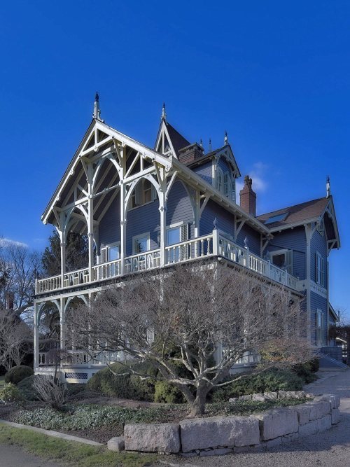
Stick Style House at Stony Creek| Widest gap | Branford | CT |
|---|---|---|
| Fewer adults facing food insecurity | 8.7% | 14.9% |
Census counts: 1,180 in 1820, 28,273 in 2020. The archive holds 18 old photos and papers going back to 1670 and 6 maps from 1892 on.
31 places on the National Register of Historic Places.
Each subject compared with towns across the country (schools within Connecticut), ordered by how far Branford is from typical.
How TownRatings grades towns →
Museums, parks, gardens and other places to visit around Branford. Close and well known come first.
9 mi Stadium & arenaYale Bowl
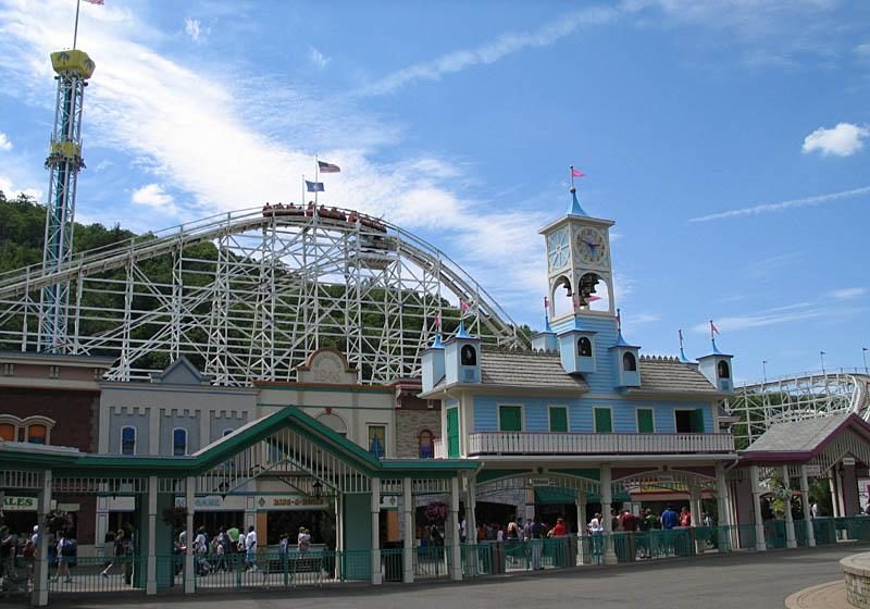
26 mi Theme parkLake Compounce
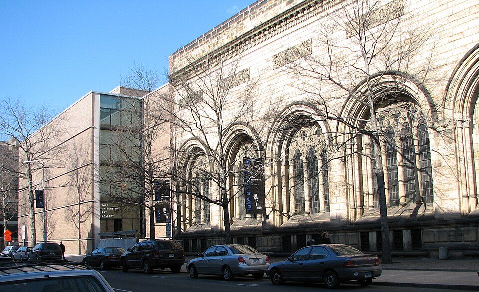
8 mi MuseumYale University Art Gallery
34 mi Stadium & arenaPeoplesBank Arena
8 mi MuseumYale Center for British Art
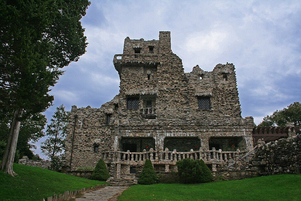
21 mi State parkGillette Castle State ParkYale Bowl: Kenneth Zirkel, CC BY-SA 4.0 · Lake Compounce: Wildcat1 at English Wikipedia, Public domain · Yale University Art Gallery: Ragesoss, Public domain · PeoplesBank Arena: PeoplesBank Arena, CC BY 2.5 · Yale Center for British Art: Sage Ross, Public domain · Gillette Castle State Park: Original uploader was Kevinpepin at en.wikipedia, Public domain
Who provides power, water and the rest in Branford, and how to reach them.
EPA SDWIS (Oct 9, 2026) · HIFLD + EIA-861 2025 · Census 2020 ZCTAs · NCES 2024–25 · registration: vote.gov, updated Sep 30, 2026.
Ordered by what stands out in Branford.
Branford trades workers with New Haven and other neighbors, is safe by national standards but not by Connecticut’s and is healthy by national standards but mid-pack in Connecticut.
74 miles of trail in 23 parks and preserves. The biggest place to walk is Lake Saltonstall Watershed Reserve Land, 1,097 acres with 11.7 miles of trail.
| Biggest places to walk | Trails | Acres |
|---|---|---|
| 1. Lake Saltonstall Watershed Reserve Land | 11.7 mi | 1,097 |
| 2. Supply Ponds Preserve | 7.5 mi | 353 |
| 3. Saltonstall Mountain Preserve | 2.9 mi | 153 |
Trails & parks © OpenStreetMap contributors · Conserved land: USGS PAD-US
Its public schools are run by the Branford School District. Two of its 6 schools are below, each with why it’s listed. The largest public high school is Branford High School, with 738 students.
| School | Level | Students | Letter |
|---|---|---|---|
| Francis Walsh Intermediate SchoolLargest public middle schoolGrades 5–8 | Grades 5–8 | 775 | B− |
| Branford High SchoolLargest public high schoolGrades 9–12 | Grades 9–12 | 738 | B |
NCES · EDFacts · graded within CT on state tests and graduation
Within Connecticut it is healthier than 50% of the 154 graded towns: Connecticut sets a high bar. Its widest gap with Connecticut is food insecurity: 8.7% of its 23,972 adults worry about having enough food, against 14.9% statewide.
14% of Branford adults binge drink, where Connecticut’s towns sit at 16% and U.S. towns at 16%. 9.1% of adults smoke cigarettes in Branford. Branford beats the Connecticut average on 12 of 32 CDC measures and trails it on 4.
| Branford | Connecticut towns | U.S. towns | |
|---|---|---|---|
| Binge drink (CDC PLACES) | 14% | 16% | 16% |
| Frequent mental distress (CDC PLACES) | 14% | 15% | 17% |
| Smoke cigarettes (CDC PLACES) | 9.1% | 9.7% | 14% |
| Yearly checkup (CDC PLACES) | 82% | 81% | 79% |
| What stands out | Branford | CT |
|---|---|---|
| Fewer adults facing food insecurity | 8.7% | 14.9% |
| Fewer uninsured adults | 6% | 10% |
| More adults who have had cancer | 11% | 8.5% |
CDC PLACES 2025 · modeled estimates for adults · CMS · HRSA
People 65 and older are 30% of residents (19% statewide); children under 18 are 14% of residents (20% statewide). Branford’s median age is 54.2 years. 52% of adults 25 and older have a bachelor’s degree or more, vs 43% across Connecticut.
| Branford | Connecticut towns | U.S. towns | |
|---|---|---|---|
| Median age | 54.2 years | 44.4 years | 40.5 years |
| Aged 65 or older | 30% | 20% | 18% |
| Under 18 | 14% | 19% | 22% |
| Bachelor’s degree or more, 25+ | 52% | 45% | 29% |
51% women, 49% men
That’s an even split within the survey’s margin of ±1.6 points. Across Connecticut, 50.9% of residents are women. Median age: women 55.4, men 52.4.
| Branford | CT | U.S. | |
|---|---|---|---|
| Under 10 | 7.4% | 10.4% | 11.6% |
| 10 to 17 | 6.6% | 9.8% | 10.3% |
| 18 to 24 | 5.7% | 9.3% | 9.1% |
| 25 to 34 | 10.5% | 12.6% | 13.7% |
| 35 to 44 | 9% | 12.7% | 13.2% |
| 45 to 54 | 11.8% | 12.5% | 12.2% |
| 55 to 64 | 18.7% | 14.2% | 12.7% |
| 65 to 74 | 17.9% | 10.7% | 10.2% |
| 75 and older | 12.4% | 7.8% | 7% |
| No diploma | 4.2% | 8.5% | 10.4% |
| High school | 21.9% | 25.3% | 26% |
| Some college | 13.4% | 16.1% | 19.1% |
| Associate’s | 8.9% | 7.6% | 8.8% |
| Bachelor’s | 27.8% | 23.3% | 21.6% |
| Graduate | 23.7% | 19.2% | 14.1% |
U.S. Census Bureau · ACS 2020-2024 5-year estimates
Branford has chilly, snowy winters and pleasant summers. July afternoons reach 84°, January nights drop to 23° and about 34 inches of snow falls in a winter.
NOAA U.S. Climate Normals, 1991–2020
Branford has about as many jobs (11,545) as working residents, but only 1,999 people both live and work here.
Most working residents leave Branford for work: only 15% work in town. The average trip to work in Branford is 24 minutes. The top destinations are New Haven (22%), Guilford (4%) and North Haven (4%).
| Branford | Connecticut towns | U.S. towns | |
|---|---|---|---|
| Working residents who work in town | 15% | 11% | 8% |
| Average trip to work | 24 minutes | 27 minutes | 25 minutes |
| Work from home | 16% | 15% | 11% |
| Median household income | $105,000 | $109,000 | $80,000 |
Census LEHD 2023 · ACS
588 flood insurance claims have been filed here, and 125 properties have flooded more than once.
Expected storm and flood damage is higher than in 57% of U.S. communities. Since 1978, 588 flood insurance claims have been paid out in Branford.
FEMA flood insurance claims · FEMA National Risk Index · OpenFEMA
At 17.4 crimes per 1,000 residents a year, it reports more crime than 64% of Connecticut’s graded towns. Reported crimes fell from 576 to 256 over the last three FBI years, a drop beyond ordinary year-to-year swings.
FBI crime data, 2025 · crimes reported to police
Typical home values rose 6.8% in the year to September 2026. 70% of Branford households own their home.
| Branford | Connecticut towns | U.S. towns | |
|---|---|---|---|
| Households that own their home | 70% | 81% | 73% |
| Median rent | $1,565 a month | $1,448 a month | $1,185 a month |
Census ACS, 2020–24 · Zillow Home Value Index · Redfin Data Center
5 within 15 miles of the center of Branford
About 5 of every 100 Branford residents are enrolled in college, against 7 across Connecticut.
Coastal flooding makes up 11% of the storm damage FEMA expects here.
FEMA National Risk Index · OpenFEMA · OpenStreetMap
31 places in Branford on the National Register of Historic Places.
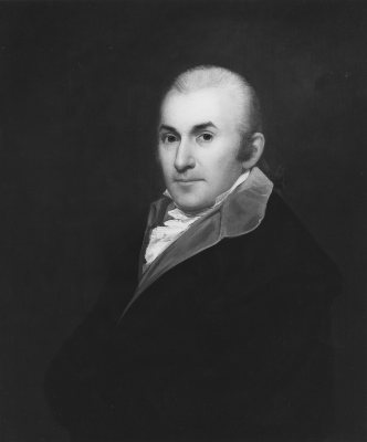
22 notable people were born in Branford.


Town in Connecticut, United States
Branford is a shoreline town located on Long Island Sound in New Haven County, Connecticut, United States, about 6 miles (10 km) east of downtown New Haven. The town is part of the South Central Connecticut Planning Region. Branford borders East Haven to the west, Guilford to the east, and North Branford to the north. The population was 28,273 in the 2020 census.
From Wikipedia, licensed CC BY-SA 4.0 · facts via Wikidata (CC0)
3 towns share a border with Branford.
| Town | CT rank | Overall | Cost | Safety | Schools | Health |
|---|---|---|---|---|---|---|
| Branford | #90 | B | D | B− | B− | A |
| East Haven | #130 | C− | C− | C+ | C− | B− |
| Guilford | #40 | A− | D | B+ | A− | A |
| North Branford | #76 | B | D | A− | B | A |
Short answers, built from the data on this page.
For most people who can afford it, yes. Branford grades B overall, better than 56% of U.S. towns and #90 of 151 in Connecticut. It grades A for health, B− for safety and B− for schools. Cost of living is its weak spot, with a D.
Yes. Cost of living, which also weighs rents, property taxes and how many households pay 30% or more of their income for housing, grades D.
22 notable people were born here, including Alex Deibold and Henry B. Plant.