Bloomfield’s post office opened in 1835, and 7 of its places are on the National Register
More historic than 53% of U.S. towns · #148 of 155 in Connecticut. What drives it
Most of Bloomfield was built recently: 7% of its homes predate 1940 and the median home dates from 1970. Below: 2 old photos and papers, maps from 1892 on, and the census since 1850.
The Bloomfield post office opened in 1835, the earliest record of the town by name. Two smaller post offices, Wintonbury (1816) and North Bloomfield (1885), opened inside today’s town and later closed.
First census: 1,412 in 1850191 years
How historic is Bloomfield?
B−
More historic than 53% of U.S. towns, on its age, its old homes and the National Register.
Founding year: the first Bloomfield post office (Blevins & Helbock, CC0).The full story ↓
History grade
What drives Bloomfield’s History grade
On its age, its old homes and the National Register, Bloomfield is more historic than 53% of U.S. towns, #148 of 155 in Connecticut. Its age holds the grade up; its share of homes from before 1940 pulls it down.
B−
HistoryA character grade: shown, never part of Bloomfield’s overall grade.
Connecticut towns list more on the Register than most of the country (a typical Connecticut town has 73.3 per 10,000 residents, the U.S. 2.4), so Bloomfield’s 6.0 sits below most of its state (4% of Connecticut towns have fewer) while its 13 historic buildings outnumber those of 77% of U.S. towns.
How sure. Graded on any two of the three inputs instead, the letter would range from C to B. The pre-1940 share (±1.9 points) is firm at this size. The founding year is the first post office, not a stated founding date.
Founding year: the first post office (other dates in Quick answers). Homes: Census ACS 2020–24. National Register: National Park Service, May 2026 list; each listing counted once (boundary changes and added documentation belong to their listing), and a historic district counts its contributing buildings. How TownRatings grades history →
What stands out about Bloomfield’s past
Read from the archive, the National Register and the record. The page puts what stands out first.
Originally land of the Poquonock Native Americans, the area was first settled in 1660 as part of Windsor, organized as the Parish of Wintonbury in 1736. Wintonbury comes from three names from neighboring towns Windsor, Farmington, and Simsbury. It was finally incorporated as the town of Bloomfield by the Connecticut General Assembly on May 28, 1835. Initially, the town's local economy was agriculturally based, mostly in shade tobacco, remaining as such until it developed as a postwar suburb of Hartford starting in the 1950s. Today, Bloomfield's local character varies. While the town's southern and eastern fringes are more densely populated and developed, the northern and western sections maintain a more rural feel with meadows, woods, and some remaining farmland.
Passages that mention Bloomfield, cut from the printed page as they were published.
History of ancient Windsor, Connecticut, including East Windsor, South Windsor, and Ellington, prior to 1768, the date of their separation from the old town1859 · page 379Read the page →
Read the text
In 1845, Wintonbury parish, together with a portion of Poquonnoc society in Windsor, was incorporated as the town of Bloomfield. To this was added, in 1840, a portion of Simsbury, known as Scotland parish. The town of Bloomfield, as now constituted, is bounded n. and e. by Windsor, s. by Hartford, and w. by Simsbury, and averages four miles in length and breadth. On the east border of the town there is a forest extending the whole length of the township, and about one and a
Text read by machine from the scan; it may contain errors.
History of ancient Windsor, Connecticut, including East Windsor, South Windsor, and Ellington, prior to 1768, the date of their separation from the old town1859 · page 632Read the page →
Read the text
paired, and without applying for admission to the Bar, he relinquished his legal studies, and settled upon his patrimony, as a farmer. Upon taking the electoral oath in 1832, he was chosen to represent the town of Windsor in the General Assembly. Again, in 1838, he received the same appointment from the town of Bloomfield, which had, three years before, been incorporated by the legislature. In both cases he acquitted himself as a fearless and eloquent legislator. It was in 1S38 that questions touching the subject of slavery were first pressed upon ihe attention of the legislature. Mr. G. did not hesitate to range himself on the side of freedom, and advocate the claims of justice and humanity. His speech on the proposition to
Text read by machine from the scan; it may contain errors.
Scans and text from the Internet Archive. Books published in 1930 or earlier, which are in the public domain.
Timeline
Bloomfield, 1807 to 1976
Woven from the archive, old maps, post office records, the National Register and the people born here.
Nothing in the archives for these yearsWeddings on Main Street, storms, parades, school pictures, the old store. If it’s in your family album, it belongs here.
The Bloomfield post office opened in 1835, the earliest record of the town by name (U.S. post office records).
How does Bloomfield rank for history?
Bloomfield is more historic than 53% of U.S. towns, #148 of 155 in Connecticut. The History grade combines the town’s founding era, the share of homes built before 1940 and its National Register listings. It’s a character grade, so it isn’t part of the overall grade. How it works.
What is on the National Register in Bloomfield?
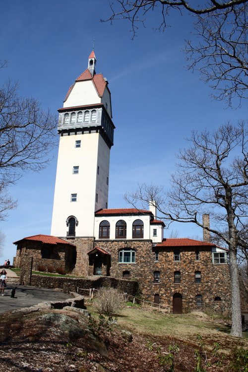
7 listings: 7 buildings, among them the Old Farm Schoolhouse (listed 1972, the first). 13 historic buildings in all.
How old are the homes in Bloomfield?
7% of Bloomfield’s homes were built before 1940 (Census estimate, ±1.9 points), against a typical 15% for a Connecticut town; the median home was built in 1970.
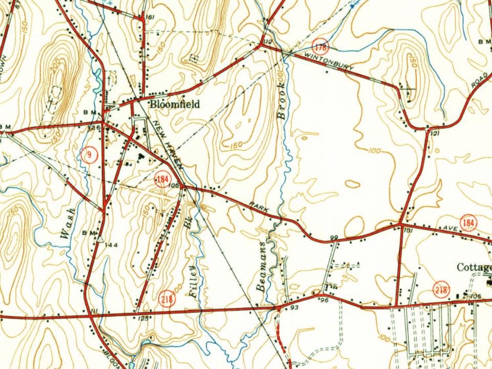
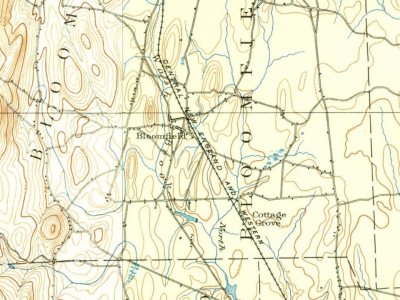
Founding dates: Wikidata, Wikipedia, the U.S. post office records of Blevins & Helbock (CC0) and the Census. Homes by year built: Census ACS 2020–24. National Register of Historic Places: National Park Service (list of May 22, 2026). Old photos, postcards and papers: Wikimedia Commons, the Library of Congress and other public archives, credited on each item’s page. Maps: U.S. Geological Survey historical topographic maps (via Esri) and Sanborn fire-insurance maps (Library of Congress). History text and census tables: Wikipedia (CC BY-SA 4.0). Places that used to be: USGS Geographic Names Information System (2021).
From Wikimedia Commons (7), the Library of Congress (4), Wikidata (1), the National Register of Historic Places (7), Wikipedia, Wikidata and Wikipedia for famous people, U.S. Geological Survey historical maps, U.S. Census counts (via Wikipedia), the US Post Offices dataset (Blevins & Helbock), the USGS Geographic Names Information System and old county and town histories (Internet Archive). Archive images are copied here with their credits and licenses, shown on each photo’s page. Refreshed monthly.







 2011
 2011
 2011
 2011
 2011
 2010
 2010
 2010
 2007


