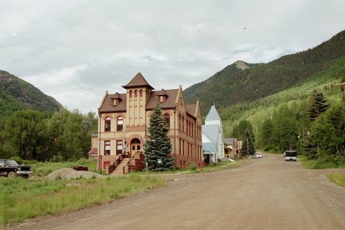
Rico’s post office opened in 1879, and 29% of its homes were built before 1940
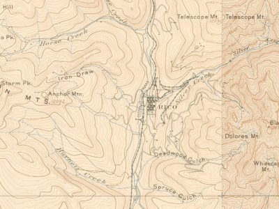
Its Register listings are the Rico City Hall, the William Kauffman House and the Dey Building. Below: 2 old photos and papers, maps from 1886 on, and the census since 1880.
Lost two-thirds of its people between 1890 and 1980, then grew 3-fold.
15 censuses, 1880–2020.
U.S. Census Bureau decennial counts, from the census table on Rico’s Wikipedia page.
Every building
Rico, building by building, 1886–1899
Fire insurance maps drew every building, what it was made of and what it was used for, so insurers could price the risk of fire. Pick a year, then a sheet.
1886Sheet 1 of 1
Edition
Sheets
BrickWoodStone
Sanborn Map Company, via the Library of Congress. Editions published in 1930 or earlier, which are in the public domain.
The story so far
Rico, in brief
Wikipedia doesn’t have a history of Rico yet. The photos, dates and memories neighbors add here are how it gets written.
Rico is a town in eastern Dolores County, Colorado, United States. It was settled in 1879 as a silver mining center in the Pioneer Mining District; today it functions as a historic and tourism site. The population was 288 at the 2020 census. Its current form of government is that of a home rule municipality. Rico is a name derived from Spanish meaning "rich".
Its first post office opened in 1879. Between the 2010 and 2020 censuses its population grew from 265 to 288 (+9%).
Intro from Wikipedia. Population: U.S. Census Bureau.
Timeline
Rico, 1870 to 1897
Woven from the archive, old maps, post office records, the National Register and the people born here.
Alma Mater MinemineAtlantic Cable MinemineBadger Tunnel MinemineBancroft MinemineBen Group MinemineBurns Group MinemineEagle Tunnel MinemineEighty-eight Tunnel MinemineEnterprise MinemineFutura MinemineGolden Fleece MinemineGraysill MinemineHibernia MinemineHicks MinemineIron Dollar MinemineKey Group MinemineLarson MinemineLucky Boy Minemine
US Post Offices dataset (Blevins & Helbock, CC0). Places and cemeteries from the USGS Geographic Names Information System (2021).
Questions about Rico’s history
What year was Rico founded?
The Rico post office opened in 1879, the earliest record of the town by name (U.S. post office records).
What is on the National Register in Rico?
Three places: the Rico City Hall (listed 1974), the William Kauffman House (1982) and the Dey Building (1999).
Founding dates: Wikidata, Wikipedia, the U.S. post office records of Blevins & Helbock (CC0) and the Census. Homes by year built: Census ACS 2020–24. National Register of Historic Places: National Park Service (list of May 22, 2026). Old photos, postcards and papers: Wikimedia Commons, the Library of Congress and other public archives, credited on each item’s page. Maps: U.S. Geological Survey historical topographic maps (via Esri) and Sanborn fire-insurance maps (Library of Congress). History text and census tables: Wikipedia (CC BY-SA 4.0). Places that used to be: USGS Geographic Names Information System (2021). How TownRatings grades history →
From Wikimedia Commons (6), Wikidata (1), the National Register of Historic Places (3), U.S. Geological Survey historical maps, U.S. Census counts (via Wikipedia), the US Post Offices dataset (Blevins & Helbock), the USGS Geographic Names Information System and Sanborn fire insurance maps (Library of Congress). Archive images are copied here with their credits and licenses, shown on each photo’s page. Refreshed monthly.


 c. 1870
 2021
 2021
 2019
 2008