Fairplay dates to 1859, and 6 of its places are on the National Register
Most of Fairplay was built recently: 9% of its homes predate 1940 and the median home dates from 1994. 6 places in town are on the National Register, among them a historic district with 28 buildings. Below: 3 old photos and papers, maps from 1960 on, and the census since 1890.
A historic gold mining settlement, the town was founded in 1859 during the early days of the Pike's Peak Gold Rush. The town was named by settlers who were upset by the generous mining claims given to the earliest prospectors and promised a more equitable system for its residents. The Fair Play, Colorado Territory, post office opened on August 2, 1861, and on November 7, 1867, county voters selected Fair Play as the new seat of Park County, Colorado Territory. The Town of Fair Play was incorporated on November 15, 1872, and changed the spelling of its name to Fairplay on October 1, 1924.
Nothing in the archives for these yearsWeddings on Main Street, storms, parades, school pictures, the old store. If it’s in your family album, it belongs here.
Between 183 and 739 people in every census since 1890.
14 censuses, 1890–2020.
U.S. Census Bureau decennial counts, from the census table on Fairplay’s Wikipedia page.
Questions about Fairplay’s history
What year was Fairplay founded?
In 1859, according to Wikidata. Fairplay’s post office opened in 1862, and the census of 1890 counted 301 people here.
What is on the National Register in Fairplay?
6 listings: 5 buildings, among them the Summer Saloon (listed 1974, the first), and 1 historic district, the South Park City Museum, with 28 contributing buildings. 34 historic buildings in all.
Founding dates: Wikidata, Wikipedia, the U.S. post office records of Blevins & Helbock (CC0) and the Census. Homes by year built: Census ACS 2020–24. National Register of Historic Places: National Park Service (list of May 22, 2026). Old photos, postcards and papers: Wikimedia Commons, the Library of Congress and other public archives, credited on each item’s page. Maps: U.S. Geological Survey historical topographic maps (via Esri) and Sanborn fire-insurance maps (Library of Congress). History text and census tables: Wikipedia (CC BY-SA 4.0). Places that used to be: USGS Geographic Names Information System (2021). How TownRatings grades history →
From Wikimedia Commons (12), the National Register of Historic Places (6), Wikipedia, U.S. Geological Survey historical maps, U.S. Census counts (via Wikipedia), the US Post Offices dataset (Blevins & Helbock) and the USGS Geographic Names Information System. Archive images are copied here with their credits and licenses, shown on each photo’s page. Refreshed monthly.


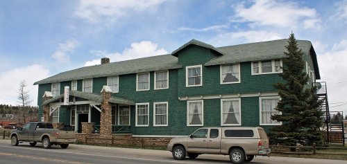


 2010
 2010
 2010
 2010
 2007
 2007
 2007
 2005
 2003
