 Top
National Historic Site · 1898–1929Seager Wheeler's Maple Grove FarmHighway 312Photo: Canadian2006 · CC BY-SA 3.0 · Commons file
 Seager Wheeler's Maple Grove Farm · Photo: Canadian2006 · CC BY-SA 3.0
1historic place on the registers
History of Rosthern No. 403 · Canada’s heritage registers
One place in Rosthern No. 403, at the top of the registers
Per resident Rosthern No. 403 outdoes 92% of Canadian towns, with 3.6 for every 10,000 people. That place is Seager Wheeler's Maple Grove Farm, a national historic site, from 1898.
Historic places
1
3.6 per 10,000 residents
Highest designations
1
National Historic Sites and Classified Federal Heritage Buildings
Oldest building
1898
the first construction date on its record
Homes built before 1961
28%
typical town: 18%
Through time
Old pictures of Rosthern No. 403
The oldest view of one of its historic places, made before 1950. A tap opens it at full size, with its credit.
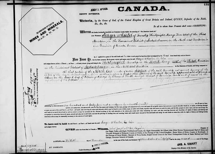 c. 1898
Public domain or CC0, made before 1950, from Wikimedia Commons; old views of places can be drawings, prints or maps of their time. Each credit opens the image’s page.
The map
Where Rosthern No. 403’s history is
Every place on the registers inside the town, by its designation.
Highest designations
Names show on hover, and a tap takes you to the place’s page.
The 1, by tier
1 Highest designations
Most entries are federal, from Parks Canada’s Directory of Federal Heritage Designations; local listings outside Québec are known only through Wikidata items with an article.
Points from Wikidata (Parks Canada’s files carry none) and from Québec’s register, as mapped there.
Highest designations
One place in Rosthern No. 403 with the highest designation
National Historic Sites and Classified Federal Heritage Buildings, Canada’s highest federal recognition. Each one opens its own page.
Around the town
Battle of Tourond's Coulee / Fish Creek, 24 km from Rosthern No. 403, is the closest
The oldest, Carlton House, dates from 1810, 42 km away. They belong to 17 towns, chiefly Central Business District, Haultain and Buena Vista. Among them are 18 provincial or municipal listings, 10 National Historic Sites and a heritage railway station.
The 12 nearest, within 50 km
| Battle of Tourond's Coulee / Fish CreekNational Historic Site · 1885 · 24 km away, in Aberdeen No. 373 |
| WanuskewinNational Historic Site · 31 km away, in Corman Park No. 344 |
| Doukhobor Dugout HouseNational Historic Site · 1899–1900 · 33 km away, in Laird No. 404 |
| Vonda RinkMunicipal heritage property · 1942 · 34 km away, in Aberdeen No. 373 |
| Forestry Farm Park and ZooNational Historic Site · 38 km away, in Evergreen |
| BatocheNational Historic Site · 1870–1931 · 39 km away, in St. Louis No. 431 |
| Next of Kin Memorial AvenueNational Historic Site · 1922–1924 · 40 km away, in North Park |
| Battle of Duck LakeNational Historic Site · 1885 · 40 km away, in Beardy's 97 and Okemasis 96 |
| All Saints Anglican ChurchMunicipal heritage property · 1896 · 40 km away, in Duck Lake No. 463 |
| College BuildingNational Historic Site · 1910–1913 · 40 km away, in Grosvenor Park |
| Rugby ChapelMunicipal heritage property · 1912 · 41 km away, in University |
| Victoria SchoolMunicipal heritage property · 1888 · 41 km away, in Grosvenor Park |
Homes by age
Rosthern No. 403 is still building: 9.4% of homes date from 2016 to 2021, against 4.1%
Only 13% of Rosthern No. 403’s homes were built from 1981 to 2000, less than the typical town’s 23%. Before 1961: 28% of Rosthern No. 403’s homes, against 18% in most towns. Homes built from 2001 to 2015 make up 26% of Rosthern No. 403’s, against 15% in the typical town.
28%
Before 1961
25%
1961–80
13%
1981–2000
26%
2001–15
9.4%
2016–21
Rosthern No. 403Typical town
2021 Census, private dwellings by period of construction (Statistics Canada); the typical town is the middle Canadian town of 2,500 or more.
Neighbours
Rosthern No. 403 and its neighbours
| Town | People | Places | Highest | Oldest |
|---|---|---|---|---|
| Rosthern No. 403 | 2,791 | 1 | 1 | 1898 |
| Osler | 1,473 | 0 | 0 | — |
| Laird No. 404 | 1,488 | 0 | 0 | — |
| Waldheim | 1,447 | 0 | 0 | — |
In brief
Rosthern No. 403 in brief
Older stock first: 28% of homes in Rosthern No. 403 were standing by 1961, against 18% in the typical town. The count is 1 historic place, one with the highest designation, with Seager Wheeler's Maple Grove Farm first. Otherwise the figures are ordinary: it has one historic place, about typical for a town its size (the middle one has 1); and its designation dates from 1994.
How to read these numbers
What this data can and can’t tell you
- People and events. The open directory puts its national historic persons nowhere, so a town shows one only on firm ground: a birth there, matched by name and life years, or a historic place there named for the person whose record says so. Events are left out.
- Protection. Being on these registers doesn’t mean a building can’t change. Federal designation commemorates; protection is provincial or municipal, and those lists aren’t open here.
- Provincial and municipal lists. Outside Québec, provinces’ and municipalities’ heritage registers aren’t open data; their places are known only through Wikidata items with a register number, and only those with an encyclopedia article get a page.
- Map points. Federal places get their map points from Wikidata, since Parks Canada’s files carry none; they are as mapped there.
- The tiers. National Historic Sites and the most protected buildings form the top tier; recognized federal buildings, stations and lighthouses the second; provincial and municipal listings the third.
- The federal register. Parks Canada’s Directory of Federal Heritage Designations lists every National Historic Site, federal heritage building, heritage railway station and lighthouse; the Canadian Register of Historic Places adds their statements in English and French.
- The grade. History isn’t one of Canada’s graded pillars, so this page describes and compares without a letter.
Questions about Rosthern No. 403’s history
Which places in Rosthern No. 403 have the highest designation?
It is Seager Wheeler's Maple Grove Farm.
What is the oldest building in Rosthern No. 403?
Seager Wheeler's Maple Grove Farm (National Historic Site): the first construction date on its record is 1898.
How old are the homes in Rosthern No. 403?
28% of its homes were built before 1961, against 18% in the typical Canadian town.
Contains information licensed under the Open Government Licence – Canada (Parks Canada).
Sources: Parks Canada, Directory of Federal Heritage Designations · Canadian Register of Historic Places (federal extract) · Wikidata (CC0) for map points, other names and articles · Statistics Canada, 2021 Census (homes by period of construction). Under the Statistics Canada Open Licence.
Adapted from Statistics Canada (Census of Population 2021, population estimates 2025, 2021 census boundaries) under the Statistics Canada Open Licence; this does not constitute an endorsement by Statistics Canada. Neighbourhood names in some cities © OpenStreetMap contributors (ODbL).