Centre d'exposition de Val-David
Centre d'exposition de Val-David is an art gallery in Val-David. 3 more places to visit are within 5 km. For a second stop, Ski Chantecler is 8.6 km away.
Art gallery in Val-David
Inside Val-David
Inside Val-David’s municipal boundary: Centre d'exposition de Val-David. Towns near it ↓
Drawn from OpenStreetMap, Wikidata, ODCAF and the heritage registers, with Statistics Canada’s 2021 outlines and ECCC’s 1991–2020 normals.
The seasons here
Highs of 19–25°C mark May to September in Val-David.
Centre d'exposition de Val-David
Inside the town’s municipal boundary: in Val-David.
- Type
- Art gallery
- Town
- in Val-David
The essentials
Locating Centre d'exposition de Val-David
Orange: Centre d'exposition de Val-David.
© OpenStreetMap contributors · Numbers: the places near it, as listed below. The dashed line is Val-David’s municipal boundary. · Statistics Canada 2021 outline
Staying near Centre d'exposition de Val-David
Sainte-Adèle is the biggest of the 8 bases nearby (15,216 people). Start with its own town; the others follow by distance.
- 1Val-David
- 2Val-Morin
- 3Sainte-Agathe-des-Monts
- 4Sainte-Marguerite-du-Lac-Masson
- 5Sainte-Adèle
- 6Sainte-Lucie-des-Laurentides
- 7Saint-Adolphe-d'Howard
- 8Morin-Heights
Val-David
Val-Morin
Sainte-Agathe-des-Monts
Sainte-Marguerite-du-Lac-Masson
Compare the 8 towns
| Town | Where Centre d'exposition de Val-David is | People | Places to visit |
|---|---|---|---|
| Val-David | It’s in town | 5,920 | 6 |
| Val-Morin | 1.5 km southeast of it | 3,226 | 6 |
| Sainte-Agathe-des-Monts | 2.1 km west of it | 12,154 | 6 |
| Sainte-Marguerite-du-Lac-Masson | 4.2 km east of it | 3,842 | 1 |
| Sainte-Adèle | 4.9 km southeast of it | 15,216 | 13 |
| Sainte-Lucie-des-Laurentides | 8.3 km north of it | 1,651 | 1 |
| Saint-Adolphe-d'Howard | 14 km southwest of it | 3,974 | 6 |
| Morin-Heights | 15 km south of it | 5,086 | 6 |
Also near Centre d'exposition de Val-David
A visit can add 6 ski hills, a theme park and a museum, from 10 places within 15 km.
 Ski hillMont-Avalanche13 km away3Theme parkTheme parkVillage Du Père Noël1.7 km away4
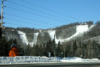 Ski hillSki Mont Gabriel13 km away5Ski hillSki hillBelle Neige3.3 km away6MuseumMuseumMusée Zénon-Alary12 km away7Ski hillSki hillSommet Olympia15 km away8Ski hillSki hillVallée Bleue1.2 km away
Within 15 km, close and well known first. Numbers match the map.
Questions before you go
Where is Centre d'exposition de Val-David?
Inside the town’s municipal boundary: Centre d'exposition de Val-David is in Val-David, Quebec.
What is Centre d'exposition de Val-David?
Art gallery.
When is the best time to visit Centre d'exposition de Val-David?
In Val-David, May to September are the warmest, with afternoon highs of 19–25°C (ECCC 1991–2020 normals).
Sources: © OpenStreetMap contributors (ODbL), Wikidata (CC0), Statistics Canada’s ODCAF (Open Government Licence – Canada), the federal and Québec heritage registers, Statistics Canada 2021 census boundaries, ECCC 1991–2020 climate normals (Open Government Licence – Canada).
Photos: each place’s Wikidata image, from Wikimedia Commons under the licence below (our copy, resized).
Photo credits (2)
- Mont-Avalanche: D7g8d, CC BY 4.0, Wikimedia Commons
- Ski Mont Gabriel: P199, CC BY-SA 4.0, Wikimedia Commons
Adapted from Statistics Canada (Census of Population 2021, population estimates 2025, 2021 census boundaries) under the Statistics Canada Open Licence; this does not constitute an endorsement by Statistics Canada. Neighbourhood names in some cities © OpenStreetMap contributors (ODbL).