Vallée Bleue
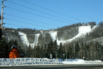
Vallée Bleue is a ski hill you can visit in Val-David. Within 5 km there are 3 more places to visit. Nearby, Ski Chantecler (8.3 km) leads the list.
Ski hill in Val-David
Inside Val-David
Vallée Bleue is a place to visit inside Val-David’s municipal boundary. Towns near it ↓
Drawn from OpenStreetMap, Wikidata, ODCAF and the heritage registers, with Statistics Canada’s 2021 outlines and ECCC’s 1991–2020 normals.
Seasons in Val-David
In Val-David, May to September bring the warmest days: highs of 19–25°C.
Vallée Bleue
Location: in Val-David, within the town’s municipal boundary.
- Type
- Ski hill
- Town
- in Val-David
Where it sits
Orange shows Vallée Bleue; numbers mark the places near it.
© OpenStreetMap contributors · The dashed line is Val-David’s municipal boundary. · Statistics Canada 2021 outline
Towns near Vallée Bleue
With 15,216 people, Sainte-Adèle is the largest of the 8. Each of these towns lists it on its own page of things to do.
- 1Val-David
- 2Sainte-Agathe-des-Monts
- 3Val-Morin
- 4Saint-Adolphe-d'Howard
- 5Sainte-Adèle
- 6Sainte-Lucie-des-Laurentides
- 7Sainte-Marguerite-du-Lac-Masson
- 8Morin-Heights
Val-David
Sainte-Agathe-des-Monts
Val-Morin
Saint-Adolphe-d'Howard
Compare the 8 towns
| Town | Where Vallée Bleue is | People | Places to visit |
|---|---|---|---|
| Val-David | It’s in town | 5,920 | 6 |
| Sainte-Agathe-des-Monts | 1.4 km west of it | 12,154 | 6 |
| Val-Morin | 1.6 km southeast of it | 3,226 | 6 |
| Saint-Adolphe-d'Howard | 4.4 km southwest of it | 3,974 | 6 |
| Sainte-Adèle | 4.6 km southeast of it | 15,216 | 13 |
| Sainte-Lucie-des-Laurentides | 9.3 km north of it | 1,651 | 1 |
| Sainte-Marguerite-du-Lac-Masson | 12 km northeast of it | 3,842 | 1 |
| Morin-Heights | 15 km south of it | 5,086 | 6 |
More near Vallée Bleue
6 ski hills, a theme park and a museum are among the 11 within 15 km.
 Ski hillMont-Avalanche12 km away3Ski hillSki hillSki Morin Heights15 km away4Theme parkTheme parkVillage Du Père Noël1.2 km away5
 Ski hillSki Mont Gabriel13 km away6Ski hillSki hillBelle Neige2.4 km away7MuseumMuseumMusée Zénon-Alary12 km away8Ski hillSki hillSommet Olympia15 km away
Within 15 km, close and well known first. Numbers match the map.
A visit to Vallée Bleue: questions
Where is Vallée Bleue?
Vallée Bleue is in Val-David in Quebec, and inside the town’s municipal boundary.
What is Vallée Bleue?
Ski hill.
When is the best time to visit Vallée Bleue?
In Val-David, afternoons are warmest from May to September, at 19–25°C (ECCC 1991–2020 normals).
Sources: © OpenStreetMap contributors (ODbL), Wikidata (CC0), Statistics Canada’s ODCAF (Open Government Licence – Canada), the federal and Québec heritage registers, Statistics Canada 2021 census boundaries, ECCC 1991–2020 climate normals (Open Government Licence – Canada).
Photos: each place’s Wikidata image, from Wikimedia Commons under the licence below (our copy, resized).
Photo credits (2)
- Mont-Avalanche: D7g8d, CC BY 4.0, Wikimedia Commons
- Ski Mont Gabriel: P199, CC BY-SA 4.0, Wikimedia Commons
Adapted from Statistics Canada (Census of Population 2021, population estimates 2025, 2021 census boundaries) under the Statistics Canada Open Licence; this does not constitute an endorsement by Statistics Canada. Neighbourhood names in some cities © OpenStreetMap contributors (ODbL).