 Top
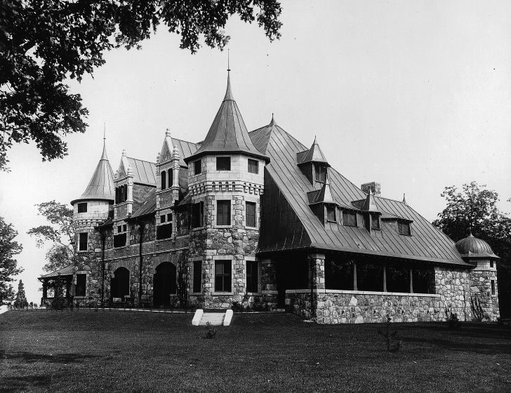
National Historic Site · 1860–1931Senneville Historic DistrictPhoto: Wm. Notman & Son · Public domain · Commons file
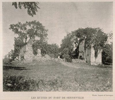
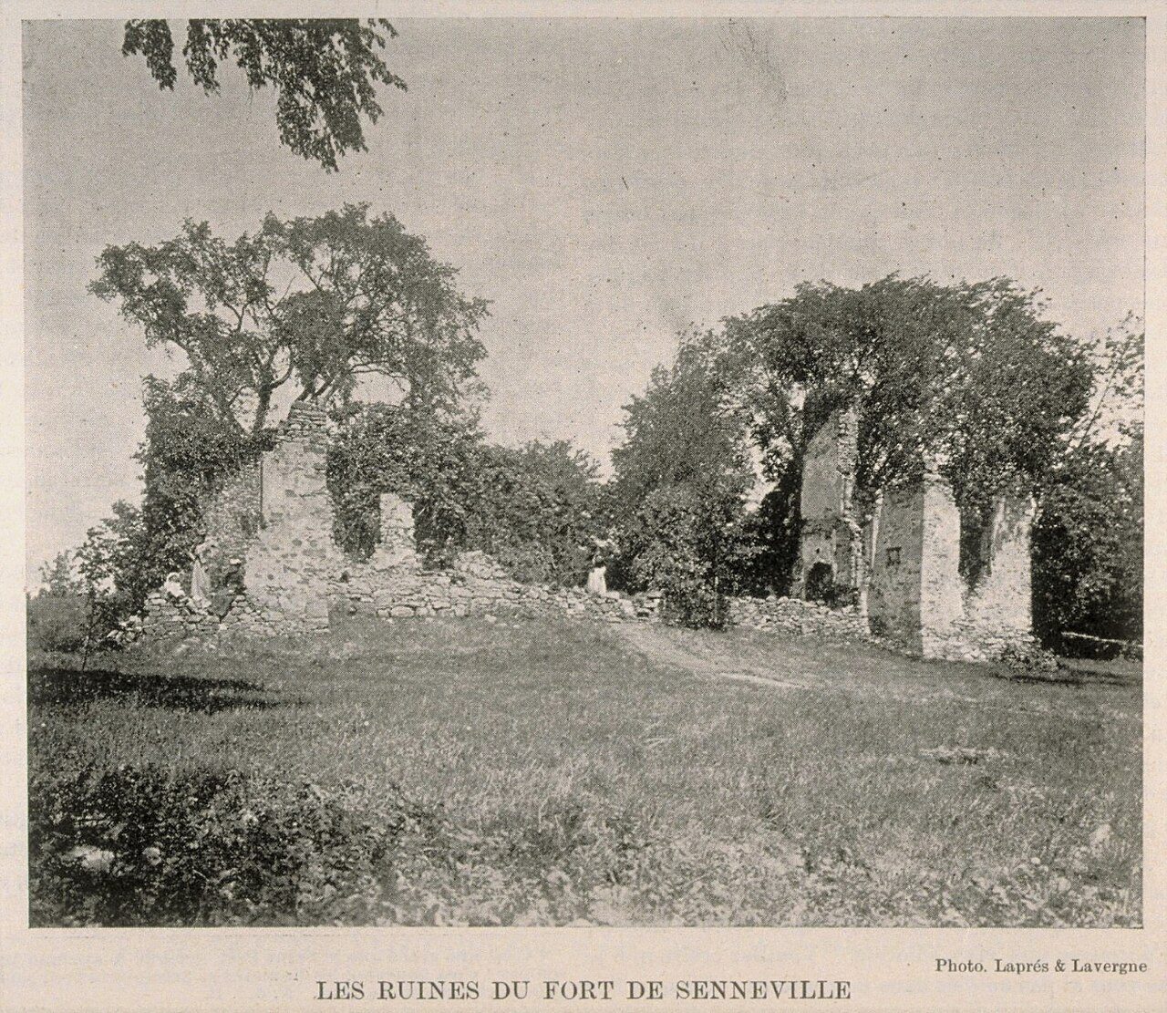 Fort Senneville · Public domain
2historic places on the registers
History of Senneville · Canada’s heritage registers
Senneville’s record starts in 1702 with Fort Senneville
Homes from before 1961 make up 59% of Senneville’s stock, above the 18% of the typical town. All 2 historic places listed here are of the highest rank. Wikidata gives 1679 for the municipality, whether that is when it was founded, incorporated or merged. A further one sits a short way past the edge of town.
Historic places
2
Highest designations
2
National Historic Sites, classified federal buildings and Québec’s classements
Oldest building
1702
the first construction date on its record
Homes built before 1961
59%
typical town: 18%
In pictures
All 2 top-tier places in Senneville, pictured
Both places on Senneville’s registers have a photo here. 2 of Senneville’s places also have old views on their own pages. In front: Fort Senneville and Senneville Historic District.
Photos from Wikimedia Commons, each credited to its photographer with its licence; names open the place’s page. Tap a photo to step through them full screen.
Through time
The past of Senneville, 1839 to 1895
By date: the oldest views of 2 of its historic places. Hover a dot for its date; tap a picture to see it full screen.
 c. 1839
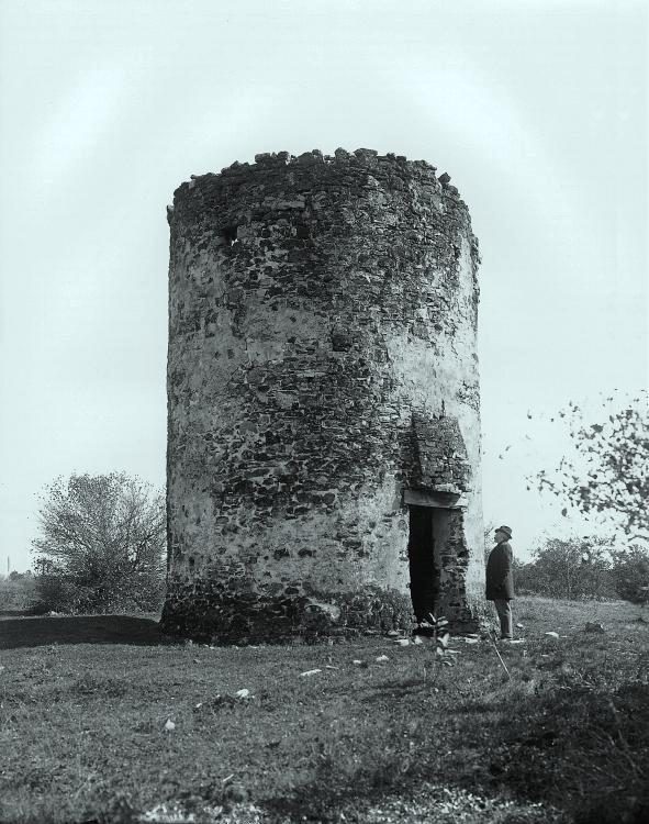 c. 1895
Public domain or CC0, made before 1950, from Wikimedia Commons; old views of places can be drawings, prints or maps of their time. Each credit opens the image’s page.
The map
Where Senneville’s history is
Every place on the registers inside the town, by its designation.
Highest designations
Dots open their places’ pages; hover first to read the name.
The 2, by tier
2 Highest designations
Federal designations come from Parks Canada; Québec’s own register adds what the province has classified and what the municipality has cited.
Points from Wikidata (Parks Canada’s files carry none) and from Québec’s register, as mapped there.
Highest designations
2 places in Senneville with the highest designation
Fort Senneville is the earliest, from 1702; the latest dates from 1860. By designation: a National Historic Site and a place classified by Québec. National Historic Sites and Classified Federal Heritage Buildings, Canada’s highest federal recognition. Each one opens its own page.
 Top
Around the town
Leave Senneville and the first historic place is Maison Simon-Fraser, 1.3 km away
The oldest, Maison Rangé-dit-Laviolette, dates from 1700, 4.3 km away. Count to 5 km and there are 6. Between them, 3 towns share them, mainly Vaudreuil-Dorion, Sainte-Anne-de-Bellevue and Baie-D'Urfé.
The 6 nearest, within 5 km
| Maison Simon-FraserClassified heritage building (Québec) · 1790–1810 · 1.3 km away, in Sainte-Anne-de-Bellevue |
| Sainte-Anne-de-Bellevue CanalNational Historic Site · 1840–1844 · 1.4 km away, in Sainte-Anne-de-Bellevue |
| Site archéologique de l'Île-aux-TourtesClassified heritage site (Québec) · 2.7 km away, in Vaudreuil-Dorion |
| Maison Rangé-dit-LavioletteMunicipal citation (Québec) · 1700 · 4.3 km away, in Baie-D'Urfé |
| Maison du Chanoine-Lionel-GroulxCited heritage site (Québec) · 4.9 km away, in Vaudreuil-Dorion |
| Trestler HouseClassified heritage building (Québec) · 1798 · 4.9 km away, in Vaudreuil-Dorion |
Just outside Senneville: 1
| Battle of the Lake of Two MountainsNational Historic Site · 100 m outside the town |
Homes by age
Only 2.8% of Senneville’s homes were built from 2016 to 2021 (4.1% is typical)
Half of the homes standing in Senneville today were built before 1961. Only 0% of Senneville’s homes were built from 2001 to 2015, less than the typical town’s 15%. Senneville built little from 1981 to 2000: 13% of its homes, where most towns have 23%.
59%
Before 1961
24%
1961–80
13%
1981–2000
0%
2001–15
2.8%
2016–21
SennevilleTypical town
2021 Census, private dwellings by period of construction (Statistics Canada); the typical town is the middle Canadian town of 2,500 or more.
Neighbours
Senneville and its neighbours
| Town | People | Places | Highest | Oldest |
|---|---|---|---|---|
| Senneville | 1,042 | 2 | 2 | 1702 |
| Sainte-Anne-de-Bellevue | 5,393 | 1 | 1 | 1790 |
| L'Île-Perrot | 11,921 | 0 | 0 | — |
| Baie-D'Urfé | 3,706 | 1 | 0 | 1700 |
| Terrasse-Vaudreuil | 1,883 | 0 | 0 | — |
| Pincourt | 15,220 | 0 | 0 | — |
| Notre-Dame-de-l'Île-Perrot | 11,716 | 5 | 4 | 1707 |
In brief
Senneville in brief
Senneville’s homes from before 1961 come to 59%, against 18% in the typical town. There are 2 historic places in all, 2 with the highest designation; Senneville Historic District heads them. Everything else is close to the norm: the designations ran from 2002 to 2003.
How to read these numbers
What this data can and can’t tell you
- The grade. History isn’t one of Canada’s graded pillars, so this page describes and compares without a letter.
- People and events. Parks Canada’s open file gives its national historic persons no place. A town’s page names one only when the person was born there (matched by name and both life years) or one of its own historic places carries the name and its record speaks of them; national historic events stay off.
- The tiers. National Historic Sites and the most protected buildings form the top tier; recognized federal buildings, stations and lighthouses the second; provincial and municipal listings the third.
- Protection. Québec’s classements and citations carry legal protection: work on a classified building needs the minister’s authorization, on a cited one the municipality’s. Federal designations commemorate.
- Québec’s register. The Répertoire du patrimoine culturel du Québec is open data, so the province’s own designations and its municipalities’ citations are here in full.
- The federal register. Every federal designation is in Parks Canada’s directory, and the Canadian Register of Historic Places gives most of them a bilingual statement of significance.
- Map points. Where a federal place sits on the map is Wikidata’s placing; the directory itself has no coordinates.
Questions about Senneville’s history
How old are the homes in Senneville?
Before 1961: 59% of its homes; the typical town has 18%.
What is the oldest building in Senneville?
Fort Senneville — its record dates it to 1702 (Classified heritage site (Québec)).
Which places in Senneville have the highest designation?
These: Senneville Historic District and Fort Senneville.
Contains information licensed under the Open Government Licence – Canada (Parks Canada). Québec register data: Ministère de la Culture et des Communications du Québec, CC BY 4.0.
Sources: Parks Canada, Directory of Federal Heritage Designations · Canadian Register of Historic Places (federal extract) · Répertoire du patrimoine culturel du Québec (MCC, Données Québec) · Wikidata (CC0) for map points, other names and articles · Statistics Canada, 2021 Census (homes by period of construction). Under the Statistics Canada Open Licence.
Adapted from Statistics Canada (Census of Population 2021, population estimates 2025, 2021 census boundaries) under the Statistics Canada Open Licence; this does not constitute an endorsement by Statistics Canada. Neighbourhood names in some cities © OpenStreetMap contributors (ODbL).