 Photo: P199 · CC BY-SA 4.0
In a 25 km circle around Saint-Stanislas-de-Kostka: 23 places on the registers
Salaberry-de-Valleyfield, 7.7 km from Saint-Stanislas-de-Kostka, has the nearest place of the highest rank. Records name 2 people born in Saint-Stanislas-de-Kostka before 1914; the first is Donat Raymond. As a municipality it dates, by Wikidata, from July 1, 1855, a date that can mark incorporation or a merger as well as a founding.
The old face of Saint-Stanislas-de-Kostka
One old photograph of the town, made before 1950. Open it full screen with a tap.
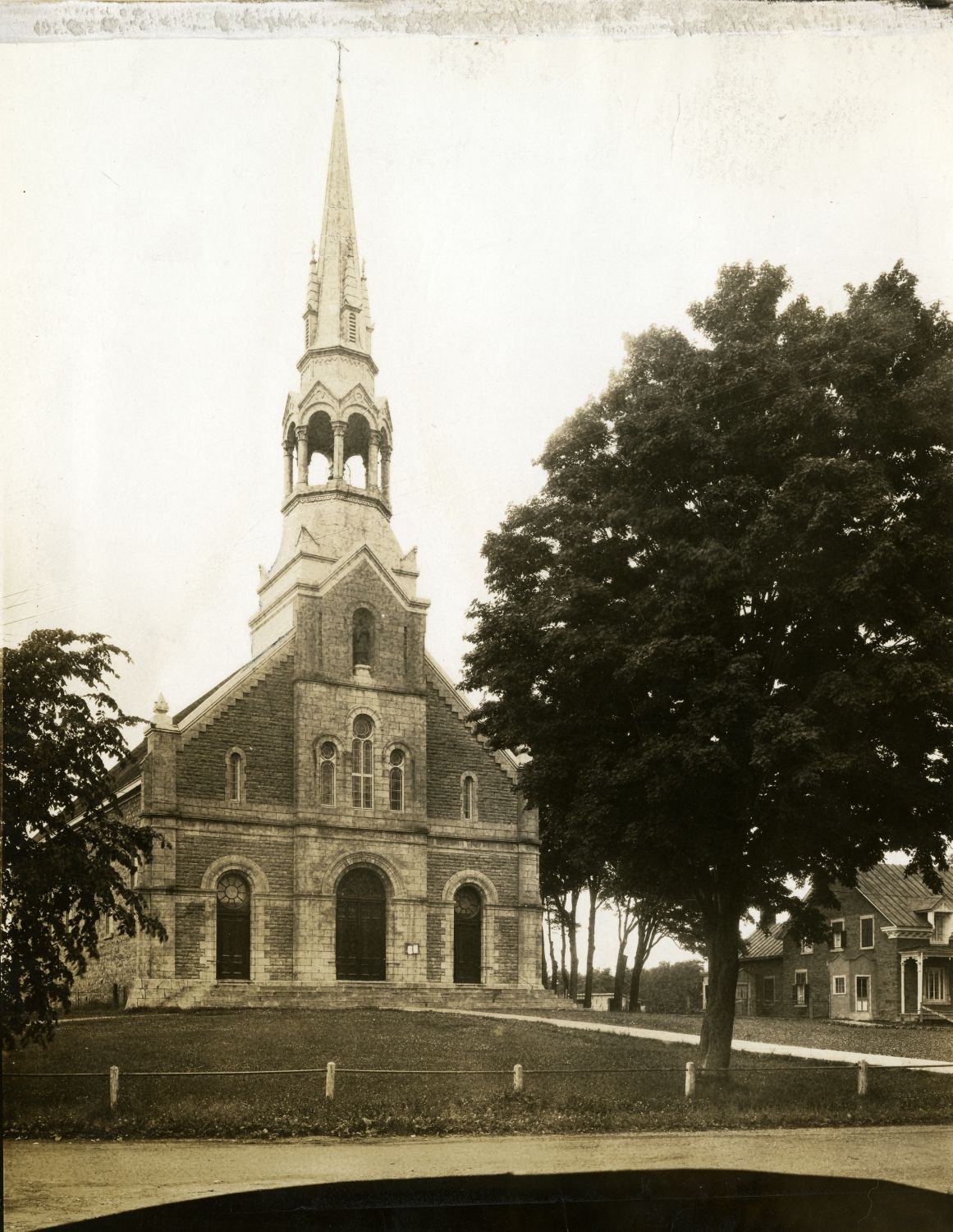 c. 1910
Public domain or CC0, made before 1950, from Wikimedia Commons; old views of places can be drawings, prints or maps of their time. Each credit opens the image’s page.
The registers find 23 places within 25 km of Saint-Stanislas-de-Kostka
Site patrimonial de l'Entrée-Supérieure-de-l'Ancien-Canal-de-Beauharnois, 7.4 km away, leads 19 places with the top designation. Their towns number 9: Salaberry-de-Valleyfield, Vaudreuil-Dorion and Huntingdon first. The earliest date is Battle of the Cedars’s, 1776, 15 km away.
The 12 nearest, within 25 km
| Arrondissement institutionnel de la paroisse de Sainte-CécileCited heritage site (Québec) · 7.2 km away, in Salaberry-de-Valleyfield |
| Site patrimonial de l'Entrée-Supérieure-de-l'Ancien-Canal-de-BeauharnoisClassified heritage site (Québec) · 1842–1845 · 7.4 km away, in Salaberry-de-Valleyfield |
| Pont Jean-De La LandeClassified heritage building (Québec) · 1894–1895 · 7.4 km away, in Salaberry-de-Valleyfield |
| Coteau-du-LacNational Historic Site · 1779–1782 · 11 km away, in Coteau-du-Lac |
| Édifice O'ConnorMunicipal citation (Québec) · 1915 · 12 km away, in Huntingdon |
| Hôtel de ville de HuntingdonClassified heritage building (Québec) · 1859–1860 · 12 km away, in Huntingdon |
| Bureau d'enregistrement de HuntingdonClassified heritage building (Québec) · 1922 · 12 km away, in Huntingdon |
| Le Petit PouvoirClassified heritage building (Québec) · 1899 · 13 km away, in Les Cèdres |
| Bâtiment Joseph-Olivier-ArchambaultMunicipal citation (Québec) · 1851 · 14 km away, in Salaberry-de-Valleyfield |
| Maison Pierre-CharrayClassified heritage building (Québec) · 1794 · 14 km away, in Les Cèdres |
| Battle of the CedarsNational Historic Site · 1776 · 15 km away, in Les Cèdres |
| Rivière-Saint-Pierre AqueductClassified heritage site (Québec) · 1843–1844 · 16 km away, in Salaberry-de-Valleyfield |
Within 25 km of Saint-Stanislas-de-Kostka, the years before Confederation left the most
Places as far as 25 km from Saint-Stanislas-de-Kostka, not in it, dated by the first construction year on their records.
The bars count 20 dated places within 25 km. 15 predate Confederation. Battle of the Cedars, in Les Cèdres, goes back furthest, to 1776.
29% of Saint-Stanislas-de-Kostka’s homes are older than 1961, against a usual 18%
Half of the homes standing in Saint-Stanislas-de-Kostka today were built before 1981. Homes built from 2016 to 2021 make up 5.7% of Saint-Stanislas-de-Kostka’s, above the typical 4.1%. 27% of Saint-Stanislas-de-Kostka’s homes were built from 1961 to 1980, close to the typical town’s 27%.
2021 Census, private dwellings by period of construction (Statistics Canada); the typical town is the middle Canadian town of 2,500 or more.
Saint-Stanislas-de-Kostka and its neighbours
| Town | People | Places | Highest | Oldest |
|---|---|---|---|---|
| Saint-Stanislas-de-Kostka | 2,162 | 0 | 0 | — |
| Saint-Louis-de-Gonzague | 2,536 | 0 | 0 | — |
| Salaberry-de-Valleyfield | 47,002 | 5 | 3 | 1842 |
| Sainte-Barbe | 1,993 | 0 | 0 | — |
| Les Coteaux | 6,294 | 0 | 0 | — |
| Godmanchester | 1,590 | 0 | 0 | — |
| Saint-Zotique | 10,445 | 0 | 0 | — |
Saint-Stanislas-de-Kostka in brief
The 2021 Census dates 29% of Saint-Stanislas-de-Kostka’s homes before 1961, against 18% in the typical town. Otherwise the figures are ordinary: Maxime Raymond (1883) and Donat Raymond (1880) are its people of the past on the record.
What this data can and can’t tell you
- Québec’s register. The Répertoire du patrimoine culturel du Québec is open data, so the province’s own designations and its municipalities’ citations are here in full.
- The federal register. Parks Canada’s Directory of Federal Heritage Designations lists every National Historic Site, federal heritage building, heritage railway station and lighthouse; the Canadian Register of Historic Places adds their statements in English and French.
- The tiers. Tiers follow the designation: national recognition and classement first, other federal designations next, provincial and local listings last.
- The grade. There is no history grade: the page sets out the record and compares it with other towns.
- People and events. The open directory puts its national historic persons nowhere, so a town shows one only on firm ground: a birth there, matched by name and life years, or a historic place there named for the person whose record says so. Events are left out.
- Protection. In Québec, a classement or a municipal citation under the Loi sur le patrimoine culturel protects the building in law; a federal designation recognises significance and binds only federal owners.
Questions about Saint-Stanislas-de-Kostka’s history
How many historic places does Saint-Stanislas-de-Kostka have on the registers?
Saint-Stanislas-de-Kostka has none of its own yet. Arrondissement institutionnel de la paroisse de Sainte-Cécile, in Salaberry-de-Valleyfield, is the nearest, 7.2 km away.
When did Saint-Stanislas-de-Kostka become a municipality?
By Wikidata, Saint-Stanislas-de-Kostka dates from July 1, 1855; the record doesn’t say whether that is a founding, an incorporation or a merger.
How old are the homes in Saint-Stanislas-de-Kostka?
29% predate 1961, where the typical town has 18%.
Contains information licensed under the Open Government Licence – Canada (Parks Canada).
Sources: Parks Canada, Directory of Federal Heritage Designations · Canadian Register of Historic Places (federal extract) · Wikidata (CC0) for map points, other names and articles · Statistics Canada, 2021 Census (homes by period of construction). Under the Statistics Canada Open Licence.
Adapted from Statistics Canada (Census of Population 2021, population estimates 2025, 2021 census boundaries) under the Statistics Canada Open Licence; this does not constitute an endorsement by Statistics Canada. Neighbourhood names in some cities © OpenStreetMap contributors (ODbL).