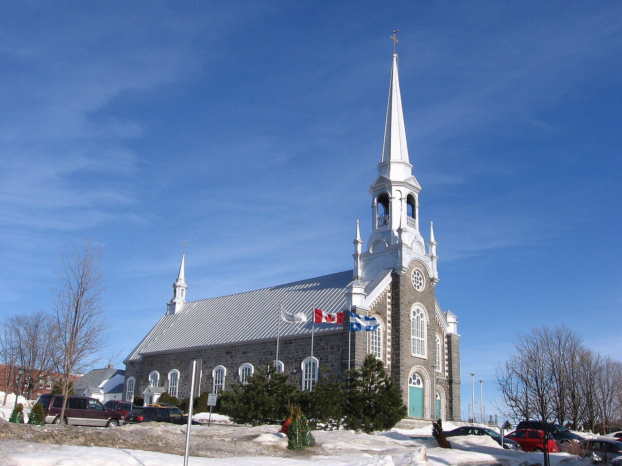
Église Saint-Raphaël · Photo: Harfang · CC BY-SA 3.0
3historic places on the registers
History of Saint-Raphaël · Canada’s heritage registers
Canada’s registers list 3 historic places in Saint-Raphaël
Homes from before 1961 make up 33% of Saint-Raphaël’s stock, above the 18% of the typical town. The oldest dated place, Église Saint-Raphaël, goes back to 1849. 3 more stand just outside, within 5 km of the town’s edge. Among the places are 3 municipal citations.
National Historic Sites, classified federal buildings and Québec’s classements
Provincial and local listings
3
municipal citations on Québec’s register
Oldest building
1849
the first construction date on its record
Homes built before 1961
33%
typical town: 18%
How it began
The record of Saint-Raphaël, from 1993 on
The date Wikidata keeps for Saint-Raphaël is December 8, 1993; whether it was a founding or a legal act, the entry leaves open. A reorganization in 1993 folded in Saint-Raphaël and Saint-Raphaël.
Every place on the registers inside the town, by its designation.
Provincial and local listings
Each dot is a place: point at it for the name, tap it for its page.
The 3, by tier
3 Provincial and local listings
Two open registers meet here: Parks Canada’s Directory of Federal Heritage Designations and Québec’s heritage register, which records both provincial classements and municipal citations.
Points from Wikidata (Parks Canada’s files carry none) and from Québec’s register, as mapped there.
Provincial and local listings
3 local listings in Saint-Raphaël
Citations the municipality has made, registered with Québec’s ministry of culture. They date from 1849 (Église Saint-Raphaël) to 1899. Each one opens its own page.
33% of Saint-Raphaël’s homes were built before 1961
New building in Saint-Raphaël runs at the usual pace: 5.1% of homes from 2016–21, the typical town 4.1%. Few of Saint-Raphaël’s homes date from 1981 to 2000: 17%, the norm 23%. More than half of Saint-Raphaël’s housing predates 1981.
33%
Before 1961
31%
1961–80
17%
1981–2000
15%
2001–15
5.1%
2016–21
Saint-RaphaëlTypical town
2021 Census, private dwellings by period of construction (Statistics Canada); the typical town is the middle Canadian town of 2,500 or more.
Of the homes standing in Saint-Raphaël, 33% went up before 1961, against 18% in the typical town. The count is 3 historic places. The rest is about typical: its past has one life on the record, Jean-Jules Richard (1911); and all its places were designated in 2008.
How to read these numbers
What this data can and can’t tell you
•
People and events. National historic persons carry no place in the open file. They appear on a town’s page when born there (same name, same birth and death years) or when a historic place inside it carries their name and its record names them with their dates; national historic events don’t appear.
•
The federal register. The federal list is complete and open: Parks Canada’s directory for the designations, the Canadian Register of Historic Places for what each one is and why it matters.
•
Québec’s register. Québec’s Répertoire du patrimoine culturel records the province’s classements and declarations and every municipal citation, each with a description and a point.
•
The grade. History isn’t one of Canada’s graded pillars, so this page describes and compares without a letter.
•
The tiers. National Historic Sites and the most protected buildings form the top tier; recognized federal buildings, stations and lighthouses the second; provincial and municipal listings the third.
•
Protection. Québec’s classements and citations carry legal protection: work on a classified building needs the minister’s authorization, on a cited one the municipality’s. Federal designations commemorate.
Questions about Saint-Raphaël’s history
How many historic places does Saint-Raphaël have on the registers?
3 historic places inside Saint-Raphaël, by the federal, Québec and Wikidata-known registers.
How old are the homes in Saint-Raphaël?
33% of its homes were built before 1961, against 18% in the typical Canadian town.
What is the oldest building in Saint-Raphaël?
By its record, Église Saint-Raphaël, from 1849 (Municipal citation (Québec)).
Contains information licensed under the Open Government Licence – Canada (Parks Canada). Québec register data: Ministère de la Culture et des Communications du Québec, CC BY 4.0.
Sources: Parks Canada, Directory of Federal Heritage Designations · Canadian Register of Historic Places (federal extract) · Répertoire du patrimoine culturel du Québec (MCC, Données Québec) · Wikidata (CC0) for map points, other names and articles · Statistics Canada, 2021 Census (homes by period of construction). Under the Statistics Canada Open Licence.
 Local