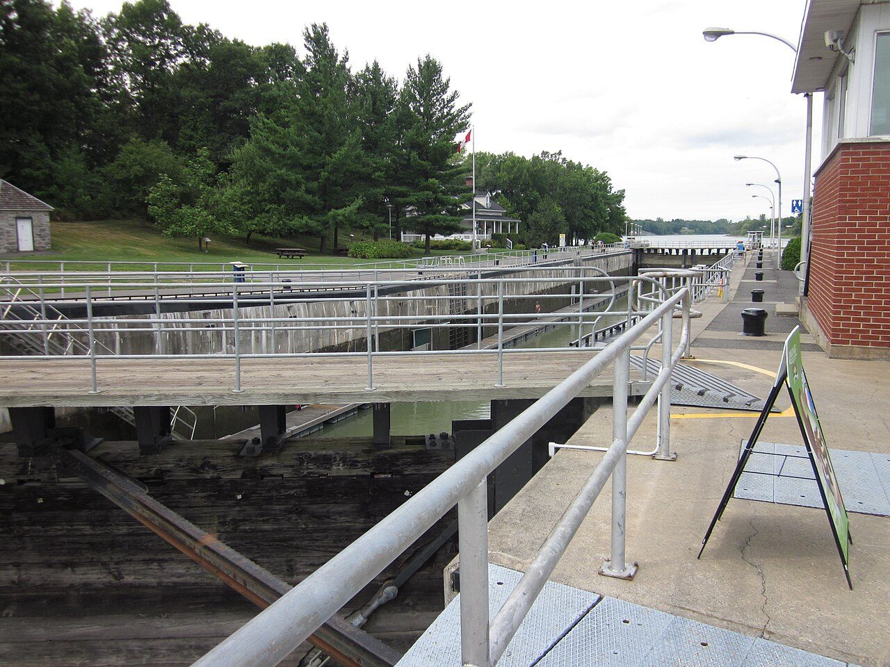
Saint-Ours Canal · Photo: Fralambert · CC BY-SA 3.0
3historic places on the registers
History of Saint-Ours · Canada’s heritage registers
History in Saint-Ours goes back to 1792: Domaine seigneurial de Saint-Ours
Before 1961: 40% of Saint-Ours’s homes, where most towns have 18%. Inside the town the registers count 3 historic places; 2 are top designations. The list takes in a municipal citation.
National Historic Sites, classified federal buildings and Québec’s classements
Provincial and local listings
1
municipal citations on Québec’s register
Oldest building
1792
the first construction date on its record
Homes built before 1961
40%
typical town: 18%
In pictures
Saint-Ours’s 2 highest designations, each in a photo
All of Saint-Ours’s designated places are pictured. 2 of Saint-Ours’s places also have old views on their own pages. Two to begin with: Saint-Ours Canal and Domaine seigneurial de Saint-Ours.
Photos from Wikimedia Commons, each credited to its photographer with its licence; names open the place’s page. Tap a photo to step through them full screen.
Through time
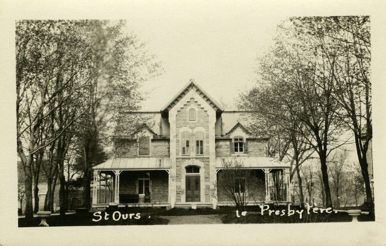
Old Saint-Ours, 1910 to 1920
The oldest views of 2 of its historic places, in date order. Scroll the strip and tap a picture to open it.
1890190019101920193019401950Confederation to 1900Boom yearsThe wars and betweenAfter the war
Public domain or CC0, made before 1950, from Wikimedia Commons; old views of places can be drawings, prints or maps of their time. Each credit opens the image’s page.
How it began
Saint-Ours on record since 1847
February 6, 1847 is the date of Saint-Ours’s municipality in Wikidata, and like many such dates it may record a charter, not the first homes. The name Saint Ours lasted until 1866, when Saint-Ours took another.
Every place on the registers inside the town, by its designation.
Highest designationsProvincial and local listings
Names show on hover, and a tap takes you to the place’s page.
The 3, by tier
2 Highest designations1 Provincial and local listings
Two open registers meet here: Parks Canada’s Directory of Federal Heritage Designations and Québec’s heritage register, which records both provincial classements and municipal citations.
Points from Wikidata (Parks Canada’s files carry none) and from Québec’s register, as mapped there.
Highest designations
2 places in Saint-Ours with the highest designation
They are a National Historic Site and a place classified by Québec. National Historic Sites and Classified Federal Heritage Buildings, Canada’s highest federal recognition. Their dates run from 1792, with Domaine seigneurial de Saint-Ours, to 1830. Each one opens its own page.
Saint-Ours added few homes from 2016 to 2021: 3.1%, where most towns have 4.1%
More than half of Saint-Ours’s housing predates 1981. Homes built from 2001 to 2015 make up just 11% of Saint-Ours’s, against 15% in the typical town. Building from 1961 to 1980 gave Saint-Ours 28% of its homes, near the usual 27%.
40%
Before 1961
28%
1961–80
20%
1981–2000
11%
2001–15
3.1%
2016–21
Saint-OursTypical town
2021 Census, private dwellings by period of construction (Statistics Canada); the typical town is the middle Canadian town of 2,500 or more.
Born here
Lives that started in Saint-Ours, 1800–1881
Wikidata and Wikipedia agree on 8 births here before 1914. By Wikipedia’s reach, Narcisse Pérodeau leads, with 5 articles. Of the 8, 7 were born in the years before Confederation. The longest life was Narcisse Pérodeau’s: 81 years, to 1932.
François-Roch de Saint-Ours
Siméon Marchesseault
Joseph Daigle
Joseph-Adolphe Dorion
Narcisse Pérodeau
Louis Lacouture
Louis Coderre
Onésime Lacouture
1800182518501875190019251950
NP
Narcisse Pérodeau1851–1932 · Canadian politician
JD
Joseph Daigle1831–1908 · Canadian politician
LC
Louis Coderre1865–1935 · Canadian politician
FS
François-Roch de Saint-Ours1800–1839 · Canadian politician
SM
Siméon Marchesseault1806–1855 · Canadian bailiff and Patriote
JD
Joseph-Adolphe Dorion1832–1900 · Canadian politician
LL
Louis Lacouture1858–1932 · Canadian politician
OL
Onésime Lacouture1881–1951
Everyone born in Saint-Ours → Born before 1914 (the page’s periods: Confederation to the First World War). Birthplaces from Wikidata, each checked against the person’s Wikipedia article.
The pre-1961 share of Saint-Ours’s homes is 40%, against 18% in the typical town. There are 3 historic places in all, 2 with the highest designation; Saint-Ours Canal heads them. Narcisse Pérodeau (1851), Joseph Daigle (1831) and Louis Coderre (1865) are the best known of its historic lives. Everything else is close to the norm: its places were designated between 1929 and 2012.
How to read these numbers
What this data can and can’t tell you
•
The federal register. Every federal designation is in Parks Canada’s directory, and the Canadian Register of Historic Places gives most of them a bilingual statement of significance.
•
Map points. Where a federal place sits on the map is Wikidata’s placing; the directory itself has no coordinates.
•
Québec’s register. Québec’s Répertoire du patrimoine culturel records the province’s classements and declarations and every municipal citation, each with a description and a point.
•
The grade. This page gives no grade; history doesn’t count toward a Canadian town’s letter.
•
Protection. A place classified or cited under Québec’s law is protected; National Historic Site status alone protects only what the federal government owns.
•
The tiers. The highest designations are National Historic Sites, Classified Federal Heritage Buildings and Québec’s classements; then come the other federal designations; then provincial and local listings.
•
People and events. Parks Canada’s open file gives its national historic persons no place. A town’s page names one only when the person was born there (matched by name and both life years) or one of its own historic places carries the name and its record speaks of them; national historic events stay off.
Questions about Saint-Ours’s history
What is the oldest building in Saint-Ours?
By its record, Domaine seigneurial de Saint-Ours, from 1792 (Classified heritage site (Québec)).
How old are the homes in Saint-Ours?
The 2021 Census dates 40% of its homes before 1961 (18% in the typical town).
Which places in Saint-Ours have the highest designation?
They are Saint-Ours Canal and Domaine seigneurial de Saint-Ours.
Contains information licensed under the Open Government Licence – Canada (Parks Canada). Québec register data: Ministère de la Culture et des Communications du Québec, CC BY 4.0.
Sources: Parks Canada, Directory of Federal Heritage Designations · Canadian Register of Historic Places (federal extract) · Répertoire du patrimoine culturel du Québec (MCC, Données Québec) · Wikidata (CC0) for map points, other names and articles · Statistics Canada, 2021 Census (homes by period of construction). Under the Statistics Canada Open Licence.


 c. 1910
 Top
 Top
 Local