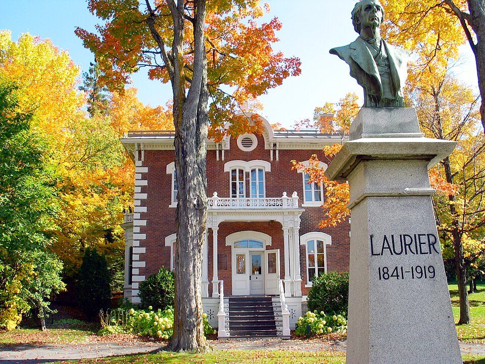
Musée Laurier, 2.1 km from Saint-Christophe-d'Arthabaska
Museums or galleries make up 3 of the 5 places on the list. Saint-Christophe-d'Arthabaska itself has none of them. The trip to Parc Marie-Victorin is 22 km.
Leading the list near Saint-Christophe-d'Arthabaska
The rest of the best known are 2 museums and 2 water parks.
 MuseumMusée Laurier700 m outside town, to the north
 MuseumMaison recyclée des Artisans du rebut global400 m outside town, to the northeastWater parkWater parkLac Le Mirage4.4 km outside town, to the northMuseumMuseumMusée De L'Hôtel Des Postes700 m outside town, to the northWater parkWater parkPlace Elliot-Tardif3.9 km outside town, to the northwest
Each has a page of its own: what it is, who runs it, the weather month by month and what else is near it.
On the map
The dashed line is Saint-Christophe-d'Arthabaska’s municipal boundary; orange marks its middle (where most people live). Numbers match the list below. © OpenStreetMap contributors · Statistics Canada 2021 outline
What there is to see
Green: inside Saint-Christophe-d'Arthabaska. Grey: within 5 km of its edge.
Every one of them
Close and well known first. Provincial and city parks are on the Outdoors page instead.
Historic places in Saint-Christophe-d'Arthabaska → · Parks, footpaths and green space in Saint-Christophe-d'Arthabaska →
A drive away

Places well known beyond Saint-Christophe-d'Arthabaska (Wikipedia articles in several languages, published visitor counts, or a Parks Canada or Sépaq property), close and famous first. Distances are straight lines from the middle of the town.
Common questions about Saint-Christophe-d'Arthabaska
What is there to see near Saint-Christophe-d'Arthabaska?
Look just beyond Saint-Christophe-d'Arthabaska: within 5 km are Maison recyclée des Artisans du rebut global, Lac Le Mirage and Musée De L'Hôtel Des Postes, though none is inside it.
Is there a Parks Canada or Sépaq property near Saint-Christophe-d'Arthabaska?
No: none lies within 5 km of Saint-Christophe-d'Arthabaska on our list.
How is this list made?
One list is built from OpenStreetMap, Wikidata, ODCAF and the heritage registers: museums, galleries, national historic sites, forts, lighthouses, gardens, national parks, waterfalls, ski hills, zoos and theme parks. Historic buildings need a visitor sign such as opening hours, a fee, a website, a heritage operator or a Wikipedia article, and hotels, restaurants and tour operators never count. A place belongs to the town when it lies inside its 2021 outline or within 5 km of the edge.
Places to visit: Canada publishes no open tourism list, so this one is assembled from OpenStreetMap (© OpenStreetMap contributors, ODbL), Wikidata (CC0), Statistics Canada’s ODCAF museums and galleries (2020, Open Government Licence – Canada), the federal and Québec heritage registers and CPCAD’s national parks, and it reflects what mappers and editors have recorded. Forts, houses, lighthouses and churches count only with a sign that visitors are welcome. Places sit in each town’s 2021 census outline; visitor counts are Wikidata’s latest, with their year.
Photos: each place’s Wikidata image, from Wikimedia Commons under the licence below (our copy, resized).
Photo credits (3)
- Musée Laurier: Musée Laurier, Public domain, Wikimedia Commons
- Maison recyclée des Artisans du rebut global: SocrateMtl, CC BY-SA 4.0, Wikimedia Commons
- Parc Marie-Victorin: Danielhbordeleau, CC BY-SA 4.0, Wikimedia Commons
Adapted from Statistics Canada (Census of Population 2021, population estimates 2025, 2021 census boundaries) under the Statistics Canada Open Licence; this does not constitute an endorsement by Statistics Canada. Neighbourhood names in some cities © OpenStreetMap contributors (ODbL).