
Centre national de conservation et d'études des collections is Duberger—Les Saules’ place to visit
Museums or galleries make up 47 of the 71 places on the list. One place to visit is mapped inside Duberger—Les Saules’ neighbourhood outline, with 70 more within 5 km of its edge. A typical year brings about 497K visitors to Musée de la civilisation. The list includes 5 places in care: 3 by Parks Canada and 2 by Sépaq. Montmorency Falls is worth a day, 15 km from the centre.
The names to know in Duberger—Les Saules
 MuseumMusée national des beaux-arts du Québec2.6 km outside town, to the east · 324K visitors a year
 MuseumMusée de la civilisation4.7 km outside town, to the east · 497K visitors a year
 CastleQuébec Citadel4 km outside town, to the east
 CathedralNotre-Dame Roman Catholic Cathedral4.3 km outside town, to the east
 BattlefieldPlains of Abraham2.3 km outside town, to the east
Each has a page of its own: what it is, who runs it, the weather month by month and what else is near it.
Where they are
To the east is where most of the 70 nearby are.
The dashed line is Duberger—Les Saules’ neighbourhood outline; orange marks its middle (where most people live). Numbers match the list below. © OpenStreetMap contributors · Statistics Canada 2021 outline
How the list breaks down
Green: inside Duberger—Les Saules. Grey: within 5 km of its edge.
Run by Parks Canada and Sépaq: Aquarium du Québec, Fortifications of Québec, Dauphine Redoubt and Saint-Louis Forts and Châteaux.
The whole list for Duberger—Les Saules
After the one in town come 70 more within 5 km of its edge.
Musée national des beaux-arts du Québec
Art museum in Quebec City, Canada.
Notre-Dame Roman Catholic Cathedral
Catholic basilica-cathedral in Quebec City, Quebec, Canada.
 8
Holy Trinity Anglican Cathedral
Cathedral of the Anglican Diocese of Quebec.
 9
Roger-Van den Hende botanical garden
Botanical garden in Quebec City, Quebec, Canada.
 10
 11
 12
 13
 14
Ursuline Monastery
Historic convent in Old Quebec, turned religious museum and teaching centre.
 15
 16
 17
 18
Jesuit House of Sillery
Historic Jesuit farmhouse in the Sillery neighborhood of Quebec City; occupies the site of Saint-Joseph Mission.
 19
Musée de géologie René-Bureau
Geology museum at Laval University in Quebec City.
 20


Pavillon Pierre-Lassonde
Museum complex building of Musée national des beaux-arts du Québec.

Gate Saint-Louis, Quebec City
City Gate in Old Town of Quebec City.


The one inside Duberger—Les Saules comes first, then the places within 5 km, close and well known first. Provincial and city parks are on the Outdoors page instead.
Historic places in Duberger—Les Saules → · Parks, footpaths and green space in Duberger—Les Saules →
Within a day
 WaterfallMontmorency Falls15 km northeast
 WaterfallChaudière Falls11 km southeast
 Ski hillLe Relais14 km north
 MuseumLévis Forts12 km east
 Historic houseMaison natale Louis-Fréchette9.3 km east
 Ski hillStoneham Mountain Resort25 km northwest
 Art galleryAux Trois Couvents28 km northeast
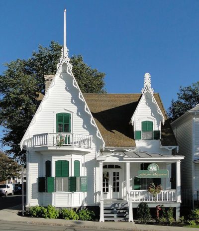 MuseumMaison Alphonse-Desjardins9.7 km east
 National historic siteMaison Quézel20 km southwest
 MuseumMaison Drouin38 km northeast
Places well known beyond Duberger—Les Saules (Wikipedia articles in several languages, published visitor counts, or a Parks Canada or Sépaq property), close and famous first. Distances are straight lines from the middle of the town.
Duberger—Les Saules: questions and answers
Does Duberger—Les Saules have a museum?
Yes, Musée de la place Royale, Musée de l'Amérique française and Musée de géologie René-Bureau, all in Duberger—Les Saules or within 5 km.
Is there a Parks Canada or Sépaq property near Duberger—Les Saules?
Yes: within 5 km of Duberger—Les Saules, the places run by Parks Canada and Sépaq are named in the By kind chart.
What are the best-known days out near Duberger—Les Saules?
The best known within 40 km are Chaudière Falls (11 km), Le Relais (14 km), Lévis Forts (12 km), Maison natale Louis-Fréchette (9.3 km).
How is this list made?
Places come from four open sources (OpenStreetMap, Wikidata, Statistics Canada’s ODCAF, the federal and Québec heritage registers), each site once. A building counts as a place to visit only with opening hours, a fee, a website, a heritage operator or a Wikipedia article; hotels, restaurants and tour firms are dropped. The town’s 2021 outline and 5 km around it set the reach.
Places to visit: Canada publishes no open tourism list, so this one is assembled from OpenStreetMap (© OpenStreetMap contributors, ODbL), Wikidata (CC0), Statistics Canada’s ODCAF museums and galleries (2020, Open Government Licence – Canada), the federal and Québec heritage registers and CPCAD’s national parks, and it reflects what mappers and editors have recorded. Forts, houses, lighthouses and churches count only with a sign that visitors are welcome. Places sit in each town’s 2021 census outline; visitor counts are Wikidata’s latest, with their year.
Photos: each place’s Wikidata image, from Wikimedia Commons under the licence below (our copy, resized).
Photo credits (38)
- Musée national des beaux-arts du Québec: colros, CC BY-SA 2.0, Wikimedia Commons
- Musée de la civilisation: Claude Gagnon, CC BY-SA 3.0, Wikimedia Commons
- Québec Citadel: chensiyuan, CC BY-SA 4.0, Wikimedia Commons
- Notre-Dame Roman Catholic Cathedral: Pierre-Olivier Fortin, CC BY-SA 3.0, Wikimedia Commons
- Plains of Abraham: NickHam, CC BY-SA 3.0, Wikimedia Commons
- Holy Trinity Anglican Cathedral: TravelingOtter, CC BY 2.0, Wikimedia Commons
- Roger-Van den Hende botanical garden: Cephas, CC BY-SA 3.0, Wikimedia Commons
- Musée de l'Amérique française: Jeangagnon, CC BY-SA 3.0, Wikimedia Commons
- Aquarium du Québec: Josyan Pierson, CC BY 2.5, Wikimedia Commons
- Fortifications of Québec: Jean Gagnon, CC BY-SA 3.0, Wikimedia Commons
- Terrasse Dufferin: Selbymay, CC BY-SA 3.0, Wikimedia Commons
- Ursuline Monastery: Jeangagnon, CC BY-SA 3.0, Wikimedia Commons
- Bois-de-Coulonge Park: Gilbert Bochenek, CC BY-SA 3.0, Wikimedia Commons
- Dauphine Redoubt: Christophe.Finot, CC BY-SA 2.5, Wikimedia Commons
- Parc Victoria: Jstremblay, CC BY-SA 3.0, Wikimedia Commons
- Jesuit House of Sillery: GBoivinT, CC BY-SA 3.0, Wikimedia Commons
- Musée de géologie René-Bureau: Cephas, CC BY-SA 3.0, Wikimedia Commons
- Musée naval de Québec: Musée naval de Québec, CC BY-SA 3.0, Wikimedia Commons
- Îlot des Palais: Jeangagnon, CC BY-SA 3.0, Wikimedia Commons
- Pavillon Pierre-Lassonde: Cephas, CC BY-SA 4.0, Wikimedia Commons
- Gate Saint-Louis, Quebec City: Guilhem Vellut from Annecy, France, CC BY 2.0, Wikimedia Commons
- Saint-Louis Forts and Châteaux: Local hero, Public domain, Wikimedia Commons
- Parc de la Visitation: Harfang, CC BY-SA 3.0, Wikimedia Commons
- Cartier-Brébeuf: Jugag, CC0, Wikimedia Commons
- Villa Cataraqui: Gilbert Bochenek, CC BY 3.0, Wikimedia Commons
- Pavillon Charles-Baillairgé: Jeangagnon, CC BY-SA 3.0, Wikimedia Commons
- Maison historique Chevalier: Jeangagnon, CC BY-SA 3.0, Wikimedia Commons
- Huron-Wendat Museum: Pierre-Olivier Fortin from Québec, Canada, CC BY 2.0, Wikimedia Commons
- Montmorency Falls: Jean-Christophe BENOIST, CC BY 4.0, Wikimedia Commons
- Chaudière Falls: Eric Fortin, CC BY-SA 3.0, Wikimedia Commons
- Le Relais: Judicieux, CC BY-SA 4.0, Wikimedia Commons
- Lévis Forts: Bernard Gagnon, CC BY-SA 3.0, Wikimedia Commons
- Maison natale Louis-Fréchette: Jean-Philippe Bourgoin, CC BY-SA 3.0, Wikimedia Commons
- Stoneham Mountain Resort: Gabriel Picard, CC BY-SA 4.0, Wikimedia Commons
- Aux Trois Couvents: Centre d'Interprétation de la Côte-de-Beaupré, CC BY-SA 3.0, Wikimedia Commons
- Maison Alphonse-Desjardins: Bernard Gagnon, CC BY-SA 3.0, Wikimedia Commons
- Maison Quézel: JeffT, CC BY-SA 3.0, Wikimedia Commons
- Maison Drouin: RaphaëlFFL, CC BY-SA 4.0, Wikimedia Commons
Adapted from Statistics Canada (Census of Population 2021, population estimates 2025, 2021 census boundaries) under the Statistics Canada Open Licence; this does not constitute an endorsement by Statistics Canada. Neighbourhood names in some cities © OpenStreetMap contributors (ODbL).