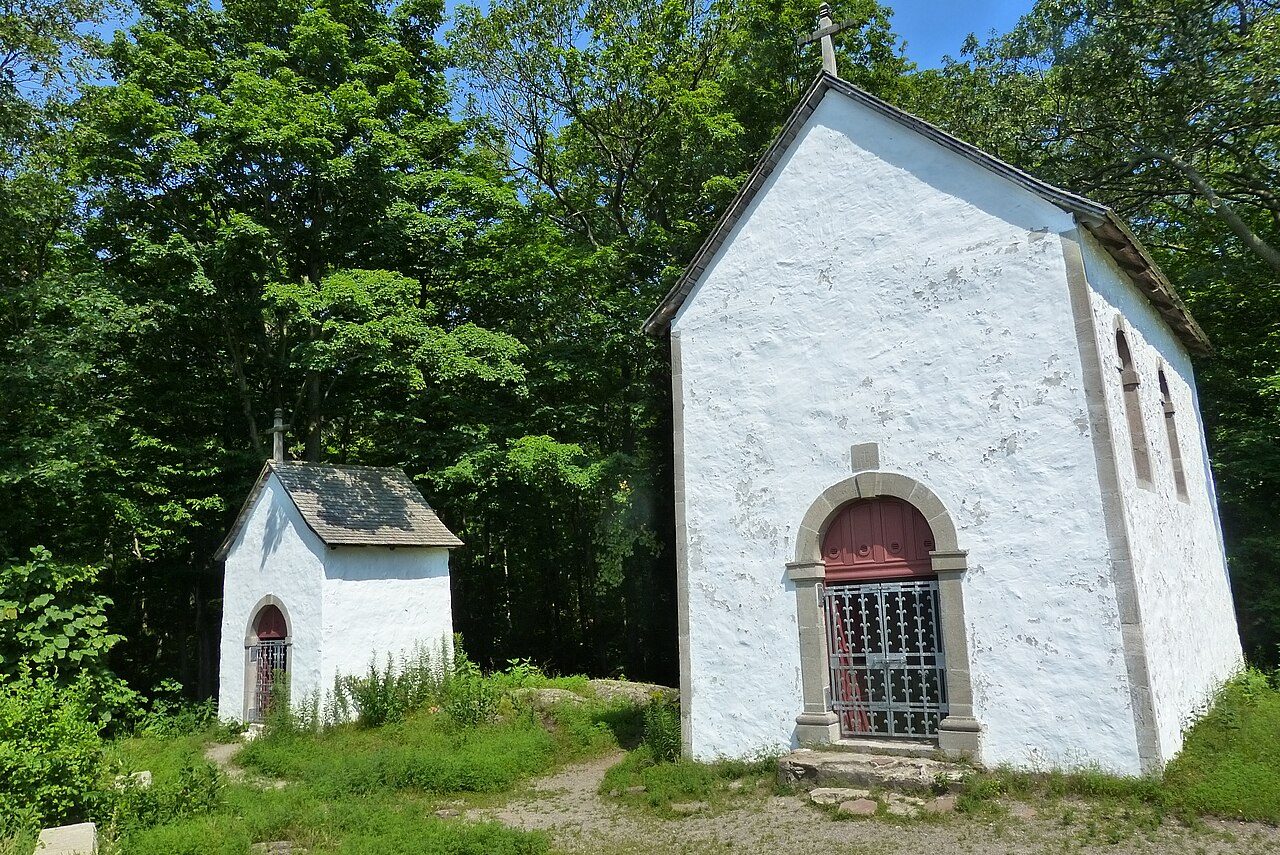
Calvaire d'Oka
Calvaire d'Oka, c. 1885 and today
Drag across to compare. The two views aren’t taken from exactly the same spot.
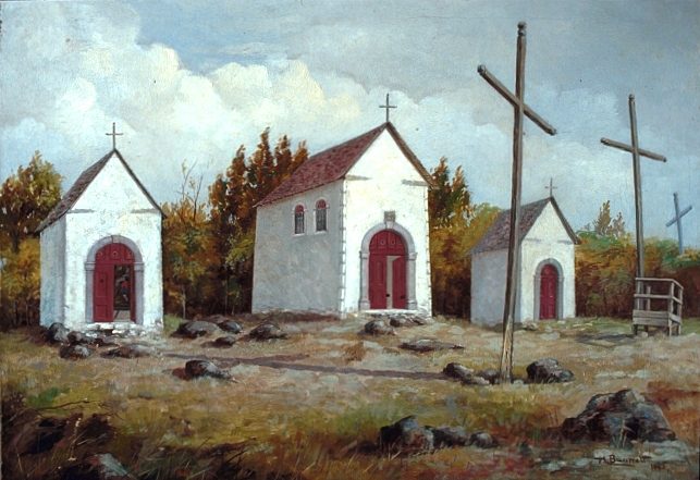
c. 1885: Photo: Henry Richard S. Bunnett · Public domain. Today: Photo: Vincent Poirier · CC BY-SA 3.0.
About Calvaire d'Oka
Québec classifies Calvaire d'Oka, one of 4 such places in Oka. Calvaire d'Oka dates from 1740–1742.
Le calvaire d'Oka est un chemin de croix formé de sept édicules érigés entre 1740 et 1742. Les petites chapelles, en moellons crépis, sont coiffées de toits en pavillon ou à deux versants. Elles sont dotées d'ouvertures cintrées ou rectangulaires. Les quatre premières chapelles bordent un sentier de montagne et les trois autres occupent le sommet. Le calvaire est situé au coeur du parc national d'Oka, dans la municipalité d'Oka. Ce bien est classé site patrimonial. Des objets patrimoniaux classés sont associés au lieu.
From Québec’s Répertoire du patrimoine culturel (in French: the register has no English text), Calvaire d'Oka · CC BY 4.0 · the register’s own words, unchanged
Under Québec’s law, classement is the province’s own designation.
4 old views of Calvaire d'Oka
Made before 1950, from 1885 to 1925: public domain or CC0. Tap one to see it full screen.
 c. 1925
 c. 1925
 c. 1925
From Wikimedia Commons, copied to our own server; some are drawings, prints or maps of their time. Each credit is in the viewer.
Finding Calvaire d'Oka
Oka


Its nearest historic neighbours are too far for a short walk.
Questions about Calvaire d'Oka
What is Calvaire d'Oka?
Calvaire d'Oka was classified in 1982, under the Loi sur le patrimoine culturel.
When was Calvaire d'Oka built?
Its register puts the building of Calvaire d'Oka at 1740–1742.
Can you visit Calvaire d'Oka?
Its exterior is visible from public ground; access inside is up to the owner.
Is Calvaire d'Oka protected?
Its classement protects it under Québec’s law; changes need the minister’s approval.
Contains information licensed under the Open Government Licence – Canada (Parks Canada). Québec register data: Ministère de la Culture et des Communications du Québec, CC BY 4.0.
Sources: Répertoire du patrimoine culturel du Québec (MCC, Données Québec) · Photos: Wikimedia Commons, each credited with its licence and copied to our own server · Wikidata (CC0) for map points, other names and articles.
Adapted from Statistics Canada (Census of Population 2021, population estimates 2025, 2021 census boundaries) under the Statistics Canada Open Licence; this does not constitute an endorsement by Statistics Canada. Neighbourhood names in some cities © OpenStreetMap contributors (ODbL).