Fort number 1
You will find Fort number 1 in Lévis. Close by, Lévis Forts is 100 m away.
Fort in Lévis
Inside Lévis
Within Lévis’ municipal boundary stands Fort number 1. Towns near it ↓
Drawn from OpenStreetMap, Wikidata, ODCAF and the heritage registers, with Statistics Canada’s 2021 outlines and ECCC’s 1991–2020 normals.
Weather through the year
Aim for May to September, when Lévis reaches 18–25°C.
Fort number 1
Inside the town’s municipal boundary: in Lévis.
- Type
- Fort
- Town
- in Lévis
The way to Fort number 1
Each numbered point is one of the places listed below; Fort number 1 is the orange one.
© OpenStreetMap contributors · The dashed line is Lévis’ municipal boundary. · Statistics Canada 2021 outline
Towns a short way from Fort number 1
In size, Lévis comes first of the 8, with 160,882 people. The towns are in order of distance, its own town first.
- 1Lévis
- 2Vieux-Québec—Cap-Blanc—Colline parlementaire
- 3Vieux-Limoilou
- 4Vieux-Moulin
- 5Sainte-Pétronille
- 6Saint-Jean-Baptiste
- 7Saint-Roch
- 8Maizerets
Lévis
Vieux-Québec—Cap-Blanc—Colline parlementaire
Vieux-Limoilou
Vieux-Moulin
Compare the 8 towns
| Town | Where Fort number 1 is | People | Places to visit |
|---|---|---|---|
| Lévis | It’s in town | 160,882 | 85 |
| Vieux-Québec—Cap-Blanc—Colline parlementaire | 3.1 km southwest of it | 5,764 | 78 |
| Vieux-Limoilou | 3.2 km west of it | 14,347 | 72 |
| Vieux-Moulin | 3.3 km northwest of it | 15,935 | 67 |
| Sainte-Pétronille | 3.9 km north of it | 1,015 | 12 |
| Saint-Jean-Baptiste | 4.1 km southwest of it | 8,882 | 75 |
| Saint-Roch | 4.5 km west of it | 8,381 | 77 |
| Maizerets | 4.6 km west of it | 14,571 | 70 |
Beyond Fort number 1
A visit can take in 4 art galleries, 3 museums and a ski hill, all within 15 km.
 MuseumLévis Forts100 m away2
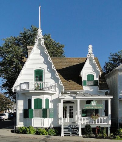 MuseumMaison Alphonse-Desjardins1.9 km away3Art galleryArt galleryEspace-temps1.4 km away4Art galleryArt galleryGalerie Florence Lemay1.9 km away5MuseumMuseumLieu historique national du chantier A.C. Davie2.1 km away6Art galleryArt galleryCentre d'exposition Louise-Carrier2.1 km away7Ski hillSki hillCentre de plein air de Lévis700 m away8Art galleryArt galleryAtelier 360 degrés1.4 km away
Within 15 km, close and well known first. Numbers match the map.
Quick answers on Fort number 1
Where is Fort number 1?
You’ll find Fort number 1 in Lévis (Quebec), within the town’s municipal boundary.
What is Fort number 1?
Fort.
When is the best time to visit Fort number 1?
Visit Lévis from May to September for the warmest weather: highs of 18–25°C on the 1991–2020 normals.
Sources: © OpenStreetMap contributors (ODbL), Wikidata (CC0), Statistics Canada’s ODCAF (Open Government Licence – Canada), the federal and Québec heritage registers, Statistics Canada 2021 census boundaries, ECCC 1991–2020 climate normals (Open Government Licence – Canada).
Photos: each place’s Wikidata image, from Wikimedia Commons under the licence below (our copy, resized).
Photo credits (2)
- Lévis Forts: Bernard Gagnon, CC BY-SA 3.0, Wikimedia Commons
- Maison Alphonse-Desjardins: Bernard Gagnon, CC BY-SA 3.0, Wikimedia Commons
Adapted from Statistics Canada (Census of Population 2021, population estimates 2025, 2021 census boundaries) under the Statistics Canada Open Licence; this does not constitute an endorsement by Statistics Canada. Neighbourhood names in some cities © OpenStreetMap contributors (ODbL).