Espace-temps
Espace-temps is an art gallery in Lévis. Top of the list nearby is Lévis Forts, 1.4 km away.
Art gallery in Lévis
Inside Lévis
Espace-temps lies within the municipal boundary of Lévis. Towns near it ↓
Drawn from OpenStreetMap, Wikidata, ODCAF and the heritage registers, with Statistics Canada’s 2021 outlines and ECCC’s 1991–2020 normals.
The weather, month by month
If warmth matters, go May to September: Lévis reaches 18–25°C.
Espace-temps
In Lévis: within the town’s municipal boundary.
- Type
- Art gallery
- Town
- in Lévis
- Official site
- espacetempsculturel.ca
Getting to Espace-temps
Espace-temps is in orange, with the places near it numbered as below.
© OpenStreetMap contributors · The dashed line is Lévis’ municipal boundary. · Statistics Canada 2021 outline
Towns within reach of Espace-temps
In size, Lévis comes first of the 8, with 160,882 people. Every one of these towns counts it as a place to visit.
- 1Lévis
- 2Vieux-Moulin
- 3Vieux-Limoilou
- 4Vieux-Québec—Cap-Blanc—Colline parlementaire
- 5Sainte-Pétronille
- 6Chutes-Montmorency
- 7Vieux-Bourg
- 8Maizerets
Lévis
Vieux-Moulin
Vieux-Limoilou
Vieux-Québec—Cap-Blanc—Colline parlementaire
Compare the 8 towns
| Town | Where Espace-temps is | People | Places to visit |
|---|---|---|---|
| Lévis | It’s in town | 160,882 | 85 |
| Vieux-Moulin | 2.2 km northwest of it | 15,935 | 67 |
| Vieux-Limoilou | 2.2 km west of it | 14,347 | 72 |
| Vieux-Québec—Cap-Blanc—Colline parlementaire | 2.2 km southwest of it | 5,764 | 78 |
| Sainte-Pétronille | 3.3 km northeast of it | 1,015 | 12 |
| Chutes-Montmorency | 3.3 km north of it | 16,273 | 50 |
| Vieux-Bourg | 3.4 km northwest of it | 14,774 | 61 |
| Maizerets | 3.5 km west of it | 14,571 | 70 |
After Espace-temps
Look within 15 km for 3 museums, 3 art galleries and a ski hill, among others.
 MuseumLévis Forts1.4 km away2
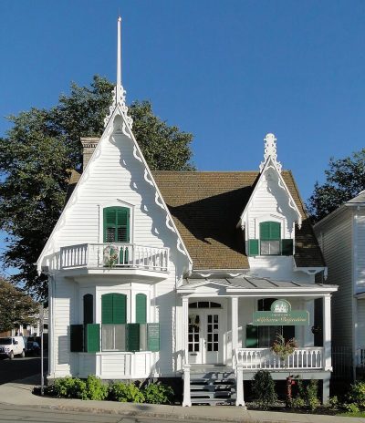 MuseumMaison Alphonse-Desjardins2.1 km away3MuseumMuseumLieu historique national du chantier A.C. Davie1.9 km away4Art galleryArt galleryGalerie Florence Lemay2.2 km away5Art galleryArt galleryCentre d'exposition Louise-Carrier2.3 km away6Art galleryArt galleryAtelier 360 degrés100 m away7Ski hillSki hillCentre de plein air de Lévis800 m away8FortFortFort number 11.4 km away
Within 15 km, close and well known first. Numbers match the map.
Questions before you go
Where is Espace-temps?
Espace-temps stands in Lévis, Quebec: inside the town’s municipal boundary.
What is Espace-temps?
Art gallery.
When is the best time to visit Espace-temps?
May to September bring Lévis its warmest afternoons, 18–25°C on ECCC’s 1991–2020 normals.
What else is there to see near Espace-temps?
Davie (1.9 km) and Galerie Florence Lemay (2.2 km).
Sources: © OpenStreetMap contributors (ODbL), Wikidata (CC0), Statistics Canada’s ODCAF (Open Government Licence – Canada), the federal and Québec heritage registers, Statistics Canada 2021 census boundaries, ECCC 1991–2020 climate normals (Open Government Licence – Canada).
Photos: each place’s Wikidata image, from Wikimedia Commons under the licence below (our copy, resized).
Photo credits (2)
- Lévis Forts: Bernard Gagnon, CC BY-SA 3.0, Wikimedia Commons
- Maison Alphonse-Desjardins: Bernard Gagnon, CC BY-SA 3.0, Wikimedia Commons
Adapted from Statistics Canada (Census of Population 2021, population estimates 2025, 2021 census boundaries) under the Statistics Canada Open Licence; this does not constitute an endorsement by Statistics Canada. Neighbourhood names in some cities © OpenStreetMap contributors (ODbL).